-
Hello, please take a minute to check out our awesome content, contributed by the wonderful members of our community. We hope you'll add your own thoughts and opinions by making a free account!
You are using an out of date browser. It may not display this or other websites correctly.
You should upgrade or use an alternative browser.
You should upgrade or use an alternative browser.
Wintry January 23rd-27th 2026
- Thread starter SD
- Start date
I got a feeling that if the GFS keep this up...that Freezing rain amount will go down. Is it safe to say we can cut that in half also?Better then my 4 inches of sleet and 1.25 frz rain lol
Last edited:
I'm sure they're all in on the low-level Arctic air winning out early on. No blocking mountains to contend with there.pretty bold strategy for professional meteorologists on live television to say this. we'll see if it pays off for em
Shinrin
Member
That 2.63 inches of freezing rain over me.. if that were to verify.. gadsden will be without power for a long time.
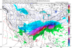
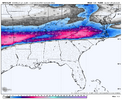
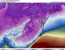
That’s way to amp. No way with that 1042 high pressure sitting to the north.CMC sticking to its guns. View attachment 186717
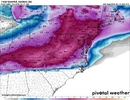
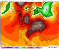
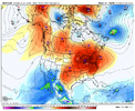
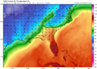
8 degrees at my house and -10 at @Oconeexman house 12 miles away is wildGFS won't back off the ridiculous cold after the event View attachment 186715
BufordWX
Member
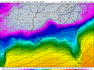
Am I seeing a -15 at Atlanta at 12z Tuesday?GFS won't back off the ridiculous cold after the event View attachment 186715
John1122
Member
It's the OG amped solution and it's really been nothing else since it started.Canadian is as amped as ever
So I would add 3.1 inches of ice topping on 7.1 inches of snow with that run
FYI that tells you that TEAL 74 is scheduled to depart Wednesday, Jan 21 at 2:00 PM EST (C. 21/1900Z).
The mission is targeting the 00Z Thursday (Jan 22) model run (22/0000Z)
The plane will be dropping dropsondes between 3:30 PM and 9:30 PM EST on Wednesday (21/2030Z TO 22/0230Z).
This data is transmitted in real-time and will be fed primarily into the 00Z GFS and Euro.
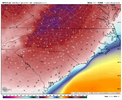
That is the craziestt 2M map I’ve ever seenAm I seeing a -15 at Atlanta at 12z Tuesday?View attachment 186719
Oh, my. That's in all-time lows territory! Temps, not dews!GFS won't back off the ridiculous cold after the event View attachment 186715
Where's Larry?
That footprint looks like blizzard 96 nc and va same thing ,double digit snow,with sleet on top
Natedogg25
Member
O
And at least one is leaning toward the GFS.I’ve heard 2 chief meteorologists in Bham say tonight that they’re not convinced that warm nose is going to come to fruition, but it’ll be interesting to watch!
wow
Member
It's way overdone.That is the craziestt 2M map I’ve ever seen
blueheronNC
Member
What a trash model. Not just plowing the LP into a 1042mb high but successfully eroding the CAD away to at or above freezing when 12 hours prior it's in the teens.CMC sticking to its guns. View attachment 186717
dsaur
Member
Is that model actually predicting the column so well it's tracking a cold tongue, such that snow is falling underneath ip/zr. How honed in are these things?
JP152
Member
Yeah, the CMC becomes a sleet fest in DC after about a foot of snow.That footprint looks like blizzard 96 nc and va same thing ,double digit snow,with sleet on top
Not the mama
Member
Guys the gfs is just behind the euro but following in its footsteps. Watch the trends. I’m not a meteorologist but even I can see that.
Btownheel
Member
By hour 108 triad has, 14 accum on kuchera. Sleet gets in way from this point on for my area, but state line, sw va up to 16 an climbing.
Big Frosty sitting at 17, 1st place
I mean, 14 inches of Kuchera snow followed by 2.5 of sleet. I’ll take it, run and grin the whole way! Basically a super baker’s dozen of concrete after compaction and with that cold it wouldn’t go anywhere for a hot minute.
Sent from my iPhone using Tapatalk
ducketta27
Member
Guys the gfs is just behind the euro but following in its footsteps. Watch the trends. I’m not a meteorologist but even I can see that.
Yeah… If you can’t tell from the trend… the pure ridiculousness of those temps after the storm should show you it’s off its rocker here. Losing another storm NW.
Sent from my iPhone using Tapatalk
SimeonNC
Member
First of all this is banter. Second of all, this storm isn’t going anywhere, the impacts just change…Yeah… If you can’t tell from the trend… the pure ridiculousness of those temps after the storm should show you it’s off its rocker here. Losing another storm NW.
Sent from my iPhone using Tapatalk
SimeonNC
Member
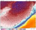
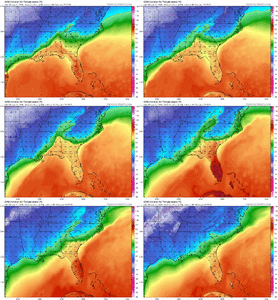
This right here should tell you that the Canadian is off it's rocker.One of the crazier weather images you will ever see. Frame it View attachment 186733
This is a great animation showing just how entrenched the CAD is for this one regardless.View attachment 186734
whoooaaa girl. easy there. i think nc needs to go all in on the front end
Be nice if ice was on bottom. It will compact, coming in after snow. But us beggars cant be choosers. Not sure if kuchera figured this or not.So I would add 3.1 inches of ice topping on 7.1 inches of snow with that run
Is that model actually predicting the column so well it's tracking a cold tongue, such that snow is falling underneath ip/zr. How honed in are these things?
That very much resembles at least several recent UKMET runs. That can not happen if the wedge the ICON and GFS are advertising is on the same planet.One of the crazier weather images you will ever see. Frame it View attachment 186733
jamesmbryanjr1
Member
Guys the gfs is just behind the euro but following in its footsteps. Watch the trends. I’m not a meteorologist but even I can see that.
Why are some mets favoring the GFS?
Sent from my iPhone using Tapatalk
Dunkman
Member
Front end thump of snow followed by all sorts of mixing is the most common way storms have played out in central NC over the years. I certainly wouldn’t bet on this one being any different.View attachment 186734
whoooaaa girl. easy there. i think nc needs to go all in on the front end
Stormsfury
Member
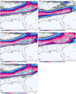
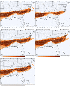
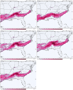
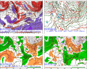
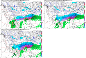
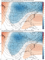
Glad you mentioned President's Day 1979 as it was on my mind earlier. In North Charleston, had a LOT of ICE with that and the temp was in the upper teens. That HIGH was 1050mb over NE Canada! This GFS run has 1043mb further south in NY than the 79 storm. There were huge sleet and snow totals in the Carolinas if my memory serves correctly.The ICON and GFS are upper echelon setups for cold temperatures in cold air damming...about as strong as you will ever see it. The Feb 1979 storm is the gold standard (last image)
View attachment 186723
View attachment 186725
View attachment 186726
View attachment 186727
View attachment 186729

