• Hello, please take a minute to check out our awesome content, contributed by the wonderful members of our community. We hope you'll add your own thoughts and opinions by making a free account!

Wintry January 23rd-27th 2026

Very concerning set-up with the qpf showing. I do have a question for some of you much sharper than me. With freezing rain, the lighter and longer the more devastating it can be. If we get high rainfall rates, could we potentially be “saved” somewhat as there would be much more runoff? Just looking for anything that can help. I am hoping for snow/sleet, but expecting the worst right now.

We are all here … we want to see a storm. But we don’t want weeks without power either!
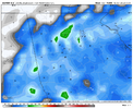
Generally yes when your temps are around 30-32. Optimal accrual temps are 26-28. We will be in the upper teens and low 20’s in this. Even with heavy rates, a lot will freeze on contact
 
Very concerning set-up with the qpf showing. I do have a question for some of you much sharper than me. With freezing rain, the lighter and longer the more devastating it can be. If we get high rainfall rates, could we potentially be “saved” somewhat as there would be much more runoff? Just looking for anything that can help. I am hoping for snow/sleet, but expecting the worst right now.

We are all here … we want to see a storm. But we don’t want weeks without power either!
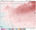
totally fair point and simple answer- yes. ice accrual is one of those things you don't need to overthink, there are no gotchas. colder air = bad. wind = bad. if you see the stream of water on the side of the road, not everything is accruing.

a saving grace for a lot of people will be that there may be some elevated convection in the ice accrual zones. if it's raining that hard, physically impossible for everything to accumulate and the ice clown maps do not factor this at all. a lot of the exaggerated qpf maps are likely because the models is picking up elevated convection training over one area. one caveat- my back of the napkin thinking with this stuff has never really accounted for surface temps below 25, which will certainly help things accrue
 
Very concerning set-up with the qpf showing. I do have a question for some of you much sharper than me. With freezing rain, the lighter and longer the more devastating it can be. If we get high rainfall rates, could we potentially be “saved” somewhat as there would be much more runoff? Just looking for anything that can help. I am hoping for snow/sleet, but expecting the worst right now.

We are all here … we want to see a storm. But we don’t want weeks without power either!
Ordinarily, lighter freezing rain accrues more efficiently; however, if these unheard of temps in the low-mid twenties during heavy freezing rain verify here in Georgia, those supercooled raindrops are going to accrue nonetheless. I've never experienced freezing rain with temps under 20 degrees, so this should be fun.
 
Very concerning set-up with the qpf showing. I do have a question for some of you much sharper than me. With freezing rain, the lighter and longer the more devastating it can be. If we get high rainfall rates, could we potentially be “saved” somewhat as there would be much more runoff? Just looking for anything that can help. I am hoping for snow/sleet, but expecting the worst right now.

We are all here … we want to see a storm. But we don’t want weeks without power either!
I was in a 1989 ice storm where it poured rain like a summer day with temps in the teens. While the trees can't necessarily hold the precip as it falls, what ends up happening is a massive and deep sheet of ice on the ground, which makes travel (including walking) virtually impossible.
 
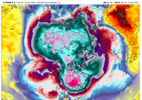
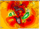
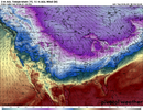
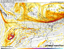
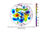
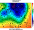
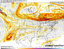
If anyone is wondering why this airmass is so catastrophically cold and pressing... take a look at the 850mb temp map. Coldest air in the northern hemisphere is under our high pressure system.

And not only is under our high pressure, but it’s co-located in the exact spot that winds up being advected our way in the CAD.

Screen Shot 2026-01-20 at 9.37.14 AM.pngScreen Shot 2026-01-20 at 9.39.10 AM.png
 
If anyone is wondering why this airmass is so catastrophically cold and pressing... take a look at the 850mb temp map. Coldest air in the northern hemisphere is under our high pressure system.

And not only is under our high pressure, but it’s co-located in the exact spot that winds up being advected our way in the CAD.

View attachment 186250View attachment 186251
It's the coldest anomaly on the entire planet.
 
totally fair point and simple answer- yes. ice accrual is one of those things you don't need to overthink, there are no gotchas. colder air = bad. wind = bad. if you see the stream of water on the side of the road, not everything is accruing.

a saving grace for a lot of people will be that there may be some elevated convection in the ice accrual zones. if it's raining that hard, physically impossible for everything to accumulate and the ice clown maps do not factor this at all. a lot of the exaggerated qpf maps are likely because the models is picking up elevated convection training over one area. one caveat- my back of the napkin thinking with this stuff has never really accounted for surface temps below 25, which will certainly help things accrue
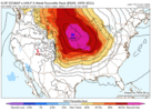
Usually I take the FRAM estimate and cut back on those totals a smidge. The euro FRAM estimate from 6z with it ongoing is 1.59”. Even if you cut that in half which will be occult with their temps around 23-25 it’s still already over 3/4” of ice accrual. That’s the level of ZR potential we have on the southern and western edge here.
 
If anyone is wondering why this airmass is so catastrophically cold and pressing... take a look at the 850mb temp map. Coldest air in the northern hemisphere is under our high pressure system.

And not only is under our high pressure, but it’s co-located in the exact spot that winds up being advected our way in the CAD.

View attachment 186250View attachment 186251
This explains why temperatures during this storm will have no problem producing wintry precipitation for almost the entire forum. The polar pipeline courtesy of the displaced polar vortex is open for business and will remain open this weekend and all of next week.
 
While we're in a lull, just so we can all be on the same page, can someone (without guessing or trying ti be funny) fill in the blanks with either AMPED, FLAT, or NO BIAS?

What biases do models have if any around 5 days out?

GFS:
EURO:
ICON:
UK:
CMC:
 
I was in a 1989 ice storm where it poured rain like a summer day with temps in the teens. While the trees can't necessarily hold the precip as it falls, what ends up happening is a massive and deep sheet of ice on the ground, which makes travel (including walking) virtually impossible.
Not to mention if the ground is already snow and sleet-covered. 2011 was like that here, but with much less freezing rain than may happen this time.
 
While we're in a lull, just so we can all be on the same page, can someone (without guessing or trying ti be funny) fill in the blanks with either AMPED, FLAT, or NO BIAS?

What biases do models have if any around 5 days out?

GFS:
EURO:
ICON:
UK:
CMC:
From bncho yesterday...

What do we know of each model?
The Euro AI is often locked onto an event inside D5 and is often deadly inside that range, but can be locked onto an incorrect solution, only to fold 48 hours before the event. It also often has a QPF bias.
The Euro often tends to overamp low pressure systems, but it also tends to hold back energy in the Baja. It also often has a QPF bias.
The GFS tends to show more suppressive, progressive solutions, and often tends to verify NW.
The CMC has a major cold bias, and tends to overdo Arctic HPs. It also, generally, has a suppressive bias, but it is less prominent than the GFS.
The UKMET tends to struggle on thermals, often being too warm. It also tends to overamp systems.
Since the GFS AI is new, I don't know much about it.
 
The events that move violently NW inside day 3-4 are ones without blocking....like Jan 2017 below. That still stings...

But this time we got a super block on with a super HP. If we can't keep this atleast somewhat in our vicinity than we suck...

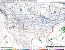
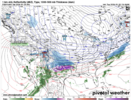
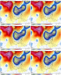
compday.b0dO895t5S.gifScreenshot 2026-01-20 at 9.57.51 AM.png
 
I bit more baja separation on the ICON @24
View attachment 186264

After seeing some of the trends last night on AI models (losing that Great Lakes low) I have a feeling we're going to see 2 things on these 12z runs today.

A little more separation with the Baja Feature and two, continued cold press driving a tick south on the suite today.
 
Sleet bomb / pingergeddon 2026.

As much as I would love to see these epic 15-25" snow totals on much of the model output verify, there's really 3 things heavily favoring against it IMO especially south of I-40 from a climo standpoint.

1) Cold air isn't firmly established prior to precip arrival. For areas south of I-40, one of the most common features of high-end overrunning snowstorms is pre-established cold. For this setup, cold is coming in last minute, which heavily favors a p-type other than snow.
2) Very high QPF - the breadth and quantify of precip implies a LOT of WAA aloft - you have to transport a lot of heat to carry a lot of moisture. This also heavily favors a p-type other than snow.
3) Intensity of the HP - the stronger they are the dryer they are...already need quite a bit of heat transport to have the column saturated. The tipping point between snow vs ice tends to be around 1040mb.

With all that said, think this ends up as a Big Daddy sleetstorm for the bulk of peeps between I-40 and I-20, with ZR being more concentrated in central AL/MS.
I agree -- almost every time, in my N.C. days, when a 6+ inch snow storm was modeled, I ended up losing some of that to sleet.
 
I agree -- almost every time, in my N.C. days, when a 6+ inch snow storm was modeled, I ended up losing some of that to sleet.
Even 1988 had sleet. I think you and me both know it’s about that front end thump and maximizing. In no way am I expecting all snow and neither should anyone else. I do think I am positioned well though.
 
After seeing some of the trends last night on AI models (losing that Great Lakes low) I have a feeling we're going to see 2 things on these 12z runs today.

A little more separation with the Baja Feature and two, continued cold press driving a tick south on the suite today.
I hope you are right about that cold air press. I worry that the forecasted strength of that cold air feeding high pressure may end up being a little less than shown which might indicate a possible northward adjustment in later model runs. High pressure systems of 1050+ mb are almost unheard of. With this storm, as advertised now, there are lots of things I thought I would never see in a Southeastern winter storm.
I think we'll get a clearer picture by Thursday morning when data from the Baja energy is sampled and used in the forecast models.
 
@Webberweather53 be honest. Are the northern solutions valid at all or can we flatten this with the high right up to go time

This isn’t our usual overrunning setup at least in the medium range.

These gargantuan Arctic air masses usually move in quicker than forecast. This tends to move the baroclinic zone southward and you can get south and colder trends like we’ve seen the last few days. Most models are likely grossly underestimating the CAD in the Carolinas and Georgia. Typically don’t see the north shift with the precip shield in something like this until it’s about to happen and we’ve settled down the Synoptics
 
Back
Top