• Hello, please take a minute to check out our awesome content, contributed by the wonderful members of our community. We hope you'll add your own thoughts and opinions by making a free account!

Wintry January 23rd-27th 2026

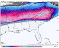
Gfs ai is predictably trending 1-2 degrees colder with every run. You can set your clock to it. It’s been like 8 runs in a row now.

Here’s the trend as the event is starting to ramp up.

View attachment 186196
It also has a Winter Storm going from Saturday morning to nearly Tuesday morning.

I think it’s close to time to mention the possibility of a second round after the main one. Models have been teasing at this. Reminds me of what happened to our West in Feb 2021 when they had two Winter storms
 
It also has a Winter Storm going from Saturday morning to nearly Tuesday morning.

I think it’s close to time to mention the possibility of a second round after the main one. Models have been teasing at this. Reminds me of what happened to our West in Feb 2021 when they had two Winter storms
The gfs has this also. As the main axis pivots we go from a sw to ne movement to a Nw to se movement and a switch back to snow
 
These model runs are complete and total insanity. 2-4 inch liquid amounts all frozen, 48-60 hr duration time, temps in the teens and low 20s, gusty winds….

This one will be in the history books, right next to march 93 and January 88.
The winds especially in the traditional CAD areas are going to be brutal. 10-20mph sustained with gusts over 30mph on the GFS
 
Ah yes negative 15 degrees Tuesday morning. That’ll be fun.View attachment 186195
Well I can tell you that CLT is not gonna beat it’s all time record low by by 10 degrees. However if there is the snow/sleet pack that models are indicating, this will be the best chance the airport has had to go sub zero since 1985
 
Well I can tell you that CLT is not gonna beat it’s all time record low by by 10 degrees. However if there is the snow/sleet pack that models are indicating, this will be the best chance the airport has had to go sub zero since 1985
The combination of snow pack and arctic air definitely gives the credence to all time record breaking low temps. Idk about -15 but I wouldn’t be surprised if we aren’t pushing -5 to -10
 
Ghe transition line is going to be a Warzone. Which looks like 85 imo. The swath of potential with what looks like 2” of liquid and the heaviest rates. Anywhere from 5” to 18-24” is a legit possibility
Just to the south of spots that stay all snow, there’s probably gonna be a 15-20 mile wide corridor that is absolutely bombed with sleet.
 
Let’s talk sleet ratios. lol.

I asked grok about sleet with a very weak 1 Celsius warm layer at 700mb and -10 Celsius 925mb layer and here’s what it said.

Confirmed the stuff Webber brought up about some semblance of snow growth.

Shockingly, a lot of us are going to be in this situation this weekend. We’re going to get to see some wonky hybrid sleet/snow mixes.

IMG_0531.png
 
I believe that’s one thing that models won’t tell you.

There’s going to be a big zone in the heart of CAD country that gets more like 4/5:1 ratios Sunday morning from a “snow/sleet” mix… that’s a result of a lot of weird stuff going on.
Partially melted flakes… refreezing/crystallizing due to a very thick and sub -10c cold layer below 750mb.
 
Are we playing in blizzard of 93s sandbox or is that just being over dramatic because we haven’t seen snow on so long.
Nothing used to describe this storm is going to be over dramatic. It’s a one in 100 year type event.

This is going to make January88 look like an Alberta clipper.
 
Forgive me for posting these maps, but I think it paints an awesome picture. Definitely should be a lot more sleet. Here’s the last frame and totals.
IMG_7937.pngIMG_7941.png
img_7938-png.186213
IMG_7939.pngIMG_7940.png
 

Attachments

  • IMG_7938.png
    IMG_7938.png
    154.2 KB · Views: 1,143
So near atl these snow maps are kind of decieving in the fact it shows a sharp snow cutoff above us but we are still getting tons of freezing and sleet?
 
Back
Top