-
Hello, please take a minute to check out our awesome content, contributed by the wonderful members of our community. We hope you'll add your own thoughts and opinions by making a free account!
You are using an out of date browser. It may not display this or other websites correctly.
You should upgrade or use an alternative browser.
You should upgrade or use an alternative browser.
Wintry January 23rd-27th 2026
- Thread starter SD
- Start date
wow
Member
N GA/SC are goners. My goodness.
rburrel2
Member
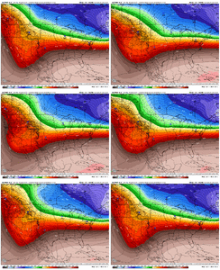
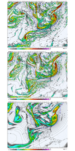
Physics based models continue to lead the way here…??? Both gfs ai and euro ai shifted in their direction… and both gfs and euro held their ground and actually got a little colder/stronger with the high pressure.
Absolutely amazing 12z runs today fellas
Absolutely amazing 12z runs today fellas
Webberweather53
Meteorologist
Are my eyes deceiving me or are the Euro and GFS close to being in agreement at this point?
pivotal stuck on hr 84. ugh someone finish bringing it home
wow
Member
Yeah this Arctic press is going to shred any STJ low here. Like being pulling into a black hole.
bud006
Member
Stating the obvious, but hoping the temps above the surface lead this to be more sleet and not freezing rain for my location. These runs … it’s almost breathtaking to see.
—30—
iwantsouthernsnow123
Member
If that seriously can come just a little more south.. I'd be in the snow. Still not buying into it, but if trends like this can continue over the next few days might show more interest.
Makeitsnow
Member
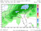
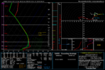
looking at 700mb to surface temps that is a monster sleet storm in north ga/sc
That’s inaccuratewind during zr is not necessarily a bad thing.
There’s a map somewhere that shows wind dramatically increases zr impacts
A lot of damage from ice (esp on power lines) comes from the “shedding of the ice” which causes high tension vibrations and damage
wow
Member
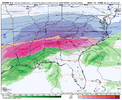
Climatology would point to the freezing rain scope as more limited, but still there will be an area that's going to get it.good.That's one large freezing rain field. Millions of people
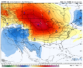
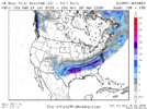
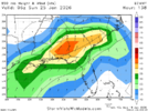
You have a 1045 high in Iowa and 1041 over northern Virginia, lawd. How could you draw it up any betterTPV tells the high where to go which tells the precip where to go. A South Carolina Sleet Nuke. Euro Trend:
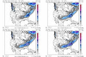
View attachment 185704
Webberweather53
Meteorologist
Here is what I posted on Facebook earlier today from my personal account in case anyone was curious here.
BLUF:
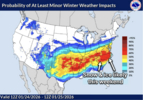
- A major winter storm is possible for much of the Southern & Southeastern US near the end of this week into this weekend, including the Carolinas
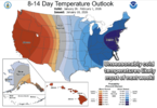
- Unseasonably cold temperatures are likely through most of next week.
An unusually favorable weather pattern for snow/ice is setting up later this week into next weekend (Fri - Sun) over the Southern US, including the Carolinas.
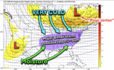
Later this week, a big chunk of the "polar vortex" will dive down into southern Canada, feeding unusually cold air into the East-Central US. Meanwhile, a large stream of tropical moisture from the Gulf of America & Tropical Eastern Pacific will move northward along the subtropical jet stream and "overrun" this cold arctic air mass. This will likely cause a very extensive area of snow, sleet, and freezing rain to break out from the Southern Great Plains up through mid-Atlantic states, with the Carolinas very likely in the direct path of this storm. Wintry precipitation could start as early as late in the day on Friday or Friday night in the Carolinas and possibly continue through Sunday.
While confidence in details like amounts, timing, etc is still low for now, the most likely outcome for eastern and central North Carolina is that this storm produces a wintry mix of predominately sleet that is mixed with freezing rain and snow. Greater chances for snow currently look to be to our north into Virginia, while freezing rain/ice may be an even bigger concern just to our south down into coastal North Carolina, South Carolina, & Georgia. Regardless, significant to major accumulations of snow, sleet, and/or freezing rain/ice are possible in/around east-central North Carolina late Friday through Sunday.
In addition to the snow and ice, temperatures are likely to be unseasonably cold during and after this potential winter storm passes. Depending on how much snow and ice falls from this potential winter storm, low temperatures in the teens or single digits are certainly possible in eastern-central North Carolina. In fact, another shot of Arctic air is likely to move into later in the following week and prolong this unusually intense cold spell.
This also means that whatever snow or ice that falls late Friday through Sunday would have the potential to stick around for many days afterwards! Hence, **if** this winter storm materializes and you are significantly impacted by it, you will want to plan and prepare accordingly for potential power or travel issues for at least a few to several days.
I will try to provide updates as needed on this upcoming potential winter storm and unseasonably cold weather over the coming days.
- Eric W.


rburrel2
Member
Makeitsnow
Member
this is lights out for.......so many people.
NBAcentel
Member
Webberweather53
Meteorologist
Oh yeah this definitely looks like a more amped version of January 1988.
Far from a done deal for anyone, anywhere, but this is why I never, ever worry about precipitation / moisture / dry La Niña etc. Get the right setup in the way things are supposed to be aligned and the gulf won’t let you down
Sky86
Member
What would it take for the snow axis to shift father south into Georgia?
An all timer taking shape here. As grueling as this looks, this is why we do this. Y’all make preparations and don’t get caught staring at the headlights.
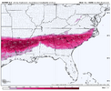
Anyone have sleet map from Euro
trackersacker
Member
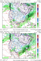
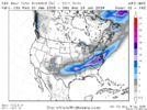
Yeah we don’t do ice like that up hereThat much ice in East TN on the CMC makes me think its bogus. View attachment 185643
Believe this ZR frame (wherever it does eventually set up) has a high probability of occurring with this event.Far from a done deal for anyone, anywhere, but this is why I never, ever worry about precipitation / moisture / dry La Niña etc. Get the right setup in the wayi things are supposed to be aligned and the gulf won’t let you down
Webberweather53
Meteorologist
Basically this looks like a more amped version of January 1988
Warmer air aloft but colder air mass moving in at the low-levels, with of course more background moisture to play with as the tropics and the upstream oceans are warmer than they were then. Just upped ante across the board
Warmer air aloft but colder air mass moving in at the low-levels, with of course more background moisture to play with as the tropics and the upstream oceans are warmer than they were then. Just upped ante across the board
Blue_Ridge_Escarpment
Member
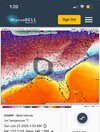
0 degrees Monday morning at Morganton MRN. -3 degrees Tuesday morning.
- Joined
- Jan 23, 2021
- Messages
- 4,602
- Reaction score
- 15,197
- Location
- Lebanon Township, Durham County NC
It may have been since 1988 since I started a storm at 19/10

