atlweatherman
Member
Can you do one for Atlanta?
Can you do one for Atlanta?
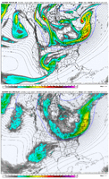
My personal opinion is this has the makings of the Jan 2022 storm all over again. Not from an H5 standpoint but from a surface level. We were looking at a massive sleet and ZR Storm. Then we got FGEN WAA front end snow that way overperformed and held on for much longer than anticipated. I feel like that’s going to have a great chance to happen here too. Obviously you can’t nail those details down until 12-36 hours out. I wouldn’t be shocked to see the 85 north crew really over perform on snow before the eventual switch to sleet. The surface level cold is equivalent to that Jan 2022 storm too. We snowed or sleeted in the low to mid 20’s then.
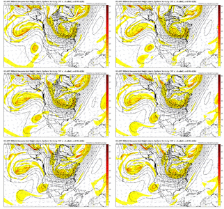
Was looking at that...with the west coast ridge being modeled to rise up by all globals...was thinking AI might be more right. But that's just a guess...Comparison here of the AIFS vs. EPS at the MOT (the Moment of Truth!) when the wave is in the desert southwest.
As the height lines show, the EPS has the more west-to-east southern slider look out front. There is more "activity" / vort energy diving down thru W Canada on the east side of the tall western ridge on the AIFS and the tropospheric polar vortex (TPV) in E Canada has moved farther east. The baja wave has kicked out farther east too as wow mentioned....all leading to a more north solution on the AIFS
View attachment 185558
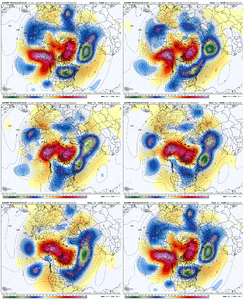
Always good...I see a lot of colors good or bad?
An astute observation, considering how it snapped to the progressive solution in one run and is already slow walking it back...Would not surprise me to see the AIFS suddenly snap back to a less progressive baja low and look like the Euro Ensemble mean. The PV will trend slower and park that HP over us. The baja lows rarely come out in one piece with this setup.
bouncy discussed yesterday here how the 'snap' jumps/moves with AI are a feature to correct initial errors better than the traditional model systemsAn astute observation, considering how it snapped to the progressive solution in one run and is already slow walking it back...
View attachment 185564
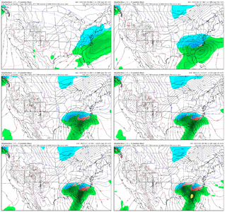
Is he using old or legacy model data? AI suites show this trending north by a lot, if not cutting?Update. Glenn Burns don’t need a model. He’s seen this movie a time or two View attachment 185556
He is using physics model data. Most Mets have not jumped on the AI board yet, as it is still relatively unproven in many areas…though it seems to be quickly gaining support.Is he using old or legacy model data? AI suites show this trending north by a lot, if not cutting?
Chainsaws. Make sure your neighborhood has chainsaws. I've got 6 now since living thru Atl in 73. I'm never without a working saw and fresh chains. Only had to learn that lesson the one time.It has been a long time since a potential storm five days out has grabbed my attention like this. Thanks to everyone for helping me understand the setup with your comments and observations.
If I am correct - and I’d greatly appreciate guidance if not, because I’m constantly learning - models historically struggle with depth/reach of CAD.
Being in the far northern ATL burbs, I’m very closely watching this one. Makes me thankful I spent time this summer cutting down some dead trees and limbs around my house.
Good day to check our batteries and flashlights, and price additional battery packs and other items … just in case.
—30—
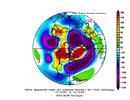
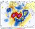
The 06z AI resembles the 00Z Ukmet.Comparison here of the AIFS vs. EPS at the MOT (the Moment of Truth!) when the wave is in the desert southwest.
As the height lines show, the EPS has the more west-to-east southern slider look out front. There is more "activity" / vort energy diving down thru W Canada on the east side of the tall western ridge on the AIFS and the tropospheric polar vortex (TPV) in E Canada has moved farther east. The baja wave has kicked out farther east too as wow mentioned....all leading to a more north solution on the AIFS
View attachment 185558
My guess is it includes sleet/snow.This includes ice though I'm assuming correct? Sleet and ZR?
Yes. Key word being working. The time to fix a gunked up carb and cracked fuel lines on your grandpas homelite chainsaw is not during a storm. It’s well before.Chainsaws. Make sure your neighborhood has chainsaws. I've got 6 now since living thru Atl in 73. I'm never without a working saw and fresh chains. Only had to learn that lesson the one time.
We are around five days away and the energy that will trigger this storm has not been sampled yet. You are correct that a lot can change during the upcoming time period but the strong signal the models are showing for a major winter storm for the Southeast can't be ignored and will probably verify. The details are what will have to be figured out and fine tuned during the next 120 hours. I am going to start making plans in case this turns into a freezing rain fest for KRDU. I will have to check our generator and the chain saw when I get the chance and start preparing like this event is going to be a repeat of December 2002 when my area got socked with around .75 inches of freezing rain.I know right now the models are showing us getting an ice storm but we are still 4 to 5 days away for models to get a better handle on this potential winter storm. Yes a lot can change from now until then so i say let’s just enjoy the weather because it’s the only weather we got
I think you are spot on here. I wouldn’t be surprised if we go SN to IP to ZR in lulls and then doing it all in reverse.
Hey man, do you think we can see ice here in South/Central Bama?
The only words showing up for me are dry slot
I hope so! But I am right on the transition line and that’s never worked out before. I think things are going to continue to trend north per usual. Spann is saying cold rain is very likely.Hey man, do you think we can see ice here in South/Central Bama?
I agree, usually Miller Bs here end up with a lot of mixed slop and rain. However, this is such a cold air mass, we may see very little in terms of rain and a lot of transition from snow to ice and back to snow again, especially in NC.I think you are spot on here. I wouldn’t be surprised if we go SN to IP to ZR in lulls and then doing it all in reverse.
If I remember correctly in the Charlotte area don't we usually have a dry slot when we have a setup like this and the low transfers to the coast?
We need to get rid of the idea of the Baja low entering this one. Needs to stay to the side.Euro is another massive ice storm. It's pulling in more moisture from the West this run compared to 00z. View attachment 185504
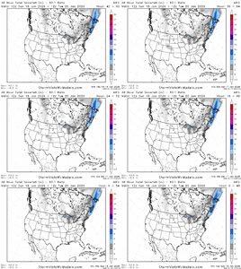
One thing I would add is that if we are looking at a Miller A/B hybrid, there could be a change over back to snow in a lot of areas as the coastal gets cranking.
There is variance. Miller B Dec 2002 didn’t have any problem with precip, but yes, some Miller B’s struggle. Miller A/B Jan 2010 had decent precip but not as much as expectedIf I remember correctly in the Charlotte area don't we usually have a dry slot when we have a setup like this and the low transfers to the coast?
That happens quite frequently with Miller B systems and a dry slot could be a saving grace for areas that happen to be under it during a potential ice storm of this magnitude.If I remember correctly in the Charlotte area don't we usually have a dry slot when we have a setup like this and the low transfers to the coast?
Hey man, do you think we can see ice here in South/Central Bama?
generally i agree with this, but i need to know more about the aifs first. i haven't had enough beers with itWould not surprise me to see the AIFS suddenly snap back to a less progressive baja low and look like the Euro Ensemble mean. The PV will trend slower and park that HP over us. The baja lows rarely come out in one piece with this setup.
as another data point, it played out almost exactly as expected in richmond. rain flipped to snow around 3 pm. got a dusting that's still around. it was really prettySnow maps get a bad rap, as they should but the AI Euro never was enthused for snow in the southeast for yesterday. Atleast on SV...one of the few that didn't. Another + for the AI Euro.
It showed some light snow as it got closer to yesterday and I believe areas to the NW of RDU got some light snow.
View attachment 185581
