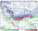
Very well could. But not sure about the over the skis part, though. Nobody's making a forecast. Just enjoying what appears to be the first legitimate threat we've had in forever. I can assure you that nobody on this board is going to wait around for a couple of days to talk about it.Everybody seems a little out over their skis. Gotta just watch for a couple days. This could be a total whiff for everybody south of VA and WV.
-
Hello, please take a minute to check out our awesome content, contributed by the wonderful members of our community. We hope you'll add your own thoughts and opinions by making a free account!
You are using an out of date browser. It may not display this or other websites correctly.
You should upgrade or use an alternative browser.
You should upgrade or use an alternative browser.
Wintry January 23rd-27th 2026
- Thread starter SD
- Start date
ChattaVOL
Member
Nothing there
Sorry picture didn’t upload. Edited it
Sent from my iPhone using Tapatalk
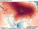
Little bit of CP flow going on there.Coldest air in the entire Northern Hemisphere is going to be over Ontario heading into this. Love to see it
View attachment 185269
Webberweather53
Meteorologist
And never ever discount that STRONG JANUARY SUN.
For just one time, I would like to look an an actual radar and see something like that.
trackersacker
Member
I found this hilarious. Bro will go on and on about how people don’t have to get hung up on snow now when it can snow all the way into March and April but yet he’s barking about January sun angle. Make it make senseAnd never ever discount that STRONG JANUARY SUN.
LukeBarrette
im north of 90% of people on here so yeah
Meteorology Student
Member
2024 Supporter
2017-2023 Supporter
To think this would only be the beginning of the storm is hard to fathom. Historic look to it
packfan98
Moderator
Tsappfrog20
Member
To think this would only be the beginning of the storm is hard to fathom. Historic look to it
Is that because that only how far it goes on the 18z?
Sent from my iPhone using Tapatalk
trackersacker
Member
billyweather
Member
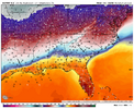
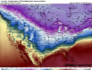
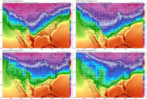
What about the 850?I decided to check out the temperatures that go with this look. HOLY CRAP!
View attachment 185274
packfan98
Moderator
dsaur
Member
In Atlanta it never varied off 32, and poured all night. Up to 4 or 5 inches of ice in places. Just needs a steady inflow of cold air, and it's disaster. Buckhead looked like Tunguska.Be carefull. That happens cause its usually 29-32 temps,fighting latent heat release battles etc.
1040HP camped out and temps in low mid 20s, is flashing red light. It will freeze every drop
blueheronNC
Member
19F and raining in Raleigh to start this event. Could be a layer cake with fluffy frosting on top of a sheet of ice (and fallen trees)I decided to check out the temperatures that go with this look. HOLY CRAP!
View attachment 185274
Tokenfreak
Member
Yikes! Hopefully it’s colder as we don’t need all that freezing rain! That would be terrible!
Sent from my iPhone using Tapatalk
Sent from my iPhone using Tapatalk
Yeah a massive ice storm. Extremely worried for CAD regions and upper south regions for a violent ice storm. These aren’t fun and not something you want to pray for. They are scary especially at night. With the scale of this winter storm it will also mean more extended power outages .. even longer than normal due to crews most likely being run thin across the SE.I feel like the 18z euro run extrapolated was going to be massive in NC.
NBAcentel
Member
In Atlanta it never varied off 32, and poured all night. Up to 4 or 5 inches of ice in places. Just needs a steady inflow of cold air, and it's disaster. Buckhead looked like Tunguska.
Right you are, Tony, unfortunately! During the back to back weekend ATL area icestorms of late Jan 2000, a large portion of both was with temps no colder than 30-31. I kept checking my thermometer.
But what’s interesting is that ice seemed to accrue more when the winds were lighter and the rain lighter.
We have the pattern. We have the ingredients. Just gotta get the details right with the timing of the TPV movement & associated surface high, and the southern stream waveOne thing the Euro AI is doing is scooting that low in the west further east/quicker. Would be be nice if the PV would also scoot a little further east.
View attachment 185266
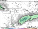
This is a tremendous look precipitation-wise here on the 18z Euro as northern stream shortwave phases in and kicks out the Baja wave into long fetch SW flow streaming across the southern half of the conus. Would like to see more cold air work in ahead of this of course
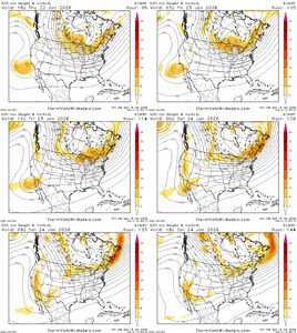
GFS AIFS ensembles much further “North” than the normal GFS and its ensembles.
Personally I lean towards a more widespread ice storm for SE regions
Personally I lean towards a more widespread ice storm for SE regions
Bigedd09
Member
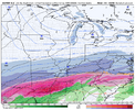
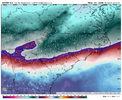
It’s also worth noting to that models tend to underestimate sleet in setups where they show biblical ZR, this 925 cold tongue is rather strong. The euro shows ZR falling but for many areas, that’s likely all sleet. View attachment 185279
If that run would’ve kept going would it have switched to snow or stayed ice tho whole time?
Sent from my iPhone using Tapatalk
High pressure trifecta. North east and west.
We have the pattern. We have the ingredients. Just gotta get the details right with the timing of the TPV movement & associated surface high, and the southern stream wave
This is a tremendous look precipitation-wise here on the 18z Euro as northern stream shortwave phases in and kicks out the Baja wave into long fetch SW flow streaming across the southern half of the conus. Would like to see more cold air work in ahead of this of course
View attachment 185280
Split flow for the win. I noticed that a large portion of the biggest SE winter storms had a split flow H5 signature with moist WSW H5 flow for the subtropical jet underneath moving in tandem with a cold NW flow of the polar jet directly to its north in the Plains states.
Hard to believe, but that 2000 storm was the last ice storm of any consequence IMBY.Right you are, Tony, unfortunately! During the back to back weekend ATL area icestorms of late Jan 2000, a large portion of both was with temps no colder than 30-31. I kept checking my thermometer.
But what’s interesting is that ice seemed to accrue more when the winds were lighter and the rain lighter.
At the time, I was working in Chamblee, and even some of the surface roads had ice in shaded areas. Not unusual at all with sleet or snow, but this was ice accrual during 30-32 degrees
- Joined
- Jan 23, 2021
- Messages
- 4,602
- Reaction score
- 15,197
- Location
- Lebanon Township, Durham County NC
Tsappfrog20
Member
It would most likely be sleet and a lot of of it
Sent from my iPhone using Tapatalk
- Joined
- Jan 23, 2021
- Messages
- 4,602
- Reaction score
- 15,197
- Location
- Lebanon Township, Durham County NC
Yep. I mean you can’t prog where it’s going past this(or I can’t) but it’s just really hard to get freezing rain with that thick of lower level cold. Now if it was -2 or warmer then yes.It would most likely be sleet and a lot of of it
Sent from my iPhone using Tapatalk
That run would’ve been an awful ice storm most likely from FAY to CAE though.
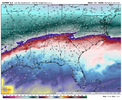
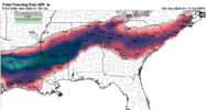
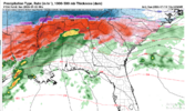
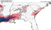
i think we get iced nglim cautiously optimistic that most of NC avoids a catastrophic ice storm but some areas further south...View attachment 185282View attachment 185283
View attachment 185284
you guys know this but i think it's pretty irresponsible to chart out p-type corridors at this juncture. typically sleet steals from the forecasted ice corridors. that ice accrual strip may be only 50 miles in width when it's all said and done but that strip will look like a hurricane passed.
- Joined
- Jan 23, 2021
- Messages
- 4,602
- Reaction score
- 15,197
- Location
- Lebanon Township, Durham County NC
One of those storms we had in like 2014 had a devastating ice storm that was like two counties wideyou guys know this but i think it's pretty irresponsible to chart out p-type corridors at this juncture. typically sleet steals from the forecasted ice corridors. that ice accrual strip may be only 50 miles in width when it's all said and done but that strip will look like a hurricane passed.
- Joined
- Jan 5, 2017
- Messages
- 3,771
- Reaction score
- 5,974
I'm very confident that the GEM has a cold bias, and that Atlanta and most of GA will only be seeing a cool rain from this storm, per the Euro. 925mb is over 5 degrees for most places with surface temps in the 40s and 50s.im cautiously optimistic that most of NC avoids a catastrophic ice storm but some areas further south...View attachment 185282View attachment 185283
View attachment 185284
Showmeyourtds
Member
To have a significant impact on roads, you would probably need ZR falling at less than 30. Depending on rates, I would imagine once you get down into the 20's, you're talking about sleet.
Bigedd09
Member
Sheesh 

Sent from my iPhone using Tapatalk


Sent from my iPhone using Tapatalk
huge performance last storm. we had our typical northwest nudges but those models accurately shut the door on today's event ever getting past nuisance levelLocked in from the jump. AI’s are the future View attachment 185286

