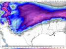
How can a snowaholic, book a cruise in the dead of winter? To high risk missing a backyard winter wx event.Did I just see that the euro AI ensemble had almost a foot mean in my backyard? Have I had too many drinks on this ship today?
-
Hello, please take a minute to check out our awesome content, contributed by the wonderful members of our community. We hope you'll add your own thoughts and opinions by making a free account!
You are using an out of date browser. It may not display this or other websites correctly.
You should upgrade or use an alternative browser.
You should upgrade or use an alternative browser.
Wintry January 23rd-27th 2026
- Thread starter SD
- Start date
256wx
Member
What’s our biggest worry to watch out for trend wise as a potential fail mode for this threat? Seems locked in, but I wish it was closer!
NWMSGuy
Member
So far, Memphis, Jackson and Huntsville are holding off any wintry mention for this upcoming weekend in their latest noon AFD’s. 
Snowflowxxl
Member
Freezing rain is always over-modeled as an fyi. This looks like fun to track for the next week tho!
I would say northwest trends and lack of QPF could be an issue down the road. Especially since colder air can be dry.What’s our biggest worry to watch out for trend wise as a potential fail mode for this threat? Seems locked in, but I wish it was closer!
- Joined
- Jan 23, 2021
- Messages
- 4,602
- Reaction score
- 15,197
- Location
- Lebanon Township, Durham County NC
It was a family thing. Just being a good husband. We can bail in Curacao on Thursday if needed.How can a snowaholic, book a cruise in the dead of winter? To high risk missing a backyard winter wx event.
For those of you heading to the AMS Conference this system may happen while you’re away 
If wasn’t a contractor for wintry weather I would book one now. Have one for March currentlyHow can a snowaholic, book a cruise in the dead of winter? To high risk missing a backyard winter wx event.
ChattaVOL
Member
So far, Memphis, Jackson and Huntsville are holding off any wintry mention for this upcoming weekend in their latest noon AFD’s.
Guessing they will wait till tomorrow.
Huntsville usually is pretty cautious
Sent from my iPhone using Tapatalk
What’s our biggest worry to watch out for trend wise as a potential fail mode for this threat? Seems locked in, but I wish it was closer!
Snow in the Southeast is never locked in, until it's physically falling. HP timing and evolution of the wave in the Desert SW are two things to keep an eye on. The mentioned wave should trigger precipitation blossoming in the southern Plains in about 5 days, as currently modeled. To my untrained eye this is more of a classic overrunning event initially aided by Pac moisture, with Gulf moisture then some Atl development.
Stormlover
Member
Brent
Member
trackersacker
Member
What’s the risk that this thing becomes Ohio Valley trash next weekend?
Bigedd09
Member
It's been a long time since I've seen confidence this high already
Though I think it's more Friday Night Saturday haha
View attachment 185218
Wow you went from never ending ridge to an immediate winter storm! Impressive
Sent from my iPhone using Tapatalk
The biggest concern thinking ahead is surface temps not cold enough (ie the thing trends north with time). So far, she's trended south quite a bit. Hopefully this continues substantially.What’s our biggest worry to watch out for trend wise as a potential fail mode for this threat? Seems locked in, but I wish it was closer!
Mahomeless
Member
Not even close…suppression (southern trend - last winters GOM bomb) is your storm track worryI would say northwest trends and lack of QPF could be an issue down the road. Especially since colder air can be dry.
NWG_WX14
Member
With the strength of the high pressure we should be much more worried about suppression than an apps cutterWhat’s the risk that this thing becomes Ohio Valley trash next weekend?
LukeBarrette
im north of 90% of people on here so yeah
Meteorology Student
Member
2024 Supporter
2017-2023 Supporter
Good thing I went last year in New Orleans! My girlfriend is heading down to present some research and she will not be happy if she misses snow hahaFor those of you heading to the AMS Conference this system may happen while you’re away
The biggest concern thinking ahead is surface temps not cold enough (ie the thing trends north with time). So far, she's trended south quite a bit. Hopefully this continues substantially.
I'm never gonna be concerned about suppression. That has burned me once or twice, but it will take years of that to match how many times I've been burned by temps from a NW trending storm track.
Chris Justus is saying there is already moderate confidence in this threat. New vid out
mydoortotheworld
Member
I say this half jokingly but if you do the math we hope for a couple days of a southward/suppressed trend and then a couple days of N/NW trend to get to roughly the same look as the 12z model suite. Win win*I'm never gonna be concerned about suppression. That has burned me once or twice, but it will take years of that to match how many times I've been burned by temps from a NW trending storm track.
*except the power grid
a_gilmore88
Member


I trust the weather channel app in the long range as far as I can throw it, but I don’t know the last time I’ve seen this level of accumulation forecast at this distance. Speaks to the level of agreement we’re seeing.
Webberweather53
Meteorologist
Yeah I see why we’ve trended to extreme cold and a monster upper Midwest high in the medium range and a big uptick in snow/ice chances during this window
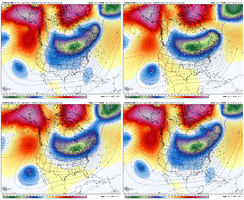
North Pacific storm track is more blocked up near model initialization, which strengthens the western ridge/+PNA more, sending a big chunk of the tropospheric polar vortex into the conus. This in a much stronger surface high entering the us and our current storm digging in more over the southern us also contributes to the -NAO in the medium range.
This is a pattern trend we have come very familiar with this winter.
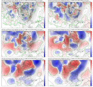
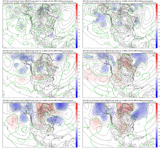


This is actually how things sometimes go at this lead-time.. or they show up big, disappear, and come back around hour 144I say this half jokingly but if you do the math we hope for a couple days of a southward/suppressed trend and then a couple days of N/NW trend to get to roughly the same look as the 12z model suite. Win win*
*except the power grid
2 FT in a place like Atlanta= Shutdown the city for a week plus
Sent from my A600DL using Tapatalk
Brent
Member
NBAcentel
Member
dsaur
Member
I'm going to get a good sleet storm out of this pattern! Always the waa to put a fly in the ointment, but to get sleet I have to risk zr. I've had a number of great sleet storms, it's why it's my favorite, but only two killer zr storms. It's really close, as bad as those storms were, but I'll take the trade. I'll live thru some bad zr to get some great sledding sleet storms.
Bigedd09
Member
I'm going to get a good sleet storm out of this pattern! Always the waa to put a fly in the ointment, but to get sleet I have to risk zr. I've had a number of great sleet storms, it's why it's my favorite, but only two killer zr storms. It's really close, as bad as those storms were, but I'll take the trade. I'll live thru some bad zr to get some great sledding sleet storms.
Skeet storms are awesome! Stays on the ground forever
Sent from my iPhone using Tapatalk
- Joined
- Jan 23, 2021
- Messages
- 4,602
- Reaction score
- 15,197
- Location
- Lebanon Township, Durham County NC
NEGaweather
Member


Sent from my iPhone using Tapatalk
NEGaweather
Member
dsaur
Member
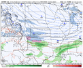
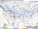
How often does it snow in the gulf? I'm betting when fronts blast down thru Mobile, they get some squalls on the oil rigs. Can the abacus tell us??Note the pockets of snow out over the Gulf/Atlantic. The WxBell algos for the Euro AI snow maps look screwy. Even Bastardi said the same thing.
That's sorta been the trend this winter. Ride her till she bucks ya.Let's keep trending that SER down please.
View attachment 185187
Here's the blueprint for disaster, H5 analysis from 12z 12/05/2002:
View attachment 185188
The -NAO looks to be in place this time, which checks a big box. I'm not sure we'll see a 1050 HP over MN, but the agreement for strong HP up in that area can't be ignored. If the -NAO is in place, then I would not favor a big NW trend at the last minute for sure.
We certainly appear to be aligning the stars and creating a broad path to victory. Hopefully, it continues. It might change tomorrow, but the amount of model support certainly has my attention, as well as pretty much all the big boxes being checked for a MAJOR winter storm in the area.
iwantsouthernsnow123
Member
When Glenn Burns is saying something out of retirement.. That's when you start taking the threat seriously.www.facebook.com
Glenn Burns is serious about this threat
Sent from my iPhone using Tapatalk
NBAcentel
Member
Lights out all of South Carolina if that were to verify
Sent from my A600DL using Tapatalk


