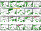
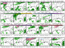
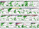
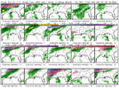
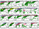
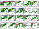
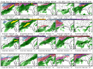
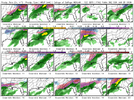
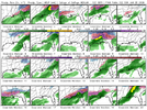
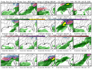
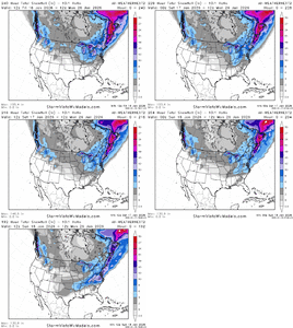
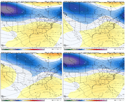
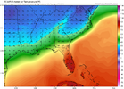
The big dogs show up early, it's just been so long since we've had one.
-
Hello, please take a minute to check out our awesome content, contributed by the wonderful members of our community. We hope you'll add your own thoughts and opinions by making a free account!
You are using an out of date browser. It may not display this or other websites correctly.
You should upgrade or use an alternative browser.
You should upgrade or use an alternative browser.
Wintry January 23rd-27th 2026
- Thread starter SD
- Start date
Stormsfury
Member
Normally. But having a hard press of a 1045mb high constantly refreshing the airmass negates that normal process.From a meteorology standpoint: Is the heat release cause by freezing rain possible to allow THAT much accrual? Self limiting? .75 crippled CLT back in early 2000's.
lol. That little meso HP parked over the foothills of NC. Just there to say 'this heavy CAD is for real!'Yeah I mean that oughta work out for somebody, huh?
View attachment 185163
View attachment 185164
View attachment 185165
View attachment 185166
View attachment 185167
NWMSGuy
Member
Snow_chaser
Member
Glenn Burns is biting. On his fb page he’s saying if he’s wrong, he’s wrong but need to be prepared for a potential devastating ice storm
At least in SC, our public funded Santee Cooper is positioned pretty well for recovery should we have ice issues. The private conglomerates like Duke and Dominion I’m not sure of. Let’s hope we don’t have THAT kind of ice.
UNCSC
Member
I really don’t know what to think. Which is it gonna be?
I really don’t know what to think. Which is it gonna be?
GFS CMC and UKMET also have strong high pressure modeled. Obviously we have no clue how this plays out but this isn’t normal territory either.
Webberweather53
Meteorologist
I really don’t know what to think. Which is it gonna be?
X doubt. The euro isn’t the only model showing this
Snowking2.0
Member
I’m really liking where i’m sitting here north of Huntsville in Hazel Green Alabama for this potential system
rburrel2
Member
The only models I can find in the rainy/cutter camp at 12z are the jma, gfs ai, and Fourcast ai. Everything else is a major hit. We could still lose this quick if it goes the other way though. Need to hold on to it for another day or two to lock in.
Me sitting here like “we can’t possibly fumble this look” like I did last time. Maybe we won’t fumble it this time it’s like we are given a field goal kick at the 20 yd line…
Notice how it’s the same area of Georgia that just got hit
iGRXY
Member
I'd be way more worried about suppression vs a cutterThe only models I can find in the rainy/cutter camp at 12z are the jma, gfs ai, and Fourcast ai. Everything else is a major hit. We could still lose this quick if it goes the other way though. Need to hold on to it for another day or two to lock in.
Naw, that is the total from today includingNotice how it’s the same area of Georgia that just got hit
Blue_Ridge_Escarpment
Member
With a 1050 HP roaring down, I tend to agree.I'd be way more worried about suppression vs a cutter
NEGaweather
Member
Notice how it’s the same area of Georgia that just got hit
Pretty sure that part is today’s output for today’s event
Sent from my iPhone using Tapatalk
iGRXY
Member
Even if you cut some of that off, you're still in the 1040-1045 range which still kills the cutter theoryWith a 1050 HP roaring down, I tend to agree.
It's going to pull me in again
olhausen
Member
Good lord! The whole board would be thrilled with this.View attachment 185143Sweet Jesus I’ve never seen a mean that large in my life
rburrel2
Member
Meh, if this was is suppressed I think there’s a follow up wave that’ll hit.I'd be way more worried about suppression vs a cutter
One major way we might escape this period without wintry weather is if everything goes in to the first storm and it’s rainy. That’s my biggest fear.
If that Baja low hangs back bc the trough doesn’t drop so hard out west, we have a good shot a few days later.
Webberweather53
Meteorologist
I really don’t know what to think. Which is it gonna be?
Honestly, I’m not sure what they’re going on about here
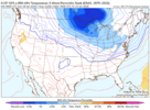
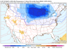
Your low to mid-level temps just above the boundary layer (which aren’t subject to those model biases) are threatening January records (dark blue) over southern Canada and the Upper Midwest.
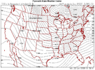
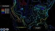
Your SLP records (via WPC) are in the low to mid 1050s in January. 1050mb ish isn’t unreasonable at all
rburrel2
Member
But… I think you’re right in that we will see more corrections south thanks to the retrograding block that should keep a trough from troughing too much in the Pacific Northwest.
- Joined
- Jan 23, 2021
- Messages
- 4,602
- Reaction score
- 15,197
- Location
- Lebanon Township, Durham County NC
Did I just see that the euro AI ensemble had almost a foot mean in my backyard? Have I had too many drinks on this ship today?
Yeah, I tend to agree, What exactly is the "long track record..." they refer to in this context?Honestly, I’m not sure what they’re going on about here
Your low to mid-level temps just above the boundary layer (which aren’t subject to those model biases) are threatening January records (dark blue) over southern Canada and the Upper Midwest.
Your SLP records (via WPC) are in the low to mid 1050s in January. 1050mb ish isn’t unreasonable at all
View attachment 185189
View attachment 185190
View attachment 185191
They just want to say “we always said this was nothing” when we manage to fumble it
more like Freezing rain/Sleet potential. Let's hope for a colder solution at the 850.Are temps a problem GA this time around or would it still ice/snow with what its showing currently?
WolfpackHomer91
Member
With these CAD set ups, does anyone have any previous winter storms to compare this too? Right now I’m south of the cut off so I want to compare to see if this type of storm has historically missed my area or if there is a chance for me still…
Feb 2014/ Feb 2004/ Dec 2018
Sent from my iPhone using Tapatalk
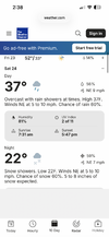
My TWC app is now showing 42/26 for next Sunday, with freezing rain that day and night.
rusrius
Member
I remember those crippling ice storms from my childhood (and I’m approaching 60 years old) and I really don’t want to have to go through that again.
WolfpackHomer91
Member
If February 2014 is the best analog we may be able to avoid the biblical ice. Pretty sure the zr maps were almost as bad and we ended up with sleet and snow instead.
Feb 2014….. last time I saw bonkers numbers 5-6 days out. I will never forget that Sat AM before the storm on Weds that run came out with 10-20” in NC…. And just kept coming and coming and coming run after run. EURO that Sunday (yes ik including ice) dropped that run of widespread 15-20+” and then it was game on bc it was under 100hrs. That Monday evening before Weds AM I wish I still had the screenshots from NWS GSP “Snow and Sleet Heavy at times. Accumulating 6-10”” then the next Overnight “Snow occasionally mixing with sleet accumulation 5-7” and the point Forecast graphic had me at 12-18” it was insanity
Sent from my iPhone using Tapatalk
Thinking same thing, looking at model trends. Heck of a press forecasted with how everything is positioned up above usI'd be way more worried about suppression vs a cutter
WolfpackHomer91
Member
Glenn Burns is biting. On his fb page he’s saying if he’s wrong, he’s wrong but need to be prepared for a potential devastating ice storm
Go watch his video on March 93’ …. He was scoffed at for calling for 3’ in N GA….. he nailed it
Sent from my iPhone using Tapatalk
Every model that bouncycorn stood next to and said “this is the best we got” is shrieking bloody murder
Let it take you weeks like the one we’re about to have is why we do thisIt's going to pull me in again

