-
Hello, please take a minute to check out our awesome content, contributed by the wonderful members of our community. We hope you'll add your own thoughts and opinions by making a free account!
You are using an out of date browser. It may not display this or other websites correctly.
You should upgrade or use an alternative browser.
You should upgrade or use an alternative browser.
Jan. 17-18, 2026 SE Winter Weather Threat
- Thread starter RBR71
- Start date

blueheronNC
Member
The learnings from this event will likely need to be that cold chasing moisture over the apps without a cold feed from the north already established / to tap into never ever ever works out for central NC
Wild stuff. That certainly qualifies as a major snow. Tenille, well east of macon is 33/all snow so that area is going to do very well too.
The NWS has just corrected this down from 3” to 2” though it’s still a very nice hit:
RELIMINARY LOCAL STORM REPORT
NATIONAL WEATHER SERVICE PEACHTREE CITY GA
937 AM EST SUN JAN 18 2026
.TIME... ...EVENT... ...CITY LOCATION... ...LAT.LON
.DATE... ....MAG.... ..COUNTY LOCATION..ST.. ...SOURCE.
..REMARKS..
0908 AM SNOW MONTICELLO 33.30N 83.68W
01/18/2026 M2.0 INCH JASPER GA BROADCAST MEDIA
CORRECTS PREVIOUS SNOW REPORT FROM
MONTICELLO. REPORT FROM MEDIA OF 2 INCHES OF
SNOW IN MONTICELLO.
Drizzle Snizzle
Member
That’s Trisha Yearwoods hometown I thinkThe NWS has just corrected this down from 3” to 2” though it’s still a very nice hit:
RELIMINARY LOCAL STORM REPORT
NATIONAL WEATHER SERVICE PEACHTREE CITY GA
937 AM EST SUN JAN 18 2026
.TIME... ...EVENT... ...CITY LOCATION... ...LAT.LON
.DATE... ....MAG.... ..COUNTY LOCATION..ST.. ...SOURCE.
..REMARKS..
0908 AM SNOW MONTICELLO 33.30N 83.68W
01/18/2026 M2.0 INCH JASPER GA BROADCAST MEDIA
CORRECTS PREVIOUS SNOW REPORT FROM
MONTICELLO. REPORT FROM MEDIA OF 2 INCHES OF
SNOW IN MONTICELLO.
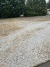
Still coming down here although it should be ending within the hour. We have definitely had a couple of bursts of moderate snow with larger flakes. Ground temperatures have limited accumulations but I'm thinking we're going to end up with just under an inch.Perry, GA View attachment 184981
I'm definitely not complaining considering we got up to 62° yesterday!
Drizzle Snizzle
Member
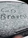
I’m gonna go outside in a few and take some pics before it melts lol.
Sctvman
Member
It has changed to all snow in Dublin, GA
EastmanGAWX
Member
Mahomeless
Member
- Joined
- Oct 17, 2023
- Messages
- 900
- Reaction score
- 2,158
3/4” in Macon and it’s done.
Balakay
Member
Just made a harrowing drive from Atlanta to Augusta on I-20. Very heavy snow from about Conyers to Thomson, was whiteout conditions. Currently mixing in Evans, GA. A few cars wrecked around Lake/Greensboro . Very quick transitions as well, was fun but a little scary haha
Heavy snow/rain mix in Aiken, SC. Trying to pull it up 20.
Round Oak Weather
Member
2 inches just halfway between Monticello and Gray, Ga in Round OakThe NWS has just corrected this down from 3” to 2” though it’s still a very nice hit:
RELIMINARY LOCAL STORM REPORT
NATIONAL WEATHER SERVICE PEACHTREE CITY GA
937 AM EST SUN JAN 18 2026
.TIME... ...EVENT... ...CITY LOCATION... ...LAT.LON
.DATE... ....MAG.... ..COUNTY LOCATION..ST.. ...SOURCE.
..REMARKS..
0908 AM SNOW MONTICELLO 33.30N 83.68W
01/18/2026 M2.0 INCH JASPER GA BROADCAST MEDIA
CORRECTS PREVIOUS SNOW REPORT FROM
MONTICELLO. REPORT FROM MEDIA OF 2 INCHES OF
SNOW IN MONTICELLO.
Keep us updated. Are you seeing anything Georgia Girl?Heavy snow/rain mix in Aiken, SC. Trying to pull it up 20.
Round Oak Weather
Member

GeorgiaGirl
Member
Keep us updated. Are you seeing anything Georgia Girl?
I headed southwest to Wrens. There is a dusting of snow on the ground where I'm at.
I'm honestly not sure I needed to though. When I was driving, it started trying to change over at the temp it's at near the house.
My dad's not thrilled. I'm going to try and head back now I believe... but I'll peek at the radar first.
Bigedd09
Member
Dublin Georgia cam
Sent from my iPhone using Tapatalk

Sent from my iPhone using Tapatalk
EastmanGAWX
Member
dsaur
Member
Hey, El K! I've got roofs covered, and patches of ivy with white leaves, but mostly underwhelming. Glad you got some to stick.Still coming down here although it should be ending within the hour. We have definitely had a couple of bursts of moderate snow with larger flakes. Ground temperatures have limited accumulations but I'm thinking we're going to end up with just under an inch.
I'm definitely not complaining considering we got up to 62° yesterday!
Thanks, Tony! Here's hoping a sleet storm is in the cards for you soon!Hey, El K! I've got roofs covered, and patches of ivy with white leaves, but mostly underwhelming. Glad you got some to stick.
Webberweather53
Meteorologist
Still hovering around 43F in Raleigh. Warmer than the 12z NAM forecast by a few degrees and not too far off from the hrrr
Brent
Member
The camera in Macon just basically shows the snow is gone already
Big wet flakes in Aiken SC
Bigedd09
Member
As a whole. What model would you say handled this system the best? I think the HRRR was pretty solid. At least for my area
Sent from my iPhone using Tapatalk
Sent from my iPhone using Tapatalk
Certainly not enthused by temps across the Carolinas this AM. My local station is showing 41. We shall see. I want to hope that graphic from NWS RAH is right. 
I think it may be a little early to get lessons learned, what model performed the best, etc. It’s not over yet!
I think it may be a little early to get lessons learned, what model performed the best, etc. It’s not over yet!
we did get 0.08 of rain, so that’s kinda like snow
At Smithville, GA, 10 miles S of Americus, 2-3” reported by EM:
1002 AM SNOW SMITHVILLE 31.90N 84.26W
01/18/2026 E3.0 INCH LEE GA EMERGENCY MNGR
2 TO 3 INCHES OF SNOW REPORTED IN SMITHVILLE
BY LEE COUNTY EM. SOME ACCUMULATION ON DIRT
ROADS WITH ICY PATCHES ON SPOTS IN PAVED
ROADS.
1002 AM SNOW SMITHVILLE 31.90N 84.26W
01/18/2026 E3.0 INCH LEE GA EMERGENCY MNGR
2 TO 3 INCHES OF SNOW REPORTED IN SMITHVILLE
BY LEE COUNTY EM. SOME ACCUMULATION ON DIRT
ROADS WITH ICY PATCHES ON SPOTS IN PAVED
ROADS.
Warm, wet ground certainly isn’t the best for snowcover’s staying power, sadly.The camera in Macon just basically shows the snow is gone already
Back edge pulling out quickly. Well done SGA crew
Wow, what a correction downward at Byron, GA, from 2” to 0.5”:
1013 AM SNOW 2 N POWERVILLE 32.63N 83.79W
01/18/2026 E0.5 INCH PEACH GA PUBLIC
CORRECTS PREVIOUS SNOW REPORT FROM 2 N
POWERVILLE. AN ESTIMATED 0.5 INCH OF SNOW
FELL AT HAYES CT IN BYRON.
1013 AM SNOW 2 N POWERVILLE 32.63N 83.79W
01/18/2026 E0.5 INCH PEACH GA PUBLIC
CORRECTS PREVIOUS SNOW REPORT FROM 2 N
POWERVILLE. AN ESTIMATED 0.5 INCH OF SNOW
FELL AT HAYES CT IN BYRON.
 Raleigh/The whole triangle area I am confident is just gonna get rain. Trends are strongly against us and the cold won't be strong enough. If we were just a few degrees colder this could have all been snow
  Terrible luck like always
Barely visible drizzle by lake murray
The camera in Macon just basically shows the snow is gone already
It’s gone as in melted already or gone as in stopped?
GeorgiaGirl
Member
Thought I saw rain try and mix in as I entered Richmond County but the Blythe status is 33, all snow, dusting too.
Gah this was so close to being very interesting. Now I need to GPS myself to a gas station, or my dad may have my head (I have no clue where I'm going).
Gah this was so close to being very interesting. Now I need to GPS myself to a gas station, or my dad may have my head (I have no clue where I'm going).
What if I told you 10 years ago there’d be a storm that jackpotted Macon Georgia, skipped everyone else, then Boston 
SWVAwxfan
Member
Head up US 1. There will be plenty of gas stations l.Thought I saw rain try and mix in as I entered Richmond County but the Blythe status is 33, all snow, dusting too.
Gah this was so close to being very interesting. Now I need to GPS myself to a gas station, or my dad may have my head (I have no clue where I'm going).