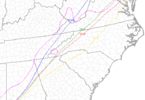
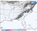
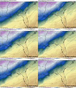
We love Raleigh near Wilmington and Charlotte near RaleighI fed Chat some prompts and this is the map it made. This is not at all what I told it to dobut we hug. Edit: omg look where it put Macon
Edit: and Augusta
Edit: oh my god look where everything is atView attachment 184848
-
Hello, please take a minute to check out our awesome content, contributed by the wonderful members of our community. We hope you'll add your own thoughts and opinions by making a free account!
You are using an out of date browser. It may not display this or other websites correctly.
You should upgrade or use an alternative browser.
You should upgrade or use an alternative browser.
Jan. 17-18, 2026 SE Winter Weather Threat
- Thread starter RBR71
- Start date
Makeitsnow
Member
Lol I didn't know Macon moved to AtlantaI fed Chat some prompts and this is the map it made. This is not at all what I told it to dobut we hug. Edit: omg look where it put Macon
Edit: and Augusta
Edit: oh my god look where everything is atView attachment 184848
NoSnowATL
Member
I think my gummy kicked in or that map is off.
dsaur
Member
The rain is over here, but it needs to get colder before the next batch. Still just 41, so the rain didn't do much column cooling. And it was pretty good rain for a bit.I'm surprised how heavy the rain is here atm....the column is very moist....wonder if that will play a role here several hours from now.
Iceagewhereartthou
Member
45 here, no precip, no cold. Good luck to everyone, I truly hope some of you get to see something!
Honestly not a bad thing, precip holding off more until the temps lower overnight can't hurt.45 here, no precip, no cold. Good luck to everyone, I truly hope some of you get to see something!
Iceagewhereartthou
Member
This one isn't my storm, I'm not supposed to see anything regardless. Hopefully you and others get to see a little bit. Would be pretty special for those areas to our south to see some back to back years.Honestly not a bad thing, precip holding off more until the temps lower overnight can't hurt.
Winds have really picked up outside here in southern Greenville county
Sky86
Member
There looks to be a good fetch of moisture going all the way back across the Gulf.
LukeBarrette
im north of 90% of people on here so yeah
Meteorology Student
Member
2024 Supporter
2017-2023 Supporter
Got a few flurries #icallthatawinView attachment 184840Dry slotted hell yeah
Nerman
Member
I fed Chat some prompts and this is the map it made. This is not at all what I told it to dobut we hug. Edit: omg look where it put Macon
Edit: and Augusta
Edit: oh my god look where everything is at
Both Birminghams lmao
Branch
Member
Looks south and headed east. Let’s see how far north and west it can goThere looks to be a good fetch of moisture going all the way back across the Gulf.
Makeitsnow
Member
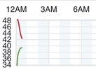
Temps.cooled from 47 to 41 underneath it here
SegTindo
Member
WSW has been expanded

Sent from my iPhone using Tapatalk

Sent from my iPhone using Tapatalk
trackersacker
Member
My coping process this week has went from “I need at least 4-6” because I haven’t seen it in several years” to “maybe we can do last minute northwest trend and get 1-3” to “Can I get an inch” to “Can I get flakes”Got a few flurries #icallthatawin
dsaur
Member
All the way into Mexico. Might be some over performing, it the cold gets over the mtns.There looks to be a good fetch of moisture going all the way back across the Gulf.
That cold is lagging so badAll the way into Mexico. Might be some over performing, it the cold gets over the mtns.
iwantsouthernsnow123
Member
Good for us. Bad for Carolinas overall. We need it to lag a bit so we don't have as much dry air coming in as early. Allows that gulf wave to try its best to push its way in.That cold is lagging so bad
is this our moment?! orange/durham county have been in the bullseye of almost every run the past few hours.......... im scared to trust haha but im gonna be cautiously optimistic00z Euro matches up with the 18z run pretty well. I'll continue to hug the clown. Chapel Hill nearly in the bullseye with 2.4"!!!
1-2" across a fairly sizable swath of central / south GA and T-1" in the western FL panhandle.
View attachment 184861
Definitely an uptick in moisture on the Mobile, AL radar. Definitely ain’t gonna help me. But maybe some of y’all? God speed and good luck!
No idea! I am very hesitant about it for obvious reasons, having cold air come in while rain is falling is not usually how we do things successfully. However, we may be in the right place to both get enough precip and to get enough cold air. Places to our west may get the cold air a bit quicker but not as much precip, while areas further east wait too long to changeover. Or at least that's what some of the modeling suggests verbatim this evening. Of course, there's plenty of reasons to not really trust the exact modeling details at this point given history, etc. In any case, given a typical modeling error at this lead time, who knows if we'll be in the bullseye once it's all said and done, or if there will be a bullseye at all as rain washes away our hopes and dreams.is this our moment?! orange/durham county have been in the bullseye of almost every run the past few hours.......... im scared to trust haha but im gonna be cautiously optimistic
I also hate the diurnal timing; it would really help if we could get some of this potential snow in the evening. We gotta hope rates rock because above freezing BL + wet ground + diurnal timing is a disaster. I wouldn't be surprised if we get absolutely nothing, but I guess if things come together 1-3" isn't outside the realm of possibility?
EDIT: Time to post our favorite NWS product!
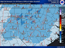
mind sharing what’s interesting?Interesting...
View attachment 184876
RollTide18
Member
Interesting...
View attachment 184876
Good or bad?
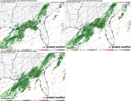
03z SREF plumes are out...
RDU: 2.30"
GSO: 1.79"
CLT: 1.29"
GSP: 0.75"
CAE: 0.99"
ATL: 0.53"
MCN: 2.33"
ABY: 2.15"
TLH: 0.10" (one crazy ARP member gives them 2.5"+)
PNS: 0.70" (!!!)
RDU: 2.30"
GSO: 1.79"
CLT: 1.29"
GSP: 0.75"
CAE: 0.99"
ATL: 0.53"
MCN: 2.33"
ABY: 2.15"
TLH: 0.10" (one crazy ARP member gives them 2.5"+)
PNS: 0.70" (!!!)
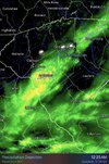
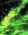
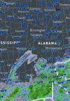
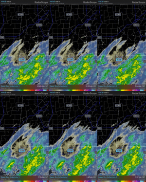
This is the radar view I've been watching since yesterday afternoon, when I began looking for indications of a little more precipitation further west along the Louisiana Coast to improve chances a tick further NW into Georgia than was modeled at the time. Again, so far, so good.

 weather.cod.edu

COD NEXLAB: Satellite and Radar
Check out COD Meteorology's Satellite and Radar Data
This is supported by radarView attachment 184877
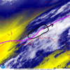
Increasing moisture in black circled area. Pink line is current roughly estimated R-S line. More low level moisture in this area than models progged.
Ah yeah, basically what I was seeing on radar. Neat.View attachment 184877
Increasing moisture in black circled area. Pink line is current roughly estimated R-S line. More low level moisture in this area than models progged.
Will this dry up or give Atlanta a chance of snow showers and flurries?This is supported by radarView attachment 184878
You may see some flakes fly, especially south of the city. I still have no measurable accumulation in ATL.Will this dry up or give Atlanta a chance of snow showers and flurries?
SimeonNC
Member
My temp is 44.2 and dropping.

