packfan98
Moderator

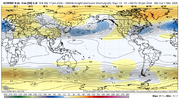
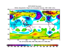
First 15-20 days look good
Thank God. @Mitch West we are going to make February great againThis honestly just looks like an El Niño winter February. La Niña is just completely dead at this point

A little ways out, but the SPV is expected to weaken to below normal strength ~mid February or so.
Sent from my iPhone using Tapatalk


I was promised an appetizer tomorrowNo way we ---- this up. Money in the bank boys.
I will say some of those bust could be icier solutions vs snow or rainA LOT of boom/bust scenarios here. For GSP, 12 show a big dog; purple/pink/teal. But on the other hand; 17 (or about 1/3) show nothing at all or just a "dusting." This far out its doesn't mean much either way; just that there is a possible system at the time frame. Way too early to get drawn in by the means or pretty colors though. Naturally all us nerds will keep an eye out but just a word to the wise; control expectations and especially hopes.
That’s absolutely ludicrous. I’ve never seen an ensemble snow mean that high in NC
Going to be some awesome accumulations maps for this run.
That one’s a beaut
Go charge your phone!
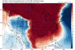
Would be borderline impossible not to get snowed onNo shortage of cold airView attachment 184743

Suppression concern?Would be borderline impossible not to get snowed onView attachment 184745
If we can keep a leftover baroclinic zone that’d help a lotSuppression concern?
100%. This is a cold and DRY look. Maybe something from New Orleans to Savannah GA, but not for most of the board.Suppression concern?
This is about 2 days later as those 2 high pressure centers pull back some. The 1st system fizzled out but this 2nd one may just do it. The BIG thing is having the cold air in place already before any precip arrives. This is how we used to do things back in the 1970's and 80's.
No. We’re about to make a run at the 40/70 benchmark. This is the pattern that produces that. And if not, a weak overrunning event will be your consolation prize. Hope you like snowSuppression concern?
I said this last night, but the last time I can remember seeing this much agreement this for out across the ensembles was February 2014. I remember we tracked that on American WX for nearly 2 weeks. I will say all of the indicies and teleconnections do seem to be lining up perfectly in that timeframeThis like 8 euro ai runs in a row with a monster winter storm in the southeast? For the same timeframe? The level of disappointment I’m gonna have if this doesn’t work out will be record breaking. I’ve literally never felt so good about a day ten threat. It’s scary.
There should honestly be more discussion about this than the event tomorrow. We don’t get looks like this very often. This is once a decade stuff.
It's gotta be like this minimum 4 days out on the Euro before I get the least bit investedWell, I just thought yesterday’s run looked good. View these nsfw ensemble pics at your own risk.
View attachment 184673View attachment 184674
