• Hello, please take a minute to check out our awesome content, contributed by the wonderful members of our community. We hope you'll add your own thoughts and opinions by making a free account!

Jan. 17-18, 2026 SE Winter Weather Threat

I'm assuming if you're SE of the rain/snow line at this point, all hope is lost? Presume that the temps aren't going to be there and there's no such thing as a SE snow trend in the deep south.
 
So in summary of the Raleigh AFD, the strong right entrant region jet streak is our ticket for any real accumulation in North Carolina. Of course, it will not be the ace in the hole unless the cold air can filter down before it hits. This is why weather is so fascinating and so difficult to predict.
 
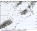
HRRR has been rather hard at work behind the scenes. Note some of that lighter grey is all verga, but the greens are more like precip reaching the ground. This map does not show Precip Type. Looking sneaky for north georgia. We'll see how it continues. View attachment 184692
One thing I am concerned about is how the virga off to the west was actually somewhat modeled by the HRRR, and as usual seems to be moving a bit faster than on the model. If that is the case, the first round of precip (and possibly only round for parts of N. GA) would move through before the deeper cold air gets into the picture, which also might be supported by the HRRR and RAP backing off on the initial burst of wet snow initially modeled. Hopefully I am wrong because if that initial finger band moves through just an hour or two later than than guidance, temps would be much more conducive to the initial mix or wet snow. As for this band, I am still concerned about dry air, but yes, if those green colors (typically you want 20+ dbz, ideally 25) are rolling over areas further NW, especially if the timing of that wave speeds up so that there is still some of the mid level moisture from the first wave nearby, then snow becomes plausible for points north and west, although at this time I don't really think the dry air is going to be overcome around ATL/I-85 unless there is a lot more moisture than modeled with this second wave aloft to reduce/moisten the dry air.
 
Not that it really matters at this point, but curious when/if that hurricane hunters flight data gets injested… still 00z runs?
 
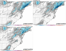
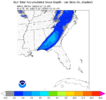
Here's the forecast from the RRFS v2 (MPAS-Based) which will eventually be replacing the HRRR, NAM, HRW-ARW, and HRW-FV3. This is different from the RRFSA v1 that is available on the model sites, which is based on the FV3 core.

View attachment 184715
I'll let you know how it does. The NW fringe divides my county in half. I can walk to the snow line!
 
Here's the forecast from the RRFS v2 (MPAS-Based) which will eventually be replacing the HRRR, NAM, HRW-ARW, and HRW-FV3. This is different from the RRFSA v1 that is available on the model sites, which is based on the FV3 core.

View attachment 184715
Thanks for posting this one. Hoping to get to know it quickly before the replacement happens (although I’ve heard there’s some push to keep the NAMs alive past the March execution date)
 
Thanks for posting this one. Hoping to get to know it quickly before the replacement happens (although I’ve heard there’s some push to keep the NAMs alive past the March execution date)
after today, put it down... Its switched back and forth so many times this winter.
 
I saw that too...calling BS on that sleet report. It's in the low 50s right now
One of the best snows I ever had back in the 90s started as late afternoon sleet with temps in the low 50s. The precip became progressivly heaver, and after an hour or so, it was pouring goose feathers. Not happening this time like that since it's too warm aloft ATM.

Atlanta got fringed, and I had six inches by 2 AM.
 
Really curious to see how the Panhandle makes out with this tomorrow morning. From experience, everything tells me that the precip should out pace the cold. But the mesos are consistent with the transition to snow across the Panhandle in the morning. I also can't believe the Weather Channel aired live 1-2 days ago the 10:1 snowfall outputs from the Euro and GFS, with 1-3"+ across the area. I'd be shocked if we see anything more than 1" in elevated and grassy surfaces, mainly across northern Holmes and Jackson counties.
 
Back
Top