scncborderwx
Member
Is the hrrr overestimating surface temps in the Carolinas?
hrrr surface temps are something else
That seems like a common jackpot zone in some of the small events recently, so it makes sense.For NC, SREF Plumes seem to be maxing out around GSO down to Asheboro and over to Salisbury.
TW
Appreciate you chiming in! A couple of inches in central Georgia would be nice! Your past contributions to the forum were always insightful, especially when you were doing the forecasts out of Macon.Lmao. I move from central GA and they might see some snow. I think up to 2” is possible there. More than likely 0.5-“ to 1” would be what I would go on TV saying.
You think the extra verga precip is an interesting look on radar/obs for northeastern GAOnly thing you could hope for is that the HRRR/RRFS are over-mixing the boundary layer. These models track record of late also isn’t actually stellar either.
Oth, the way this whole storm is being setup does concern me though and it’s hard to ignore the possibility that it is that warm at the surface.
You think the extra verga precip is an interesting look on radar/obs for northeastern GA
I'm just hoping to get something. Hoping for at least a couple of inches but i just don't think thats even a possibility honestly.Yep that is intriguing.
Probably another a classic case where the moist upglide on the leading edge of the storm is probably gonna over perform compared to very short term forecasts.
The good news is that extra precip could help some folks (esp in GA) wet bulb quicker and makes it easier to get precip later
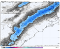
If this is right, CAE hits a jackpot & I'll forever view this model as an absolute unit. Can't wait to see how it does.Long trend on Weathernext Ens snow ending 12z Monday
View attachment 184670
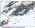
Here is the latest from 12z
View attachment 184671

Any shot at a light surprise in NE TN?Yep that is intriguing.
Probably another a classic case where the moist upglide on the leading edge of the storm is probably gonna over perform compared to very short term forecasts.
The good news is that extra precip could help some folks (esp in GA) wet bulb quicker and makes it easier to get precip later
And she's caught on to the warm bubble. Great.
Wild how the mistakes from SC affect NCAnd she's caught on to the warm bubble. Great. View attachment 184682
And she's caught on to the warm bubble. Great. View attachment 184682
Yeah that’s what I’ve been afraid of happening, can’t say I’m terribly surprised by it. This setup just doesn’t have the cold air transport or cold air in general. I knew something wasn’t right this morning when the NAM was cooler than the usually cold biased RGEM
Well since its backed off, are you back to your worst case map?Yeah that’s what I’ve been afraid of happening, can’t say I’m terribly surprised by it. This setup just doesn’t have the cold air transport or cold air in general. I knew something wasn’t right this morning when the NAM was cooler than the usually cold biased RGEM
Any shot at a light surprise in NE TN?
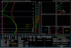
I think these temps are a bit highLooks a bit more like the HRRR temp wise now. Makes more sense given this setup
View attachment 184684
Well since its backed off, are you back to your worst case map?
Thank you. I appreciate the compliment. I’m going to be better about being more active in the forums for sure.Appreciate you chiming in! A couple of inches in central Georgia would be nice! Your past contributions to the forum were always insightful, especially when you were doing the forecasts out of Macon.
Back on the line in randleman... Typical.I’ll have to make some tweaks to that but I don’t hate where it’s at.
I think these temps are a bit high


Yea im glad no moisture..Golf tomorrow!And she's caught on to the warm bubble. Great. View attachment 184682
Yeah that northern GA snow ain't happeningView attachment 184690RRFS is a tick NW but still just barley off for us northeast GA folks. Granted RRFS is not at all considering current verga precip ongoing all over the SE. Nor is any model really.

