• Hello, please take a minute to check out our awesome content, contributed by the wonderful members of our community. We hope you'll add your own thoughts and opinions by making a free account!

Jan. 17-18, 2026 SE Winter Weather Threat

Pathetic snow map for this event. The ceiling is very low lol, but there is gonna be a winner east of the mountains. IMHO somewhere around the triad is most likely to do it pending more NW shifts given the cold air advection is likely to reach them first. View attachment 184644
Least unhinged map right here
 
what is the best resource for looking at the current 540 line, etc? I thought I had some links saved, but I hadn't needed them since last year, and now I can't find them.
 
URGENT - WINTER WEATHER MESSAGE
National Weather Service Peachtree City GA
123 PM EST Sat Jan 17 2026

GAZ082>084-093>097-104>109-180800-
/O.UPG.KFFC.WW.Y.0001.260118T0800Z-260118T1700Z/
/O.NEW.KFFC.WS.W.0001.260118T0800Z-260118T1800Z/
Bibb-Twiggs-Wilkinson-Macon-Peach-Houston-Bleckley-Laurens-Sumter-
Dooly-Crisp-Pulaski-Wilcox-Dodge-
Including the cities of Toomsboro, Abbeville, Warner Robins, Macon,
Vienna, Fort Valley, Cochran, Hawkinsville, Montezuma, Dublin,
Eastman, Cordele, Jeffersonville, and Americus
123 PM EST Sat Jan 17 2026

...WINTER STORM WARNING IN EFFECT FROM 3 AM TO 1 PM EST SUNDAY...

* WHAT...Heavy snow expected. Total snow accumulations between 1 and
3 inches.

* WHERE...Portions of central and west central Georgia.

* WHEN...From 3 AM to 1 PM EST Sunday.

* IMPACTS...Plan on slippery road conditions.

PRECAUTIONARY/PREPAREDNESS ACTIONS...

If you must travel, keep an extra flashlight, food, and water in your
vehicle in case of an emergency. The latest road conditions for the
state you are calling from can be obtained by calling 5 1 1.
 
Every single time a snow event is scant, people start talking about “over performing”. I think 2017 was very rare and models are generally pretty accurate.

The most recent relatively widespread storm on this board (late February 2025, last winter) overperformed for much of central NC, I'd say. We got a solid warning criteria event in the Triangle despite the NWS only ever having us in an advisory. Obviously, that doesn't mean we will overperform here and if anything it seems we tend to underperform more often (though that may be a figment of our perception), but it isn't impossible to overperform and isn't an exceedingly rare thing, either.

When the forecast is for basically nothing as it is, then overperformance is certainly more likely than underperformance (it's hard to underperform 0"). :D

EDIT: Also, as mentioned below the storm that gave Atlanta a surprise 3"+ in January certainly overperformed and I think the Gulf Coast Blizzard overperformed, as well (did anyone have anyone in the Florida Panhandle (!!!!!!!) getting 10" of snow from that one? - the statewide record prior to that one was a measly 4"!).
 
Every single time a snow event is scant, people start talking about “over performing”. I think 2017 was very rare and models are generally pretty accurate.

I mean just last year alone, both snow events overperformed for my backyard. The first one was the big frontogenesis band that swept through the Atlanta area which was a big surprise to many and then the Gulf coast storm which gave me 1.5 inches when I was forecasted to get virtually nothing less than 24 hours before. Overperformances happen quite a bit.
 
Clear win for the Euro AI model…wasn’t even close.


View attachment 184635

AI models excel at these sorts of events thanks to their implicit bias correction due to the ERA5 training dataset, though they aren’t perfect by any means. A weak developing wave like this at the entrance region of a anticyclonically curved jet with diffluent flow downstream are normally the kind of events that trend NW down to verification. Don’t think we’re quite finished yet with the NW trend either.
 
Pathetic snow map for this event. The ceiling is very low lol, but there is gonna be a winner east of the mountains. IMHO somewhere around the triad is most likely to do it pending more NW shifts given the cold air advection is likely to reach them first. View attachment 184644

I like your map & Allan’s, my first map is likely too pessimistic overall, though I still like the general area I highlighted yesterday NW of the Triangle.

I think the Triad area and folks NW of I-85 are setup pretty well to get a coating or so of snow out of this, maybe a few folks get lucky and find an inch or so. I would like to see what this evening’s obs and models look like before putting something else out there.
 
imagine we had cold air in place rn 😒😒

If we had real cold air in place ahead of time or been just a halfway decent looking high to the north, this would have been a really big or even historic event for some of the board.

Overrunning type events with temps well down into the 20s is usually the way to go.
 
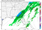
We are headed to Macon, GA where a winter storm warning was just issued. All guidance continues to throw more precip over the area run by run.

IMO that's the area that has the most potential to go boom(or bust). Wouldn't shock me to see areas in or around Macon with upwards of 4-5 inches.
 
I like your map & Allan’s, my first map is likely too pessimistic overall, though I still like the general area I highlighted yesterday NW of the Triangle.

I think the Triad area and folks NW of I-85 are setup pretty well to get a coating or so of snow out of this, maybe a few folks get lucky and find an inch or so. I would like to see what this evening’s obs and models look like before putting something else out there.
Just gotta hope we reel this one in. Hoping for at least a little snow if not a decent amount.
 
Just imagining life if the cold would make it over the mountains with no trouble 🤦‍♂️ Hopefully with more storm chances we get established cold ir more of a north press. That would dramatically alter things.
 
Back
Top