-
Hello, please take a minute to check out our awesome content, contributed by the wonderful members of our community. We hope you'll add your own thoughts and opinions by making a free account!
You are using an out of date browser. It may not display this or other websites correctly.
You should upgrade or use an alternative browser.
You should upgrade or use an alternative browser.
Misc General Banter Thread
- Thread starter Rain Cold
- Start date
LukeBarrette
im north of 90% of people on here so yeah
Meteorology Student
Member
2024 Supporter
2017-2023 Supporter
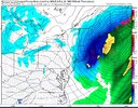
my gut is screaming too early, too early. thank goodness its just the gfs, a bad weather model
Bigedd09
Member
Yeah this is trending too far northwest too fast. As Webber said it’ll continue to do so.
Sent from my iPhone using Tapatalk
Sent from my iPhone using Tapatalk
hate it.
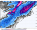
We cooking from Birmingham to Beaufort to Brooklyn to Boston, everybody eats this year.View attachment 183299
New England gets smoked! Hopefully they will shut up on twitter now
This feels like when your team scores a go-ahead touchdown with 1:30 left and your defense has been leaky all game
james, you and i both know the gfs is gonna do whatever it wants. let's let the euro speakGood luck trying to stop it now. That was a violent tug NW. Hope y’all are happy with yourselves
WolfpackHomer91
Member
Its ok.... Its been awhile since an actual qpf monster was here and not some positively tilted slider garbage....but remember even if we get too far NW theres always a slight windshield wiper effect and somewhere in the middle is the truth. RELAX everyone from N AL to Carolina coastlines... lets enjoy the next few weeks as the party is just beggining
Bigedd09
Member
Canadian is a swing and miss
Sent from my iPhone using Tapatalk
Sent from my iPhone using Tapatalk
the ukmet and euro, those are the two to watch for a substantial shift nw like that. scary stuff, honestly
i expect the gefs, some members at least, to have a foot in places though
i expect the gefs, some members at least, to have a foot in places though
Sigh I’m not getting any work done today am I
ChattaVOL
Member
View attachment 183293
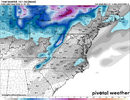
Create a snowstorm that benefits almost the entire SouthernWx forum...
GFS: COMING RIGHT UP
Painful for Chattanooga
Sent from my iPhone using Tapatalk
Work is slow for me today luckily lol. Loving the trends!Sigh I’m not getting any work done today am I
BrickTamland
Member
GFS was amazing. Just goes to show we never know until til we get to at least 5 days out. I think this could be a case of the GFS showing this storm in the long range, losing it, and then coming back again once we get inside 5 days. Would love to see the Euro jump on board. Still cautious since this would be the GFS leading the way instead of the Euro.
I'm cooked alreadyooooof what a jump. View attachment 183289
WolfpackHomer91
Member
Tim is on board … that’s a good sign he’s not a weenie atleast professionally
Sent from my iPhone using Tapatalk
Sent from my iPhone using Tapatalk
BrickTamland
Member
Like the Panthers going to a prevent defense on the Chargers' last drive when they had the lead.This feels like when your team scores a go-ahead touchdown with 1:30 left and your defense has been leaky all game
- Joined
- Jan 23, 2021
- Messages
- 4,602
- Reaction score
- 15,197
- Location
- Lebanon Township, Durham County NC
That UK slander from that one dude is one of the most out of pocket takes i've ever seen on here and thats saying somethingYep if we get the euro to continue that same trend the UKIE is this winters King imo....that model some ignore...lol
- Joined
- Jan 2, 2017
- Messages
- 1,566
- Reaction score
- 4,279
You have to shovel all your snow and bring to my yard! Never gave up on this one...too many of the right ingredients. Still may go poof but too much consensus on a more westerly and south wave with incoming cold! No overly strong block to suppress or stout SER to rain.I’m scared
- Joined
- Jan 2, 2017
- Messages
- 1,566
- Reaction score
- 4,279
Ha yes that one set me back...was hoping he was just joking but he was dead seriousThat UK slander from that one dude is one of the most out of pocket takes i've ever seen on here and thats saying something
please stop the count. please.
glad the ukmet does not make a major shift; more positive longer and east with moisture vs previous run if anything
BrickTamland
Member
My local forecast has smow showers Saturday but the GFS had the system coming through Sunday. Has it slowed down on the GFS or is the local forecast just wrong?
Bigedd09
Member
Wild how much. Disagreement there is under 100 hours
Sent from my iPhone using Tapatalk
Sent from my iPhone using Tapatalk
BrickTamland
Member
Wonder if we're in the waffling back and forth phase with the models now.
thats why you use ensembles here, not operational runs verbatim
- Joined
- Jan 23, 2021
- Messages
- 4,602
- Reaction score
- 15,197
- Location
- Lebanon Township, Durham County NC
fundamentalsthats why you use ensembles here, not operational runs verbatim
That's behind the frontal passage on Saturday.My local forecast has smow showers Saturday but the GFS had the system coming through Sunday. Has it slowed down on the GFS or is the local forecast just wrong?
Bigedd09
Member
Does the ukie have ensembles
Sent from my iPhone using Tapatalk
Sent from my iPhone using Tapatalk
Us Foothills and Mtn peeps are sitting pretty atm. I know everyone wants snow but the I-40 corridor in WNC hasn't had a warning level event since Jan 2022.
We're getting under 5 days now, so operationals are important. And, something like half of the GEFS panels have a significant SE snowstorm.thats why you use ensembles here, not operational runs verbatim
That said, we'll all feel better if and when the rest of the modeling is onboard, and ensembles are in lock step. Another 24 hours and we should have a good idea of what's going to unfold.
Yes. I'm too cheap to see them.Does the ukie have ensembles
Sent from my iPhone using Tapatalk
Yeh man, even here in Central SC it would absolutely suck to sit in a cold rain. But it would be awesome also for y’all to reel one in. The upstate into Piedmont into Western NC are due for a big one.Us foothills and Mtn peeps are sitting pretty atm. I know everyone wants snow but the I-40 corridor in the WNC hasn't had a warning level event since Jan 2022.
packfan98
Moderator
FYI, we will start a storm thread after the 12z runs have finished. Just in time for Happy Hour!
I think the GFS would be the best case scenario for almost everyone here. I know you'll be riding a fine line either way. Fun tracking regardless of the outcome.Yeh man, even here in Central SC it would absolutely suck to sit in a cold rain. But it would be awesome also for y’all to reel one in. The upstate into Piedmont into Western NC are due for a big one.


