-
Hello, please take a minute to check out our awesome content, contributed by the wonderful members of our community. We hope you'll add your own thoughts and opinions by making a free account!
You are using an out of date browser. It may not display this or other websites correctly.
You should upgrade or use an alternative browser.
You should upgrade or use an alternative browser.
Pattern January Joke
- Thread starter SD
- Start date
iwantsouthernsnow123
Member
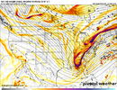
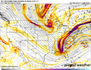
It tilts neutral rather quick then negative. It's always going to start positive that's just how phasing worksIf only it weren't so positively tilted..
trackersacker
Member
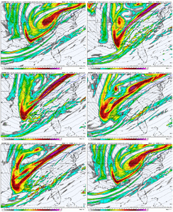
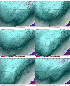
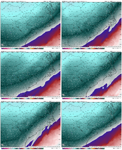
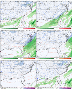
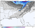
Nice to know StormVista has their act together with surface output
Not quick enough for western sectionsIt tilts neutral rather quick then negative. It's always going to start positive that's just how phasing works
NBAcentel
Member
Thing thing is a few ticks away from a big dawg. Not even scraping at the pot anymore. We are scraping for a +13000 sports betting ticket that’s relying on the last leg, on 4 more assists from lamelo ball, at halftime pending 2 quarters
iwantsouthernsnow123
Member
No this is a good trend for Western sections. Primarily because you don't want to trend too amped too soon otherwise you'll get ridged out. Perfect placement right now imoNot quick enough for western sections
I am afraid this isn’t going to work for the Alabama people or anyone west of the appsNo this is a good trend for Western sections. Primarily because you don't want to trend too amped too soon otherwise you'll get ridged out. Perfect placement right now imo
NBAcentel
Member
Keep tilting and moving that energy SW for now. We can worry about those consequences later. Plenty of time for the precip shield to expand later. Starting to look like less of a primary coastal setup after those 00z runs which is good for western sections (for now). Keep this up and the warm nose is going to be our next worry/topic of interest
iwantsouthernsnow123
Member
Possibly not, but it feels like almost every event recently has been the opposite we just can't get anything east of the mountains. Hopefully this changes itI am afraid this isn’t going to work for the Alabama people or anyone west of the apps
Only hopes for these sections is going to be that 3rd system that the GFS has been showing.I am afraid this isn’t going to work for the Alabama people or anyone west of the apps
Damn! By Thursday I’m gonna worry about WAA for me! How far west can this trend!?Sheet man View attachment 183168
SimeonNC
Member
In your opinion what is the ceiling for this type of event?Thing thing is a few ticks away from a big dawg. Not even scraping at the pot anymore. We are scraping for a +13000 sports betting ticket that’s relying on the last leg, on 4 more assists from lamelo ball, at halftime pending 2 quarters
accu35
Member
There’s plenty of GEFS members that show Alabama getting a pretty good thump of snow. We gonna be fine my friendOnly hopes for these sections is going to be that 3rd system that the GFS has been showing.
Not Northern.There’s plenty of GEFS members that show Alabama getting a pretty good thump of snow. We gonna be fine my friend
NBAcentel
Member
0-10”In your opinion what is the ceiling for this type of event?
SimeonNC
Member
It's nice to see the Western Piedmont in the deep cold 700/850s, gives us a lot a wiggle room for NW trends without the warm nose becoming an issue.Starting to see the warm air advection at 850-700mb show up as this thing slows. That by itself typically pushes up Nw zones some View attachment 183172View attachment 183173
Though personally I'd take a classic snow-to-mix NC storm at this point.
Considering there’s still 4.5 days to go, I’d be surprised based on a combo of climo that says that snow in the deep SE is pretty rare and model biases/trends when no -NAO if the common NW trend doesn’t take my and other deep SE areas out of snow within a few runs. But you never know, which makes these discussions so fascinating.
But not yet!
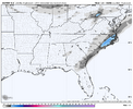
Love these old school Stormvista maps coming out early. Thanks Grit!
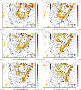
Here is the Euro run...I gotta think there are limitations on how far NW this can go. This is all northern stream, moving at a steady pace (not slow). We're not looking at some big stream phasing situation. The wave would need to slow down and really consolidate a lot of vorticity in the base of the trough, and tilt positive to neutral to negative fairly quickly. Think something like the UKMet is possible, but not thinking this can go wildly NW. No one knows at this juncture, but I think the weaker coastal scraper is just as likely as something well inland

accu35
Member
Starting tomorrow we should be getting into the short range models for the weekend storm. Let’s hope these trends can continue and increase our chances. Goodnight fam
Tsappfrog20
Member
Some great trends tonight let’s see if we can keep them coming! Night shift my time is up 7am comes early!
Sent from my iPhone using Tapatalk
Sent from my iPhone using Tapatalk
CNCsnwfan1210
Member
Not a bad set of members, do you have the EPS mean for the SE?
Sent from my iPhone using Tapatalk
Counting 23 or so with the signal. Definitely the highest yet.
CNCsnwfan1210
Member
Nothing crazy but it was a slight improvement
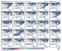
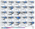
View attachment 183186
Thanks, yeah it was skewed slightly by some of the heavier members, but the footprint still looks good. We’re starting to get in the wheelhouse of the Euro/UKMET, so it will be interesting to see how things play out with this setup.
Sent from my iPhone using Tapatalk
NorthHillsWx
Member
Per GEFS and EPS, I’d say east of I-85 is solidly in the game Sunday. I really like where the triangle sits at this stage. There is still wiggle room for central NC so we won’t be relying on heavy north or south trends. Still 5 days out but seeing the ensembles cooking what the ops put out hasn’t happened with any storms yet this year especially inside day 5. Plenty of time for unhappy trends but man what a pretty overnight suite of model runs
CNCsnwfan1210
Member

WPC official discussion from 1:52 am for the weekend system
Sent from my iPhone using Tapatalk
CNCsnwfan1210
Member

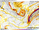
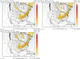
6z icon making better adjustments at H5
Sent from my iPhone using Tapatalk
CNCsnwfan1210
Member

6z icon making better adjustments at H5
Sent from my iPhone using Tapatalk
Nothing at all hardly at the surface, but H5 is getting better FWIW.
Sent from my iPhone using Tapatalk
NCWeatherNow
Member
J1C1111
Member
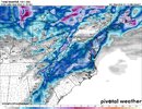
We need all the moisture as far back west as we can get it right nowUKMET really buying into the idea of a NW trend.
Might be too aggressive.View attachment 183188
View attachment 183189
CNCsnwfan1210
Member

6z GFS is sharper/little quicker with the trough than 00z
Sent from my iPhone using Tapatalk

