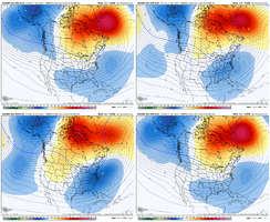
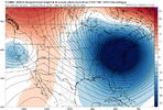
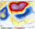
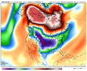
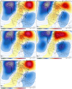
Yeah, when I mean suppressed storm track, that’s great to see - just somewhere / anywhere across the south and not cutting north and warmHonestly gotta like what it did generally speaking. Lot of cold air and energy flying around second week of January. Big things can happen.
-
Hello, please take a minute to check out our awesome content, contributed by the wonderful members of our community. We hope you'll add your own thoughts and opinions by making a free account!
You are using an out of date browser. It may not display this or other websites correctly.
You should upgrade or use an alternative browser.
You should upgrade or use an alternative browser.
Pattern January Joke
- Thread starter SD
- Start date
NBAcentel
Member
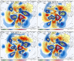
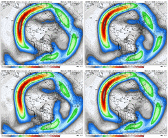
Looks like the EPS is following the same rabbit trail. Quicker western ridge so far this run. Looks like the jet extension is trending more equatorward, allowing a quicker progressionYeah, when I mean suppressed storm track, that’s great to see - just somewhere / anywhere across the south and not cutting north and warm
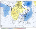
John1122
Member
Phase one, kill the Aleutian Ridge, Phase two, shut down the vortex in the Gulf of Alaska that other models show flooding Pac air into the NA continent. Phase III, hope the Gulf Coast getting two big snow events in a 12-month period is impossible.
NBAcentel
Member
NBAcentel
Member
accu35
Member
Wow!! What an awesome Euro run. Cold air in place for a long period of time. We are most likely gonna see something big in the near future storm wise. Get some rest, because night shift will start soon
Brent
Member
71 degrees at 3am in the morning 4 days before January haha
This heat wave is going out on an epic note here
Temps will be crashing after lunch
This heat wave is going out on an epic note here
Temps will be crashing after lunch
tennessee storm
Member
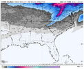
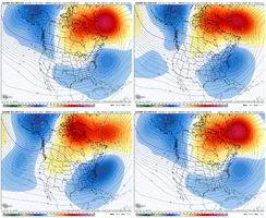
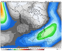
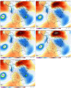
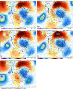
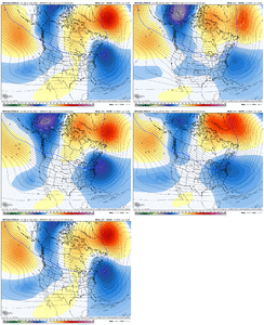
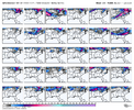
Get ready for the cool to corker rains … precio may not be the issueMain takeaways from this EPS run is it continues to show an active pattern with an active southern stream, and it continues to head the right direction. View attachment 180182View attachment 180184View attachment 180185
packfan98
Moderator
trackersacker
Member
Corker rains?Get ready for the cool to corker rains … precio may not be the issue
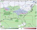
Member 27 is, but there are a couple members showing it also but not as aggressive as ole beautiful 27.6z GEFS is showing a signal on 1/8. Not sure if there’s one or two members the mean.
View attachment 180186
View attachment 180187
CNCsnwfan1210
Member

This a general idea that the south stands a decent chance of snow/winter weather down the road. With a one inch snow mean over the upper SE, the signal isn’t bad. IMO the way the upper air is setting up especially around the 10 and thereafter, miller A coastal low/southern slider comes to mind with the STJ becoming active and the mslp anomaly along the southern US/gulf/SE coast as mentioned by others with the overnight guidance. I think there will be interesting times ahead.
Sent from my iPhone using Tapatalk
CNCsnwfan1210
Member
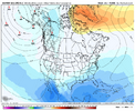
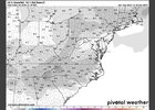
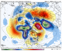
Euro did go crazy last night. sheeshView attachment 180193
That was a cold run for sure later on, and the back half of that run more or less lined up with the EPS.
Sent from my iPhone using Tapatalk
Really need some hopium tonight. This thread’s on life support. I’ll do what I can by turning on the magical Jack Frost movie.
wouldn’t this be too cold? Like suppression cold?Euro did go crazy last night. sheeshView attachment 180193
Just out of curiosity, why do you keep saying this thread is on life support?Really need some hopium tonight. This thread’s on life support. I’ll do what I can by turning on the magical Jack Frost movie.
wouldn’t this be too cold? Like suppression cold?
I was joking because it was so quiet. Except about Jack Frost I watched it.Just out of curiosity, why do you keep saying this thread is on life support?
Ok gotcha!I was joking because it was so quiet. Except about Jack Frost I watched it.
It is a suppressed look. But I didn’t think it looked too overly anomolous. We just need some southern stream energy to run in and ride that wheel out. As others have mentioned, the flow will be at a near standstill with the NAO in our favor so Lucy will be forced to hold the football to at least give us a shot at the 65 yard field goal ftwReally need some hopium tonight. This thread’s on life support. I’ll do what I can by turning on the magical Jack Frost movie.
wouldn’t this be too cold? Like suppression cold?
NBAcentel
Member
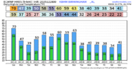
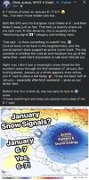
Boyer out of Asheville is complete opposite. Lol I'd rather have a enthusiastic weather man though. Anybody's kids killing them with the 6-7 meme? I'll take the mojo though. Bring it.I can’t take much more View attachment 180197
NBAcentel
Member
CNCsnwfan1210
Member
Nice progression on the 12z AIGFS. Big PT with a +PNA/-NAO and subtropical jet cutting underneath View attachment 180200View attachment 180201
El Niño flavor
Sent from my iPhone using Tapatalk
Tsappfrog20
Member
The wedge is definitely set in in the upstate of SC heavy fog in Spartanburg as I am headed back to Raleigh
Sent from my iPhone using Tapatalk
Sent from my iPhone using Tapatalk
NBAcentel
Member
lexxnchloe
Member
There is much to talk about as we start the New Year. As we close out the month of December, the analog forecasts for temperature and 500MB were quite close to reality. The warmest air was across the West and south central, while the Midwest, Great Lakes and the Northeast were somewhat colder than average (and connected to widespread, extreme cold in much of Canada and Alaska. The storm scenario was a sprawling vortex below the Aleutian Islands and in the Gulf of Alaska. That set-up was very wet for the shoreline of the immediate West Coast and helped to build a humongous, dense snow cover along and north of the International Border. One important detail is the sea ice extent, which now covers Hudson Bay and the Davis Strait. You will recall that in previous mild years the ice formation was very limited. Things are still changing, and may leave the lower 48 states vulnerable to a more serious encounter with cold and snow.
The ENSO 3.4 signature is at a moderate La Nina stage, and probably will not start to warm until mid January. If the central Pacific Ocean starts to warm (unlike now), Kelvin wave penetration will increase and the cooler SST values nearer the Galapagos Islands will start to warm. Ascendant negative neutral character (that is moving toward a weak El Nino designation in winter is very favorable for major frozen precipitation events when baroclinicity is well defined. The familiar "Southeast Ridge" has been weaker than forecast and may assume a more Bermuda High position and strength during the middle of next month. So after what should be a cold exit from 2025 to the first week of 2026 (replete with a winter storm east of the Rocky Mountains), we could see a viable candidate for a "January Thaw" followed by a snow and ice debacle that leads into a rather cold, and active, February 2026.
But I urge diligence and caution in the 11-15 and 16-20 day range simply because many folks seem hell-bent of following only the weather forecast models (which were often too variable if not wildly inaccurate) and the various climatic indices in alerting the public and business world about temperature and snow/ice threats. I state my fond axiom about Prediction: it is not a bingo game! Just because someone tells you that the MJO is in Phase 8 does not mean that a) this will happen, or b) Philly can expect abundant snowfall. Simply check out systems on satellite imagery of the temperature and precipitation array and look at its progress toward and through the USA. The best outlooks come about from climatology + persistence + model examination.
It takes much more time, but will feel better for it. And do not get me started about QBO and SSW!
Prepared by Meteorologist LARRY COSGROVE on
Saturday, December 27, 2025 at 10:35 P.M. CT
Ron Burgundy
Member
PT?Nice progression on the 12z AIGFS. Big PT with a +PNA/-NAO and subtropical jet cutting underneath View attachment 180200View attachment 180201
NBAcentel
Member
Pac trough
Stormlover
Member
That was 0Z from Saturday, today is much different
This a general idea that the south stands a decent chance of snow/winter weather down the road. With a one inch snow mean over the upper SE, the signal isn’t bad. IMO the way the upper air is setting up especially around the 10 and thereafter, miller A coastal low/southern slider comes to mind with the STJ becoming active and the mslp anomaly along the southern US/gulf/SE coast as mentioned by others with the overnight guidance. I think there will be interesting times ahead.
Sent from my iPhone using Tapatalk
Throwing a penalty flag here because I would have never ascribed PT to “pacific trough”. Ah yes the subtropical jet is seeing a Physical TherapistPac trough
CNCsnwfan1210
Member
That was 0Z from Saturday, today is much different
Yeah this was the extended run or EC 46 day, not the regular daily EPS.
Sent from my iPhone using Tapatalk
NBAcentel
Member
rburrel2
Member
I’ve always thought the our side of the world cold pool/hudson bay vortex/cold Canada pattern was overrated.
When the cold is on the other side of the globe and we get a torchy Canada, but the coldest anomalies over our area with a suppressed storm track, we can win big time.
That sorta looks like what we’re might get for mid-January.

When the cold is on the other side of the globe and we get a torchy Canada, but the coldest anomalies over our area with a suppressed storm track, we can win big time.
That sorta looks like what we’re might get for mid-January.

Yes!I’ve always thought the our side of the world cold pool/hudson bay vortex/cold Canada pattern was overrated.
When the cold is on the other side of the globe and we get a torchy Canada, but the coldest anomalies over our area with a suppressed storm track, we can win big time.
That sorta looks like what we’re might get for mid-January.
View attachment 180210
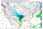
Some Mets are joining the Wuff party
Sent from my iPhone using Tapatalk
Sent from my iPhone using Tapatalk

