BHS1975
Member
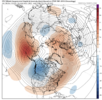
Need that vort over AK to move west over the Aleutians.Its been cooking for a while nowView attachment 178671
Need that vort over AK to move west over the Aleutians.Its been cooking for a while nowView attachment 178671
It is unreal to me that we’ve had this pattern configuration and I’ve only seen scarcely a half inch from itIts been cooking for a while nowView attachment 178671
That big vortex over AK has been the killer. Nothing has dug in. I don’t remember the last bowling ball ULL we’ve hadIt is unreal to me that we’ve had this pattern configuration and I’ve only seen scarcely a half inch from it
That’s a fair assessment, we’ve been cold ( statistically) longer than normal and we should have figured it to end with a warm phase. I’m still optimistic but it’s not looking good for the rest of Dec into early Jan! Expectation is low considering the past 3 years!I don't see any meteorological reason that the pattern is going to get stuck in suck mode for the rest of the winter. If we were in a raging NIna, then maybe. But we're not. We don't know what tropical forcing or mountain torque or angular momentum or the stratosphere or the Pacific jet is going to do the entire rest of the winter, particularly when there's no really dominant pattern driver.
I'm certainly not going to sit here and seriously pretend that it's going to be wall to wall cold. It won't be. And maybe, finally, after a month, the models are going to be right in the LR and break it all down. Fine. Might happen. They're eventually going to be right. It's a game of runs. And the cold will come back. I just think it would be better to let the cold pattern actually break down before spending too much energy worrying about when it will come back after a future warm-up might maybe set in 7-10 days out from now.
Snow is a different story. That takes a lot more luck for most of us. And we usually only get a 5 day or less lead for that.

How long have you lived in Huntersville??Tough pattern setting up. Ad I said and got trashed for, We really needed to cash in when we had the chance but most of us didn’t. I see we’re already punting January. February hasn’t been kind to us in 10 years. Just tough to see. Pattern looks brutal and long lasting. Maybe we can get lucky a couple times during peak climo in January. I personally have no faith in February.
Sent from my iPhone using Tapatalk
Since 2002. It was great until about 2016 or so. Been a spring month since.How long have you lived in Huntersville??
Feburary has delivered some of our area's best snow storms. My gut feeling having watched these models and the imput from others is that we'll have this slight warm up for a week or so, but we just seem to be in a cold pattern this year. For some reason I have a strong feeling (hopeium) we're going to score this season. Can't say I've ever seen a blockbuster storm in December. Always been January/February in my life

December 2017 and March 1993 are the best snowstorms I’ve ever seen in Georgia ! February has been a joke in the last 10 years.How long have you lived in Huntersville??
Feburary has delivered some of our area's best snow storms. My gut feeling having watched these models and the imput from others is that we'll have this slight warm up for a week or so, but we just seem to be in a cold pattern this year. For some reason I have a strong feeling (hopeium) we're going to score this season. Can't say I've ever seen a blockbuster storm in December. Always been January/February in my life
Hell yeah Webber bring it lol
Freezing fog/ice fog observations across the Florida Panhandle this morning. The NWS Mobile WFO issued a freezing fog advisory right along the FL/AL border. This is the first time EVER that an NWS WFO that services Florida has issued a freezing fog advisory.
Edit: NWS Tallahassee now issued a freezing fog advisory for Jackson County in FL, the first time any Florida county has been under such an advisory

The last frame (day 16) on the 6z GFS looks good to me. Not perfect, but a setup like this, would push the cold southeastward. I would hate to lose Christmas (to warmth) but a turn to cold by New Years would be good.
View attachment 178683
13 days in a row not reaching 50 degrees. Have my doubts today as clouds are thick and we are stuck on 36 degrees. SW wind is suppose to gust 30-40 mph this afternoon. So it may touch 50 for an hour at best. we shall see.Highs from GSO- getting this from NWS NOWData website
Nov.26-30
70, 49,44,44,42
Dec. 1-10
45,45,47,49,41,40,47,38,36, & 50?
Been a cold 2 weeks here in the triad. Had some snow fall which is always a bonus in December!
Yeah, I saw the CFS. All fantasy at that range (including GFS/euro), but I would rather see cold possibilities than wall to wall warmth. That at least lets me dream.....You would have been better served to scout the CFS if your looking for hope back half of Holliday season. 0z Has some nice winter storms for the SE.
This is the 2nd time the Charleston WFO has issued a freezing fog advisory, the first being February 9, 2022My area, too, had a freezing fog advisory late last night although I doubt that it’s the first time for it here as I find it hard to believe that it to be the case this far north:
309 AM EST WED DEC 10 2025
..PATCHY FREEZING FOG THIS MORNING
AREA OBSERVATIONS, SATELLITE IMAGERY, AND WEB CAMS INDICATE THAT
PATCHY DENSE FOG IS IMPACTING PORTIONS OF SOUTHEAST GEORGIA AND
SOUTHEAST SOUTH CAROLINA EARLY THIS MORNING. MOST OF THE PATCHY
FOG IS SHALLOW, BUT IS PRODUCING VISIBILITIES OF A QUARTER OF A
MILE OR LESS IN ISOLATED AREAS. MUCH OF THE FOG IS FORMING AS
STEAM FOG NEAR WATERWAYS INCLUDING RIVERS, STREAMS, TIDAL CREEKS,
AND MARSHES.
TEMPERATURES ACROSS THE AREA HAVE FALLEN BELOW FREEZING AND INTO THE
UPPER 20S IN MANY LOCATIONS. FREEZING FOG WILL OCCUR, EVEN
PRODUCING LIGHT RIME ICE ON ELEVATED AND EXPOSED SURFACES. WHILE
LOW VISIBILITIES COULD IMPACT TRAVEL, ESPECIALLY WHERE
VISIBILITIES CHANGE SIGNIFICANTLY OVER SHORT DISTANCES, RIME ICE
FROM FREEZING FOG IS NOT EXPECTED TO PRODUCE ANY IMPACT ON TRAVEL
CONDITIONS.
TEMPERATURES WILL RISE ABOVE FREEZING, AND ANY LINGERING FOG WILL
DISSIPATE, BETWEEN 8 AND 9 AM THIS MORNING.
PRECAUTIONARY/PREPAREDNESS ACTIONS...
IF DRIVING, SLOW DOWN AND LEAVE EXTRA DISTANCE AHEAD OF YOU IN
CASE A SUDDEN STOP IS NEEDED.
This is the 2nd time the Charleston WFO has issued a freezing fog advisory, the first being February 9, 2022
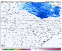
If I was in central Va, I would have some interest in this Friday's clipper. Most models (operational and short range) show accumulations.
12z 3k NAM:
View attachment 178690

