• Hello, please take a minute to check out our awesome content, contributed by the wonderful members of our community. We hope you'll add your own thoughts and opinions by making a free account!

Pattern December Doldrums 2025 🎄 ❄️

Just for future reference isn’t the above photo more of what we actually want for storms than the Barney colors over our area?

We don’t all think the same way. Barney is in itself a good thing for those like me who enjoy cold (SE style) and dry. I like that much better than nasty cold rain (nothing against @Rain Cold lol). I can’t go outside and enjoy cold rain but I can do that for cold and dry.
 
Guys don’t sweat winter just yet. It’s very early still and things will change for the better soon. @Webberweather53 made a good post about our best possible chance of something fun and wild in February, he never said we couldn’t get something to sneak up in between. All the years I been on here since 2017, I learned not to question the
experts on here but to learn. One thing I learned is to go with the flow and stop worrying about every cycle run. Models will have you down and gloomy one day and excited and ready for some fun the next. We don’t know what will exactly play out this winter but being from the south let’s enjoy this ride that Mother Nature brings from severe weather chasing to winter storms, it’s what we live for every day of our inner weenie nerd life.
 
My location hasn't been at or above 50 degrees since November. Warmest we have been this December is 49. We may come close on Dec 11th and again Dec 13. Remarkable and never happened before.
43 was my highest temp since December 1st until today as it’s 46 at the moment. The lows haven’t been anything crazy but the the highs have been way below average.
 
Yeah regardless of how much we warmup this first week of December has been one of the coldest on record here

Even if Christmas is warm(which I mean it's still 15 days who knows) and it's dry til then winter will be back I'm sure... Most of the time it's in January here anyway
Like 90% of the time January and February bring the best snows. I never get worked up in December because it’s just so rare to get more than a dusting here and there. Even when it’s more than flurries it’s still hard to top 1-2 inches. 2010 was the biggest December snow I’ve seen and it was 2 inches on 2 different occasions that month.
 
We don’t all think the same way. Barney is in itself a good thing for those like me who enjoy cold (SE style) and dry. I like that much better than nasty cold rain (nothing against @Rain Cold lol). I can’t go outside and enjoy cold rain but I can do that for cold and dry.
Why in world would anyone want Cold and Dry?? If it can't be snow with Cold then give me 85!
 
Guys don’t sweat winter just yet. It’s very early still and things will change for the better soon. @Webberweather53 made a good post about our best possible chance of something fun and wild in February, he never said we couldn’t get something to sneak up in between. All the years I been on here since 2017, I learned not to question the
experts on here but to learn. One thing I learned is to go with the flow and stop worrying about every cycle run. Models will have you down and gloomy one day and excited and ready for some fun the next. We don’t know what will exactly play out this winter but being from the south let’s enjoy this ride that Mother Nature brings from severe weather chasing to winter storms, it’s what we live for every day of our inner weenie nerd life.
Well yeah cause it's not even Winter yet
 
This doesn't mean anything except that the future is not set. And the models are still bouncing around. Don't forget that, no matter how many reds or blues you see.

View attachment 178650
View attachment 178651
View attachment 178652
Couldn’t have said it better. If anyone wants to understand how the models have been bouncing around, in the last 18 hours the GFS modeled a Christmas Eve snow storm from NC to New England and 6 hours later modeled a strong tropical storm near the SC coast
 
Imho, there’s quite a few things that don’t look quite right this year wrt canonical Nina winter as we get closer to Feb. We have followed the typical script thus far but that could easily change as early as Feb. Oth, we still very well could end up with the result we usually get, but I definitely see how we can buck that this time around

The already eastward advancing warm pool is one of those factors that doesn’t seem right to me. The other is the huge build-up of tropical +AAM which will get fluxed poleward as we see the MJO try to orbit back into the E Hemisphere in January.

I can absolutely see a scenario in late winter/Feb this year where some of this +AAM gets fluxed poleward into the northern extratropics while the MJO is orbiting into the west-central pacific with a slightly eastward shifted warm pool relative to a typical La Niña (the warm pool is already shifted eastward a bit here). Meanwhile, the NAM/AO/NAO probably trend positively thanks to the high solar/east QBO combo.

All of this would be a recipe for +PNA/+TNH/+NAO style Feb. A Feb with wild back-and-forths. One moment 70s-80s, the next it’s absolutely frigid with a chance of snow/ice.
1989 comes to mind here. That February was crazy.
 
No offense man but 40s and dry is the worst.
Your correct, it should be 35 or less from Dec - March imo... I legit have my windows open here at home while in my office, I thrive in cold, Hibernate from April - October. Also a huge fan of it being dark at 5PM daily.... my wife cant ask me to do outside chores then
 
Guys don’t sweat winter just yet. It’s very early still and things will change for the better soon. @Webberweather53 made a good post about our best possible chance of something fun and wild in February, he never said we couldn’t get something to sneak up in between. All the years I been on here since 2017, I learned not to question the
experts on here but to learn. One thing I learned is to go with the flow and stop worrying about every cycle run. Models will have you down and gloomy one day and excited and ready for some fun the next. We don’t know what will exactly play out this winter but being from the south let’s enjoy this ride that Mother Nature brings from severe weather chasing to winter storms, it’s what we live for every day of our inner weenie nerd life.
Good perspective. I like the saying I heard on a weather YT channel that says models are about which one is least wrong, not most right. I too have had my hopes dashed and also overwhelmed when I was at NCSU in 2000 for how ever much snow that was. That was pretty unexpected from what I recall, in a fun way.
 
Your correct, it should be 35 or less from Dec - March imo... I legit have my windows open here at home while in my office, I thrive in cold, Hibernate from April - October. Also a huge fan of it being dark at 5PM daily.... my wife cant ask me to do outside chores then
No it shouldn't it's the south, You're in the Wrong corner of the Globe if that's what you want
 
Tommorow, streak is in jepordy. Be way BN thurs and Fri. Then Sat, like wed, the sw wind will be screaming in 30-40mph gust both days. We miss those 2 days, it would survive atleast through mid late next week.

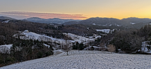
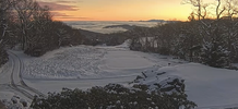
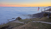
Appreciate GA wx. Also awesome pics NChighcountry. Of course that one of Mt Mitchell today and the valleyy fog, give em a run for the money.

La nina atmospheric river in full swing in NW, Washington state.
 
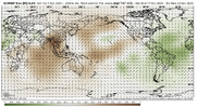
Hard to believe the pattern looks absolute dogwater with a tropical forcing regime like this. But best believe we wouldn’t somehow get a cold pattern with the MJO in the maritime.View attachment 178664
I keep looking every 12 hours, waiting on the models, ens to do their 180. Been the wash rinse repeat cycle. Advertise trough sw , death ridge se. Then suddenly flip as time draws closer. Gonna start getting fidgety by thurs, fri if we dont see some signs, better runs. Until then Im betting the streak.
 
Go back and look in Nov thread. Heres one showing on NOV 23, we was all sweating a Dec torch. Lol, ive had the coldest 1st 10 days of December ever. So theres hope, models are off again. hang tight.

RBR71

Lots of worrying for December when Thanksgiving gonna feel like Thanksgiving, and any black Friday Christmas shopping gonna feel like Christmas. Enjoy a nice cool down later this week. Worry about torches later. Don't let worry steal your joy!
 
I would also say February 2009. A Niña switching to an El Niño that had a decent snow event in Central and NE NC mid month and of course the storm and following cold shot after to start March

Had March 09’ too …. That awesome ULL I got 5-8” from that on a Sunday night


Sent from my iPhone using Tapatalk
 
I keep looking every 12 hours, waiting on the models, ens to do their 180. Been the wash rinse repeat cycle. Advertise trough sw , death ridge se. Then suddenly flip as time draws closer. Gonna start getting fidgety by thurs, fri if we dont see some signs, better runs. Until then Im betting the streak.
We all know deep down it’s not flipping this time. That’s why it’s so quiet in here. Our hope is that it jumbles up everything and we start fresh in January.
 
No it shouldn't it's the south, You're in the Wrong corner of the Globe if that's what you want

Dude trust me …. If it wasn’t for my family I’d be out of here tomorrow. I’d be in South Buffalo or Toronto or something. I like the environment up north but fit in with “Southern” rooted viewpoints


Sent from my iPhone using Tapatalk
 
We don’t all think the same way. Barney is in itself a good thing for those like me who enjoy cold (SE style) and dry. I like that much better than nasty cold rain (nothing against @Rain Cold lol). I can’t go outside and enjoy cold rain but I can do that for cold and dry.
Larry, I hope with the west pacific(pdo) significantly warming up, that will be a game changer for colder than we think moving forward🙂
 
Not trying to be a a downer here, but I am not very confident in us switching colder on modeling this go around, the troughing over AK that’s being forecasted is just continuously being force fed by the extending jet, and if we retract, the location of that trough won’t move any, it’s kind of a lose/lose situation. If I was a betting man, I’d honestly think our next string or favorable looks with storm pot is Feb/Mar, the MJO will probably return to the Indian Ocean/maritime continent in Jan and linger there, we probably have another favorable orbit in Feb, along with shortening wavelengths. Mot to say nothing could show up in Jan though, especially with how much potential momentum that could be force fed into the pacific jet. But anyways even if we did switch colder on modeling, it would likely be the same old fast flow/shallow western ridge stuff as we’ve seen with clippers. The monster -WPO is actually hurting us here with continuously chopping into the western ridge, given the flow under it wants to go back, but the jet is extending, which is what’s resulting in the -WPO ridge itself, and it’s interacting with the AK vortex just creating a stuck/bland persistent situation
 
Not trying to be a a downer here, but I am not very confident in us switching colder on modeling this go around, the troughing over AK that’s being forecasted is just continuously being force fed by the extending jet, and if we retract, the location of that trough won’t move any, it’s kind of a lose/lose situation. If I was a betting man, I’d honestly think our next string or favorable looks with storm pot is Feb/Mar, the MJO will probably return to the Indian Ocean/maritime continent in Jan and linger there, we probably have another favorable orbit in Feb, along with shortening wavelengths. Mot to say nothing could show up in Jan though, especially with how much potential momentum that could be force fed into the pacific jet. But anyways even if we did switch colder on modeling, it would likely be the same old fast flow/shallow western ridge stuff as we’ve seen with clippers. The monster -WPO is actually hurting us here with continuously chopping into the western ridge, given the flow under it wants to go back, but the jet is extending, which is what’s resulting in the -WPO ridge itself, and it’s interacting with the AK vortex just creating a stuck/bland persistent situation
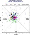
Myfro, I hope we get what we need to get to get the pattern more favorable for cold and winter weather moving forward. For now, I'm intrigued in the pdo rising from where it's been
 
Not trying to be a a downer here, but I am not very confident in us switching colder on modeling this go around, the troughing over AK that’s being forecasted is just continuously being force fed by the extending jet, and if we retract, the location of that trough won’t move any, it’s kind of a lose/lose situation. If I was a betting man, I’d honestly think our next string or favorable looks with storm pot is Feb/Mar, the MJO will probably return to the Indian Ocean/maritime continent in Jan and linger there, we probably have another favorable orbit in Feb, along with shortening wavelengths. Mot to say nothing could show up in Jan though, especially with how much potential momentum that could be force fed into the pacific jet. But anyways even if we did switch colder on modeling, it would likely be the same old fast flow/shallow western ridge stuff as we’ve seen with clippers. The monster -WPO is actually hurting us here with continuously chopping into the western ridge, given the flow under it wants to go back, but the jet is extending, which is what’s resulting in the -WPO ridge itself, and it’s interacting with the AK vortex just creating a stuck/bland persistent situation
I don't see any meteorological reason that the pattern is going to get stuck in suck mode for the rest of the winter. If we were in a raging NIna, then maybe. But we're not. We don't know what tropical forcing or mountain torque or angular momentum or the stratosphere or the Pacific jet is going to do the entire rest of the winter, particularly when there's no really dominant pattern driver.

I'm certainly not going to sit here and seriously pretend that it's going to be wall to wall cold. It won't be. And maybe, finally, after a month, the models are going to be right in the LR and break it all down. Fine. Might happen. They're eventually going to be right. It's a game of runs. And the cold will come back. I just think it would be better to let the cold pattern actually break down before spending too much energy worrying about when it will come back after a future warm-up might maybe set in 7-10 days out from now.

Snow is a different story. That takes a lot more luck for most of us. And we usually only get a 5 day or less lead for that.
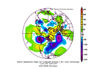
Its been cooking for a while nowcompday.Ei3EmJUyVq (1).gif
 
I don't see any meteorological reason that the pattern is going to get stuck in suck mode for the rest of the winter. If we were in a raging NIna, then maybe. But we're not. We don't know what tropical forcing or mountain torque or angular momentum or the stratosphere or the Pacific jet is going to do the entire rest of the winter, particularly when there's no really dominant pattern driver.

I'm certainly not going to sit here and seriously pretend that it's going to be wall to wall cold. It won't be. And maybe, finally, after a month, the models are going to be right in the LR and break it all down. Fine. Might happen. They're eventually going to be right. It's a game of runs. And the cold will come back. I just think it would be better to let the cold pattern actually break down before spending too much energy worrying about when it will come back after a future warm-up might maybe set in 7-10 days out from now.

Snow is a different story. That takes a lot more luck for most of us. And we usually only get a 5 day or less lead for that.
I agree completely. The fact is that the LaNina has quickly broken down to the point that the rules for typical Niña don’t really apply. Also if you look at even the warmest of model runs, one thing stays constant and that is a cold Canada with snowpack continuing to build. This is a big difference from a lot of winters of late when we’ve seen Canada get flooded with Pacific air
 
Not trying to be a a downer here, but I am not very confident in us switching colder on modeling this go around, the troughing over AK that’s being forecasted is just continuously being force fed by the extending jet, and if we retract, the location of that trough won’t move any, it’s kind of a lose/lose situation. If I was a betting man, I’d honestly think our next string or favorable looks with storm pot is Feb/Mar, the MJO will probably return to the Indian Ocean/maritime continent in Jan and linger there, we probably have another favorable orbit in Feb, along with shortening wavelengths. Mot to say nothing could show up in Jan though, especially with how much potential momentum that could be force fed into the pacific jet. But anyways even if we did switch colder on modeling, it would likely be the same old fast flow/shallow western ridge stuff as we’ve seen with clippers. The monster -WPO is actually hurting us here with continuously chopping into the western ridge, given the flow under it wants to go back, but the jet is extending, which is what’s resulting in the -WPO ridge itself, and it’s interacting with the AK vortex just creating a stuck/bland persistent situation
So Virginia will get more snow then shake my head….

(guys did I do that right?)
 
Back
Top