-
Hello, please take a minute to check out our awesome content, contributed by the wonderful members of our community. We hope you'll add your own thoughts and opinions by making a free account!
You are using an out of date browser. It may not display this or other websites correctly.
You should upgrade or use an alternative browser.
You should upgrade or use an alternative browser.
Pattern December Doldrums 2025 🎄 ❄️
- Thread starter SD
- Start date
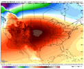
There won't be a hurricane, but I bet it will be colder than the current map is showing for Christmas.Oh but it was lol. Referring to that Christmas hurricane post.
Seasonal cold is a lot different than normal cold in sight.Only seasonable cold really. I don’t see anything but 50s and 60s for highs the next 2 weeks in much of Georgia. Lows in the 30s and 40s. Pretty normal December weather.
At least Canada will be loaded with cold air so that when the worm turns, it will turn quickly. If it needs turning at all...we will see.Got a dusting at the house last night....was nice to see some flakes fly.
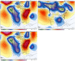
But...this looks fun too. Ho ho ho
View attachment 178629
yeah...would think we get another shot in January. But Feb has been brutal the past few years and nina Feb.At least Canada will be loaded with cold air so that when the worm turns, it will turn quickly. If it needs turning at all...we will see.
SnowNiner
Member
At least Canada will be loaded with cold air so that when the worm turns, it will turn quickly. If it needs turning at all...we will see.
Yeah the basis for the cold looks like it's still there. Big ridging north of Alaska -WPO I think, with Scandinavian ridging touching, pushing the PV down on our side of the globe (coldest air on the hemisphere in AK). The pacific jet looks like it retracts a bit and keeps troughing Alaska ruining everything. That thing somehow needs to go, +EAMT, +TNH, PDO, something. We desperately need to shake the pacific and ridge Alaska.
But to your point if that one thing changes, we change the whole system.
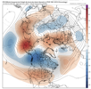
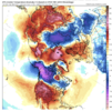
Something has changed.yeah...would think we get another shot in January. But Feb has been brutal the past few years and nina Feb.
BTW, you know it must be gloomy when all the heavy hitters are asleep and Rain Cold is holding down the fort.
But be of good cheer and wax the sleds. Christmas is coming, and the orange maps will turn blue, soon enough.
wow
Member
The big one is coming this season. Imagine if all the global models ran every hour. You'd get absolutely nothing done!
Webberweather53
Meteorologist
yeah...would think we get another shot in January. But Feb has been brutal the past few years and nina Feb.
With how the seasonal and S2S states seem to be shaking out, I wouldn’t be totally surprised if January and February swap places this year, with January being the warmer month and February being cold or not as warm vs normal.
I think this winter may have a few tricks up its sleeves with how quickly we are advancing towards El Niño conditions. A warm Feb seems far from a slam dunk this year imho (tho possible).
We won’t get to El Niño obviously by late winter but I think we will be somewhere between a modoki El Niño and classic La Niña state, which normally favors +TNH/+NAO late winter (Feb 2014 for ex)
Webberweather53
Meteorologist
If the warm pool advances any further east than where it is now, we could have a more interesting late winter than your typical La Niña.
The center of the warm pool is around 150-160E already, usually very favorable to +TNH. Even a subtle 10 ish degree eastward shift from here could easily be enough to extend the pacific jet in the means and favor a +PNA/+TNH style Feb.
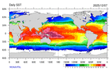
The center of the warm pool is around 150-160E already, usually very favorable to +TNH. Even a subtle 10 ish degree eastward shift from here could easily be enough to extend the pacific jet in the means and favor a +PNA/+TNH style Feb.

Webberweather53
Meteorologist
To make a +TNH/+PNA happen, you need the edge of the warm pool/29-30C SSTs to extend to about to the dateline with the center of the warm pool around 160E. It’s almost there now & another MJO event would certainly do the trick
Beech reporting 8” fresh snow! Bang!
rburrel2
Member
ducketta27
Member
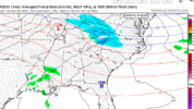
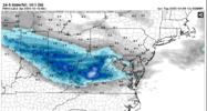
Been seeing this a couple days now, has been oddly consistent with bullseye likely West Virginia as showing on other models. Quick clipper
CNCsnwfan1210
Member
Imagine that, another system/clipper to track for VA/Northern NC before the warm up.
View attachment 178636

6z Euro wasn’t too far off
Sent from my iPhone using Tapatalk
Bigedd09
Member
Imagine that, another system/clipper to track for VA/Northern NC before the warm up.
View attachment 178636
My mental well being can’t handle another one of these lol
Sent from my iPhone using Tapatalk
That Friday clipper has gradually ticked South for Friday.
Bigedd09
Member
That Friday clipper has gradually ticked South for Friday.
This is the stage where models tick south just to go back north in the end
Sent from my iPhone using Tapatalk
oh wow...that would be welcome news!With how the seasonal and S2S states seem to be shaking out, I wouldn’t be totally surprised if January and February swap places this year, with January being the warmer month and February being cold or not as warm vs normal.
I think this winter may have a few tricks up its sleeves with how quickly we are advancing towards El Niño conditions. A warm Feb seems far from a slam dunk this year imho (tho possible).
We won’t get to El Niño obviously by late winter but I think we will be somewhere between a modoki El Niño and classic La Niña state, which normally favors +TNH/+NAO late winter (Feb 2014 for ex)
WolfpackHomer91
Member
Clipper looks to evaporate over WV mountains nothing really of note atleast for it pn 12Z
trackersacker
Member
As much as I miss snowy Februarys, if I have to choose I’m picking January. Better climo, better sun angle, and it’s more aligned with my winter outlook. Guess we’ll see.
Webberweather53
Meteorologist
oh wow...that would be welcome news!
Imho, there’s quite a few things that don’t look quite right this year wrt canonical Nina winter as we get closer to Feb. We have followed the typical script thus far but that could easily change as early as Feb. Oth, we still very well could end up with the result we usually get, but I definitely see how we can buck that this time around
The already eastward advancing warm pool is one of those factors that doesn’t seem right to me. The other is the huge build-up of tropical +AAM which will get fluxed poleward as we see the MJO try to orbit back into the E Hemisphere in January.
I can absolutely see a scenario in late winter/Feb this year where some of this +AAM gets fluxed poleward into the northern extratropics while the MJO is orbiting into the west-central pacific with a slightly eastward shifted warm pool relative to a typical La Niña (the warm pool is already shifted eastward a bit here). Meanwhile, the NAM/AO/NAO probably trend positively thanks to the high solar/east QBO combo.
All of this would be a recipe for +PNA/+TNH/+NAO style Feb. A Feb with wild back-and-forths. One moment 70s-80s, the next it’s absolutely frigid with a chance of snow/ice.
Webberweather53
Meteorologist
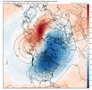
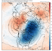
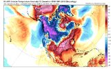
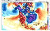
This is OLR anomaly & JRA-3Q precip difference between more positive/less negative PNA and more negative PNA -ENSO Februarys.
The key to getting a colder Feb this year is to nudge the warm pool slightly eastward and getting the convective heating anomalies centered out to ~160E in the Equatorial Pacific
Call me crazy, but the current Indo-Pacific Warm Pool could support something like that already with the highest mean SSTs centered over 160E
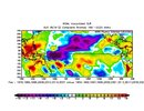
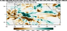


What’s the key to getting a cold JanuaryThis is OLR anomaly & JRA-3Q precip difference between more positive/less negative PNA and more negative PNA -ENSO Februarys.
The key to getting a colder Feb this year is to nudge the warm pool slightly eastward and getting the convective heating anomalies centered out to ~160E in the Equatorial Pacific
Call me crazy, but the current Indo-Pacific Warm Pool could support something like that already with the highest mean SSTs centered over 160E
View attachment 178639
View attachment 178640
View attachment 178641
Webberweather53
Meteorologist
What’s the key to getting a cold January
I don’t think the MJO is lined up right this year
SnowNiner
Member
yeah...would think we get another shot in January. But Feb has been brutal the past few years and nina Feb.
I'm not giving up on December yet, but January is still our best hope IMO. No matter the enso, Februarys like you said have been literally spring in mby. A couple years ago all the teleconnections, forcing, weeklies, everything showed mid Feb to March cold and snowy, but nope it torched. I'd have to see it to believe it at this point. Maybe early Feb, but mid and late February may as well be mid March in my mind.
Last edited:
If that’s the case then this thing is wrapping up quickly.I don’t think the MJO is lined up right this year
Cad Wedge NC
Member
Going to be fun watching this turn into Barney for the east. Been the theme all Fall.Got a dusting at the house last night....was nice to see some flakes fly.
But...this looks fun too. Ho ho ho
View attachment 178629
SnowNiner
Member
I don’t think the MJO is lined up right this year
Can you please explain? The mjo is the only thing we think is saving us from torching in 2 weeks, why the long range models may be wrong.
What’s the key to getting a cold January
Notwithstanding what the Euro Weeklies have been showing for early to mid January (-PNA), the last 11 -ENSO -PNA Decembers (back to 1983-4) all had a +PNA Jan. Of those 11, 4 were cold deep into the SE in Jan: 1984, 1985, 2011, and 2014. Also, 2022 was cool.
These 5 all had a strong +PNA of ~+1 to +1.6. The preceding Decembers of these 5 strong +PNA Januaries had -0.9 to -2.6 PNAs in 4 of the 5 cases (1984, 2010, 2013, and 2021) with only 1983 having only a weak -PNA (-0.3). So, I’m hoping for this month’s PNA to end up sub -0.25 and preferably sub -0.75 so as to give the highest chance for a strong +PNA in Jan. I’m also hoping the Euro Weeklies are way off for January. Currently, they look ugly for the SE, but they also didn’t look cold on many runs for late Nov to mid Dec earlier.
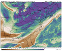
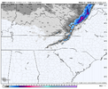
much more classic northwest flow event coming tomorrow afternoon into thursday afternoon. high ratio powder with 850s getting down toward -10c thu morning. might start as drizzle/rain at lower elevations but this one looks solid to me for the traditional spots.
View attachment 178644
View attachment 178645
View attachment 178646
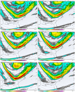
A solid trend over the last 24 hours or so for sure. Heading up there tomorrow afternoon.
you're going tomorrow afternoon? enjoy tomorrow night bud. you may not have hit the powerball lottery nw flow event, but this one is looking good to me for the favored spots. just depends what elevation you're staying atView attachment 178648
A solid trend over the last 24 hours or so for sure. Heading up there tomorrow afternoon.
Yep! I won't be far up & I don't expect much where I am at (Near Pittman Center, TN in a cabin up a mountain) but just to ride up in the snow tomorrow night potentially & to see snow on the Smokies will make me plenty happy... Especially considering how bad it looked a day or so ago. Nice trend to a decent event. We go to the Polar express Friday evening in Bryson City so if 441 is open, it'll be a cool little vibe driving there & back with some snow on the ground up in the Smokies.you're going tomorrow afternoon? enjoy tomorrow night bud. you may not have hit the powerball lottery nw flow event, but this one is looking good to me for the favored spots. just depends what elevation you're staying at
Just for future reference isn’t the above photo more of what we actually want for storms than the Barney colors over our area?This doesn't mean anything except that the future is not set. And the models are still bouncing around. Don't forget that, no matter how many reds or blues you see.
View attachment 178650
View attachment 178651
View attachment 178652

