LukeBarrette
im north of 90% of people on here so yeah
Meteorology Student
Member
2024 Supporter
2017-2023 Supporter
12z HRRR is a significant event here and falling at right time. I have my doubts though. Hoping you transition soon and see more qpf! Let's finish strongHere's a trend loop of the hrrr. Definitely some improvements for many north of I-40 and the eastern crew.
View attachment 178495
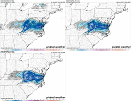
Here's a trend loop of the hrrr. Definitely some improvements for many north of I-40 and the eastern crew.
View attachment 178495

I’m too far south. Any flakes at all will be a win for me. I do think the northern part of Guilford county could get over an inch. Icy roads tomorrow regardless.12z HRRR is a significant event here and falling at right time. I have my doubts though. Hoping you transition soon and see more qpf! Let's finish strong
Preach. Somebody's gotta be just within5-20 miles south of the accumulation/transition line. Looks like it's our turn on this one lol. Wished it was our last , but we both know how that works. I am Glad to see some more get on board though, rooting for them.I’m too far south. Any flakes at all will be a win for me. I do think the northern part of Guilford county could get over an inch. Icy roads tomorrow regardless.

 beechmtn.com
Still all rain and no ping snow reports anywhere close. Disgusting.
Precip just stops right at HWY70 in Rowan and the sharp line to Asheville is absolutely hilarious to meLooks like the suspect splotchiness that the nam was showing may have been bogus. Check out the 0z vs newest 12z run.
0z
View attachment 178501
New 12z
View attachment 178502
Wellll their is 2 mPing reports close to Kannapolis. One at 8:29am and was an Ice Pellets/Sleet report and the other at 8:33am Mixed Rain/Snow so it's possibleJust had a coworker at a jobsite near downtown Kannapolis tell me it’s sleeting there. Returns over that way look pretty light based on the GSP and RDU radars.
Timing seems a bit off with this. Per CAMs, column won’t crash to snow around Triangle until 4-5pm with heavier rates (which may quickly move out)Greg Fishel's latest post on Facebook.
WINTER WEATHER UPDATE
Still expect snow in the Triangle, with the bulk of it coming from very late morning to mid-afternoon. Flurries may linger after that time period but they won't add to the snow totals much if at all. Still looking at an inch or less, mainly on grassy surfaces, with roads remaining wet throughout the day. I am becoming increasingly concerned about roads becoming very tricky tonight, perhaps as early as just after sunset. Many times behind a winter system, very dry air moves in, and any standing water on the roads evaporates before it can freeze. It does not appear that this will be the case tonight. So the chances of roads becoming icy is quite respectable, and with temperatures diving to around 20° overnight, it'll take some time tomorrow morning for the ice to melt.
I'll provide frequent updates throughout the day!
Temps are always a problem.Still all rain and no ping snow reports anywhere close. Disgusting.
I can report that it does not drop fast at all. We started snowing at 35 at 7 and it’s now 32.2r/s mix at my place, 35.6, dropping but not fast enough
i'm a little surprised you're both hurting for moisture and having temp issues at elevation. you think there's a mesoscale rainshadow deal/banding in WV robbing your moisture?I can report that it does not drop fast at all. We started snowing at 35 at 7 and it’s now 32.2
Love the improvementLooks like the suspect splotchiness that the nam was showing may have been bogus. Check out the 0z vs newest 12z run.
0z
View attachment 178501
New 12z
View attachment 178502
Bring it with you to the double RI see some flakes falling at the house on my ring camera. 37
Sent from my iPhone using Tapatalk
