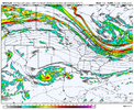
• Hello, please take a minute to check out our awesome content, contributed by the wonderful members of our community. We hope you'll add your own thoughts and opinions by making a free account!

Pattern December Doldrums 2025 🎄 ❄️

Anyone have the 2010 Boxing Day storm maps? This one reminds me of it somewhat with upper level energy diving down and hitting the baroclinic zone off the coast, igniting lift and more cold air injected. Obviously, not expecting that much this time since this one does not look as dynamic or as cold.
Here's the hourly reanalysis:
There are some similarities, but this shortwave is not as well-phased with the northern stream, which limits the depth of ascent and overall synoptic-scale lift.
 
Here's the hourly reanalysis:
There are some similarities, but this shortwave is not as well-phased with the northern stream, which limits the depth of ascent and overall synoptic-scale lift.
Thanks, I remember that one had more phasing, but even small subtle changes in the shortwave can have a major impact on sensible weather, as demonstrated by the models today between getting a couple inches of wet snow and nothing.
 
Keep in mind that the 18z/06z ECMWF/EPS does not do a complete 4D-Var data assimilation... only the 18z/06z GFS suite does. So if you're looking for a trend, take the 18z Euro with a grain of salt.

It's never been great with trends. I can remember the 18z suite failing while the Euro stuck on, only for it to fall in line with the others at 00z.

So basically you're telling me to load up on milk and bread in Moyock. Thank you sir!
 
The AIFS ens has mean highs for the northern SE already in the mid-upper 30s to low 40s between the 15-18th and lows in the 20s, solid cold already showing up. Also has some noise, and especially around the 18th
With that much consistent cold we have got to be tracking threats the week before / into Christmas. Can’t ask for much more here in the se especially this time of year. I’d trade a 12” Feb snow for a 3” Christmas snow.
 
d4d6986f9b47a9703aa7f29f858ee21e.gif

GFS going for a double stretch of the SPV, the first one around 12/14 and the second 12/21


Sent from my iPhone using Tapatalk
 
Trough is still too far east currently but hopefully that will change enough west to get a formidable system for us to track

This is just to illustrate how weak and disturbed the stratospheric polar vortex, the tropospheric vortex is more associated with the 500mb pattern. The SPV just allows for more cold air outbreaks and potential strong arctic ones with a lag time included.


Sent from my iPhone using Tapatalk
 
Bingo!

Heading south though.

The snow is starting to die out around 30 miles from NC. From my observations:

DC 1”
Fredericksburg 3”
Richmond 2”
Petersburg 2”
i am in ashland for the night (~20 miles north of richmond), with a solid 3" around here.

and be rest assured, central NC will now get snow in 3-4 days' time because i just saw my first measurable snow of the season up here in VA just like I did this past January when i traveled up to Richmond for the Jan 5-6th fun lil system -- and then boom, four days later we finally broke our multi year snow drought in the Triangle. brought the energy back down with me.

i have powers. i shall do it again. 12/8 is happening for RDU.
 
Quite a bit of freezing fog out there tonight
Went to West Jefferson today for the Christmas art crawl. On the way back through Blowing Rock, we went through some. It was thick!

WJ was beautiful today and Frosty's was lit.

Screenshot_20251205_212531_Gallery.jpg
Screenshot_20251205_212546_Gallery.jpg
 
I think we're all joining a game at this point of trying to predict the impossible... baja lows

Brings me back a little bit to when we tried predicting the system last year.. We all know how that went lol
 
On GFS you've got the baja low 200 hours later after rebuilding a million times like "Ight I'm outa here" as it tries going through the Gulf. This could be a timeframe to watch if we can get better NS support.
 

Attachments

  • gfs-deterministic-conus-vort500_z500-5659600.png
    gfs-deterministic-conus-vort500_z500-5659600.png
    172.2 KB · Views: 32
On GFS you've got the baja low 200 hours later after rebuilding a million times like "Ight I'm outa here" as it tries going through the Gulf. This could be a timeframe to watch if we can get better NS support.
Sadly the Pacific flow doesn't favor any ARs coming into the Southwest. Northwest flow for days it seems. Not my favorite flavor of winter weather, but I won't turn it down.
 
Back
Top