-
Hello, please take a minute to check out our awesome content, contributed by the wonderful members of our community. We hope you'll add your own thoughts and opinions by making a free account!
You are using an out of date browser. It may not display this or other websites correctly.
You should upgrade or use an alternative browser.
You should upgrade or use an alternative browser.
Pattern December Doldrums 2025 🎄 ❄️
- Thread starter SD
- Start date
NBAcentel
Member
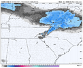
Icon is the furthest NE out of all modeling with the S/W trough looking at everythingThe rich get richer:
View attachment 178118
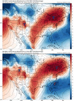
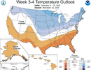
CPC with the buzzkill of the century.. I mean what in the world dude.
I'd say take the CPC 3-4 week forecast with a truckload of kosher salt:CPC with the buzzkill of the century.. I mean what in the world dude.
View attachment 178104
Not precislely date matching, but close enough.
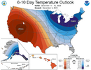
Absolutely. lolI'd say take the CPC 3-4 week forecast with a truckload of kosher salt:
View attachment 178119
Not precislely date matching, but close enough. View attachment 178121
On the optimistic side, maybe that’s a blue norther loading at @Tarheel1 house and the lights are about to flicker down here week 5CPC with the buzzkill of the century.. I mean what in the world dude.
View attachment 178104
iwantsouthernsnow123
Member
Next system monday is really starting to look like a NW Flow event.
BrickTamland
Member
NC is the new SC.
rburrel2
Member
Models have been hinting at a Lee side streamer of some sort Monday afternoon. Will be rain here if it even happens, but maybe northern nc foothills could get a surprise from it? Though they’re torching with a surface warm bubble too (prob a source of the lift). But the freezing level is really low there so it would reach the ground as snow I think.
And SC is the new Florida. And Florida is the new NY.NC is the new SC.
iwantsouthernsnow123
Member
I'll be honest, trends have been towards a NW Flow favored system. Likely just going to be some big NW flow, likely breaching containment, ASSUMING things don't downtrend.Models have been hinting at a Lee side streamer of some sort Monday afternoon. Will be rain here if it even happens, but maybe northern nc foothills could get a surprise from it? Though they’re torching with a surface warm bubble too (prob a source of the lift). But the freezing level is really low there so it would reach the ground as snow I think.
rburrel2
Member
LukeBarrette
im north of 90% of people on here so yeah
Meteorology Student
Member
2024 Supporter
2017-2023 Supporter
GFS incoming
CNCsnwfan1210
Member

Maybe the GFS will hold us over till the 00z cycle gets here
Sent from my iPhone using Tapatalk
CNCsnwfan1210
Member
Looks like some heavier rates in there, what do you think Grit?
Sent from my iPhone using Tapatalk
LukeBarrette
im north of 90% of people on here so yeah
Meteorology Student
Member
2024 Supporter
2017-2023 Supporter
From what I'm seeing with trends I think the TN/NC Apps look great at this point. Slow moving rotating bands of snow possible. If no system I think there will be NW Flow at least
NBAcentel
Member
CNCsnwfan1210
Member
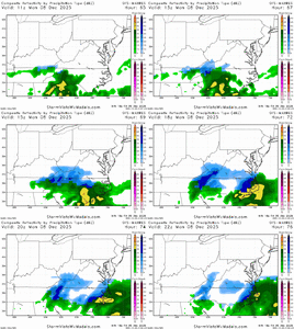
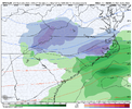
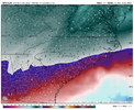
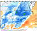
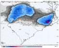
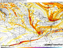
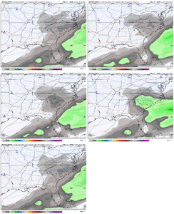
Higher QPF gives you your cold in this type of setup, View attachment 178127View attachment 178130View attachment 178131View attachment 178128
Thanks for clarifying Fro, man that’s a good look, I hope it holds.
Sent from my iPhone using Tapatalk
Looks good to me. Suspect 2m temps will not make it but looks like snowHigher QPF gives you your cold in this type of setup, View attachment 178127View attachment 178130View attachment 178131View attachment 178128
LukeBarrette
im north of 90% of people on here so yeah
Meteorology Student
Member
2024 Supporter
2017-2023 Supporter
Ha, I was kind of hoping we would shoot a weak gulf low into the Atlantic and get it out of the way, then bring in the upper wave, but a stronger version of it, and have it do its thing. That type of setup would be colder, but with lighter precip. GFS wants to go heavier rain to snow with the trailing wave not diving far enough south. Blue colors on the model now, but don't know if that ends well come game time (but good for those to the N and NW). We'll see. At least we're not staring at ++AO and mega SE ridges.Looks like some heavier rates in there, what do you think Grit?
Sent from my iPhone using Tapatalk
Last edited:
Nothing locking that high in place. Sort of a “moving in tandem” setup. Thread the needle
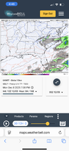
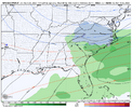
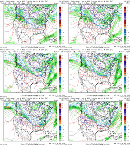
ukmet is especially strong with the streamer stuff and it did a good job predicting similar activity with our “storm” from last February. Unfortunately, it’s going to be very warm at the surface on the Lee-side Monday afternoon though. But maybe rates will overcome!
View attachment 178123
End of the UKMet run had a clipper coming in next Thursday with another in the pipeline there over E Nebraska
BrickTamland
Member
GFS looks good, but I'm skeptical about the GFS showing something and the Euro following more than the other way around.
NBAcentel
Member
NBAcentel
Member
broken025
Member
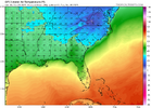
The Jimmy special?Coastal boys rejoiceView attachment 178126
NBAcentel
Member
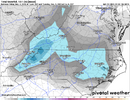
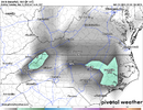
i've been down on this system from the start, but jackpot new bern with a 9 inch lollipop has my attentionView attachment 178132
Here is the WeatherBell map while I'm still on my work login
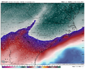
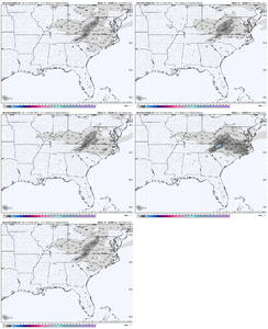
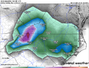
The QPF shift is everything, I was crossing my fingers that the Low would move northward!Huge increase on QPF with the 18z GEFS View attachment 178135View attachment 178136
Southern Track
Member
I think I can speak for the most of us. If you hadn’t seen the Euro most would still be ecstatic with the GFS.View attachment 178143View attachment 178144Choose your fighter.
EFisherWX
Member
Correct - I applied and was granted access to the dataset on both BigQuery and Earth Engine (EE is by far superior for processing, IMO). I also agree that the odds of us being able to make the data public as a company are low.The issue is not having a valid api key from Google to make the maps with Python, grads, etc.
I'm assuming you guys have access to the bigquery, or an API of some sort. Not sure Googles going to go for publicizing it, and I personally feel like they are very much into using that zarr format they also have to push people into using their cloud services, since it seems when you request and are granted access, it's through that
That said, Google will have a hard time finding and tracing a random, unlisted GitHub site w/ an assortment of maps back to my API key. That’s likely the move regardless of their terms of use. They have bigger fish to fry.
NCHighCountryWX
Member
- Joined
- Dec 28, 2016
- Messages
- 697
- Reaction score
- 1,914
That GFS run looked good for some of us who missed out on today's fun and games. I'd love to see a classic Miller A develop off of the coast with a cold air mass in place. Let's hope this run isn't a one off and the beginning of a trend that the other models will catch up to. I'd be happy to see a couple of inches of snow next week to get me more in the Christmas spirit.
Anyone have the 2010 Boxing Day storm maps? This one reminds me of it somewhat with upper level energy diving down and hitting the baroclinic zone off the coast, igniting lift and more cold air injected. Obviously, not expecting that much this time since this one does not look as dynamic or as cold.Starting to get some miller A characteristics here, especially with the SW Piedmont/upstate screw zone View attachment 178137

