LittleMountain
Member
Thought that building the snowpack up North was supposed to help us out? More of the same as last year. Too little precip. Cold air always retreating. Rinse and repeat.
Longtime member here, but I rarely post. I’m as impatient as the next person, but we must realize it’s only December 4th. Patience is key! I see great signs moving forward. I’ve lived many years in the south when the dreaded SE ridge was still dominating our weather this time of year. That hasn’t been the case recently. Let’s get settled in and ready for what this winter can bring us! Best of luck to everyone!!Thought that building the snowpack up North was supposed to help us out? More of the same as last year. Too little precip. Cold air always retreating. Rinse and repeat.
We just suck at anything other than historic flooding in the foothills of NC lolThought that building the snowpack up North was supposed to help us out? More of the same as last year. Too little precip. Cold air always retreating. Rinse and repeat.
I don't put much faith in that either. A week of zonal flow that snowpack along I70 and I80 is usually gone. That only helps when we get a storm immediately after a fresh snowpack up there. And it's still not helping in this particular case likely because its not enough +PNA. But too much PNA would squash it. This is exactly why I'm not a fan of La Nina like a lot on here. Sure, they're not always a torch and we can get cold. But an active southern stream is missing and diving northern stream energy fails way more often.Thought that building the snowpack up North was supposed to help us out? More of the same as last year. Too little precip. Cold air always retreating. Rinse and repeat.

6z GFS still lovin a stretched SPV mid month
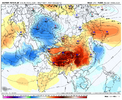
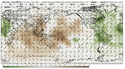
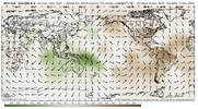
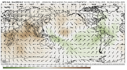
Always an interesting topic as I'll always have a soft spot for El Ninos. Problem is, outside of 02-03 and 09-10, Ninos haven't been any good post the 1980's. But I look back to last January, and though not a Nino type southern stream, the storm that hit New Orleans and east is a way to do it. Get the big cold air in here, then see if a weak wave with deep gulf overrunning can traverse the south (just a more north version for us)I don't put much faith in that either. A week of zonal flow that snowpack along I70 and I80 is usually gone. That only helps when we get a storm immediately after a fresh snowpack up there. And it's still not helping in this particular case likely because its not enough +PNA. But too much PNA would squash it. This is exactly why I'm not a fan of La Nina like a lot on here. Sure, they're not always a torch and we can get cold. But an active southern stream is missing and diving northern stream energy fails way more often.
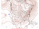
I am not going to pretend I understood everything I just read with this but when I read it & look at long range guidance with it being void of anything exciting, it makes perfect sense.Always an interesting topic as I'll always have a soft spot for El Ninos. Problem is, outside of 02-03 and 09-10, Ninos haven't been any good post the 1980's. But I look back to last January, and though not a Nino type southern stream, the storm that hit New Orleans and east is a way to do it. Get the big cold air in here, then see if a weak wave with deep gulf overrunning can traverse the south (just a more north version for us)
View attachment 177966
Yeah I don't think it takes 2 weeks.Thanks, I was confused on that. Could've sworn I've heard it takes 2 weeks
Thanks, I was confused on that. Could've sworn I've heard it takes 2 weeks
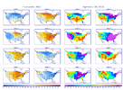
They definitely haven't done as well lately. I know 98/99 was a super Nino. So was 2015/2016. And they aren't good at all. So have we really had any warm neutral to moderate El Ninos since the late 90s that were duds? Seems like we had a dud around 19/20 or so? But other than that maybe its a lack of warm natural to moderate Ninos in the timeframe?Always an interesting topic as I'll always have a soft spot for El Ninos. Problem is, outside of 02-03 and 09-10, Ninos haven't been any good post the 1980's. But I look back to last January, and though not a Nino type southern stream, the storm that hit New Orleans and east is a way to do it. Get the big cold air in here, then see if a weak wave with deep gulf overrunning can traverse the south (just a more north version for us)
View attachment 177966
when the la nada?Always an interesting topic as I'll always have a soft spot for El Ninos. Problem is, outside of 02-03 and 09-10, Ninos haven't been any good post the 1980's. But I look back to last January, and though not a Nino type southern stream, the storm that hit New Orleans and east is a way to do it. Get the big cold air in here, then see if a weak wave with deep gulf overrunning can traverse the south (just a more north version for us)
View attachment 177966
Um, we entered phase eight yesterday, lol. The extended ensembles have been warm-biased this fall more than usual over and over again.So, I looked at the 0z CFS to see if there's any hope for optimism but there's not. More of the same ole same ole all the way through the end of December. What an absolute waste of Phase 8. It just doesn't work like it used to
Yeah 97-98 was the other Super.They definitely haven't done as well lately. I know 98/99 was a super Nino. So was 2015/2016. And they aren't good at all. So have we really had any warm neutral to moderate El Ninos since the late 90s that were duds? Seems like we had a dud around 19/20 or so? But other than that maybe its a lack of warm natural to moderate Ninos in the timeframe?
Most realize this, some not! I get the impatience with the lack of snow since 2013-14. I think since 2020 the cold has disappeared after late December which makes people forget!It's December 4th people, give it time. Stop living and dying by every model and ensemble run.
I think a lot of people also realize in a La Nina you have to score in December. 2nd half of winter is normally a torch. Now we are punting decemberMost realize this, some not! I get the impatience with the lack of snow since 2013-14. I think since 2020 the cold has disappeared after late December which makes people forget!
It's December 4th people, give it time. Stop living and dying by every model and ensemble run.
Thought it was going La Nada at the beginning of the year? We are below average with a pattern that seems decent. ( nothing is promised). Patience is a virtue that not all have!I think a lot of people also realize in a La Nina you have to score in December. 2nd half of winter is normally a torch. Now we are punting december
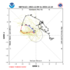
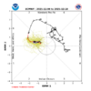
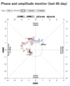
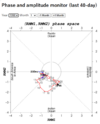
We’re decades into the future and while models are all we have, they suck. Short, mid and long term. I’m not sure what’s changed but weather forecasting is up there with palm reading, fortune cookies and horoscopes!Just like yesterday, the GEFS and EPS disagree on how long the MJO will stay in phase 8:
GEFS: only 6 days though it returns for rd 2 on 12/18:
View attachment 177969
But the EPS, which recently has been much steadier and has been verifying better than GEFS since phase 7, once again is going with a very long phase 8 (16+ days, longest in 50 years): you can’t place an MJO better than this in Dec for E US cold lovers
View attachment 177970
We’re decades into the future and while models are all we have, they suck. Short, mid and long term. I’m not sure what’s changed but weather forecasting is up there with palm reading, fortune cookies and horoscopes!
I get that, I guess I was just sarcastically saying that people live and die by them when everything is fluid and changing!They’re far from perfect but they’re much better than the things you listed, which imho have zero predictive value.
That looks amazingly consistent with phase 8 . Not that anything will materialize but we can hope.
Yeah they were calling from modoki Nino and that did not help us out really at all, despite all the positive prognosticationThey definitely haven't done as well lately. I know 98/99 was a super Nino. So was 2015/2016. And they aren't good at all. So have we really had any warm neutral to moderate El Ninos since the late 90s that were duds? Seems like we had a dud around 19/20 or so? But other than that maybe its a lack of warm natural to moderate Ninos in the timeframe?
Everything else aside, I understand we’re currently in a weak Nino with all expectations based off of modeling that we would go into a neutral period. We, the SE seem to have better winters during neutral periods. When do we see that if at all?Yeah they were calling from modoki Nino and that did not help us out really at all, despite all the positive prognostication
I'd take either one to be honest. Even if it does enter phase 7 again before back into 8. I don't want it anywhere near the maritime continent during peak climo. Although I think I remember seeing the Jan 2011 storm was phase 4 or 5. And while Dec isn't good for phase 7 Jan is. At least based on Webbers chart more winterstorms have occurred in Jan during phase 7 than any other phase. I think. I'll have to try to dig the image out if I still have itJust like yesterday, the GEFS and EPS disagree on how long the MJO will stay in phase 8:
GEFS: only 6 days though it returns for rd 2 on 12/18:
View attachment 177969
But the EPS, which recently has been much steadier and has been verifying better than GEFS since phase 7, once again is going with a very long phase 8 (16+ days, longest in 50 years): you can’t place an MJO better than this in Dec for E US cold lovers (and it looks to be cold the next 10 days per models though one must remember that there are always other factors to consider due to the complexity of the atmosphere):
View attachment 177970
We are in Weak La Niña now. Probably in an El Niño of some form next winterEverything else aside, I understand we’re currently in a weak Nino with all expectations based off of modeling that we would go into a neutral period. We, the SE seem to have better winters during neutral periods. When do we see that if at all?
I meant Nina, my apologies for the misunderstanding!We are in Weak La Niña now. Probably in an El Niño of some form next winter
You've got to be kidding me..... I have waited all my 61 years for something like that to happen. Surely we can score with that.Is this good? Lol. A gawx dream come true
View attachment 177944
Who in the heck has punted December?? It 12/4 for heavens sakeI think a lot of people also realize in a La Nina you have to score in December. 2nd half of winter is normally a torch. Now we are punting december
It's nice knowing that there is someone the same age as I am here. I turned 61 back in November.You've got to be kidding me..... I have waited all my 61 years for something like that to happen. Surely we can score with that.
