Shaggy
Member
Glad everyone else gets to track a light winter event we are just happy to see some dang rain!!
Glad everyone else gets to track a light winter event we are just happy to see some dang rain!!
That is wild how it still finds a way to cold rain with a low in the gulf. Where's the cold air!View attachment 177730
We can work with this
"Delayed but not denied"That is wild how it still finds a way to cold rain with a low in the gulf. Where's the cold air!
View attachment 177733Have to phase the jet streams to get wonderful things to happen...
Was just thinking this exact thing. Monday would look much more promising if we could get that blocking in place. Until then we really don't have too much to work with.Where's my 50/50 and NAO block? Going to be chasing ghosts till we start to see that.
May get a quick-hitter or minor to moderate event though. We just have to shoehorn it in.

Too much positive tilt not allowing cold air to get pulled inThat is wild how it still finds a way to cold rain with a low in the gulf. Where's the cold air!
Where's my 50/50 and NAO block? Going to be chasing ghosts till we start to see that.
May get a quick-hitter or minor to moderate event though. We just have to shoehorn it in.
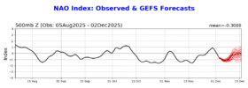
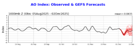
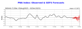
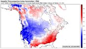
About 10 days ago, there was a lot of chatter about a big dump of frigid arctic air into the southern US by mid December. So is that off the table now?
-Average PNA for the 21 6”+ RDU snowstorms: +0.4
-Average NAO for the 21 6”+ RDU snowstorms: +0.0
+PNA (+0.25+): 11 storms (52%)
Neutral PNA (-0.25 to +0.25): 7 storms (33%)
-PNA (-0.25-): 3 storms (14%)
Fairly atypical getting this strong ph7-ph8 run in Dec nina. But a couple analogs...
View attachment 177743View attachment 177744
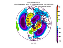
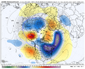
Scrolling through MSLP, the flow is #FastWhere's my 50/50 and NAO block? Going to be chasing ghosts till we start to see that.
May get a quick-hitter or minor to moderate event though. We just have to shoehorn it in.
No, what an idiot. Just nuke my Christmas vacation in Gatlinburg with a ridge the size of half the planet. Unreal.Is this good?View attachment 177747
Seattle trip?No, what an idiot. Just nuke my Christmas vacation in Gatlinburg with a ridge the size of half the planet. Unreal.
Are we thinking this is just a fake out? Or is this actually possible during a phase 8 MJO?No, what an idiot. Just nuke my Christmas vacation in Gatlinburg with a ridge the size of half the planet. Unreal.
Right there with you lolUpstate can get ready for another day just like today COLD RAIN
Don’t worry. It’s a short drive up hwy441 to Newfound Gap where it always snowsNo, what an idiot. Just nuke my Christmas vacation in Gatlinburg with a ridge the size of half the planet. Unreal.
Look at how that block over greenland moves further this way squashing our trough southward!!!
Are we thinking this is just a fake out? Or is this actually possible during a phase 8 MJO?
The good news is, I find if I take day 12 of the GFS and switch to the inverse, it can be pretty accurate!Is this good?View attachment 177747
The models are having a hard time 3 plus days out let alone that far out. This is a complex pattern we have now with a lot of moving parts.Are we thinking this is just a fake out? Or is this actually possible during a phase 8 MJO?
If Mother Nature allowed weanies to draw up an MJO prog, it would look exactly like that.Today’s MJO forecasts finally came out:
GEFS: Phase 8 12/2-16 (15 days+)
View attachment 177741
EPS: Phase 8 12/3-16 (14 days+)
View attachment 177742
Should either of these progs verify, it would be the longest winter phase 8 in 50 years!
