• Hello, please take a minute to check out our awesome content, contributed by the wonderful members of our community. We hope you'll add your own thoughts and opinions by making a free account!

Tropical Melissa

The slower speed certainly increases long range unknowns. Troughs come and go and highs build and weaken and the longer and slower it moves the more of these features become influences. One trough might miss but the next grab it and for the US that's seems largely inconsequential but for the islands and the Bahamas its critical
 
The slower speed certainly increases long range unknowns. Troughs come and go and highs build and weaken and the longer and slower it moves the more of these features become influences. One trough might miss but the next grab it and for the US that's seems largely inconsequential but for the islands and the Bahamas its critical
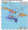
I believe this explains the forecasting difficulty in determining what is going to happen with Melissa. It is like a hitchhiker with his thumb out waiting for someone to pick him up and take him somewhere. We are not going to know much until the atmospheric feature that will eventually determine Melissa's fate picks it up and sets it in motion.
 
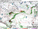
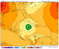
18Z Euro gives much of Jamaica near or just over 20” qpf with heavy rain still likely continuing for a few more hours with the storm still then centered over SW Jamaica and SLP way down at 943 mb; it’s then moving slowly NNE while SSE of a strong upper trough that’s then over the E US.
 
18Z Euro gives much of Jamaica near or just over 20” qpf with heavy rain still likely continuing for a few more hours with the storm still then centered over SW Jamaica and SLP way down at 943 mb; it’s then moving slowly NNE while SSE of a strong upper trough that’s then over the E US.
It's not deep enough yet
 
I'll believe a hit on Jamaica when I see it. That place has hurricane repellent plants growing there.

Oh I know I still remember when Ivan was gonna wipe away the island... There was a radio station streaming for the occasion even

But yeah if this thing blows up someone is in trouble down there... Probably Cuba and of course any rain in Haiti ends in a disaster

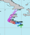
13L_tracks_latest (1).png
 
Melissa is reminding me a lot of Wilma in 2005 which has the lowest pressure ever recorded in the Atlantic. Both storms formed in nearly the same location in the Caribbean and both were October storms. If the models are correct in their intensity forecasts, Melissa could give Wilma's lowest recorded pressure of 882mb a run for its money. Wilma drifted around in about the same spot Melissa is in before heading northwest and hitting the Yucatan Peninsula and then it headed northeast scraping the tip of Southern Florida and out to sea.
 
Last edited:
I checked the coordinates as Gilbert passed over Jamaica:

It went from 17.6N, 75.3W to 18.3N, 78.5W over a 12 hour period. Per a lat/long mileage calculator, that’s 216 statute miles, which means a brisk 18 mph. That’s a whopping 6 times faster than the very slow average of 3 mph that Melissa is forecasted to move while adjacent to Jamaica! So, Gilbert held onto its strength while moving right over it at 18 mph.

How would Melissa do moving a mere 3 mph but just south of the island? I don’t see how it wouldn’t weaken some, possibly significantly from its forecasted MH strength at some point during that 48 hour period even if not immediately due to drier inflow from Jamaica.

Opinions?
 
-Atlantic 2025 ACE finally just reached 100.

-Though Melissa has yet to produce much ACE (2.2), there’s a whole lot of potential based on the NHC forecast of a combo of very slow movement for many days and reaching cat 4 status in a few days. IF this all materializes, we’d realistically be looking at the possibility of 30+ more ACE though forecasting the ultimate intensity is at a well above average difficulty for this storm. This is still struggling with shear and thus has been holding pretty steady. On the low end, this could never get much above cat 1 and end up with <15 total ACE.

-Of course, Melissa may not be the last storm.
 
Even at this late stage there's no clear trend on the models crazy

It looked east earlier and now the Euro is west keeping the Euro and GFS very far apart which I'm not sure we've ever seen at basically day 3(Jamaica landfall could be Sunday)
 
IF the NHC forecast were to play out, Melissa could end up having the 3rd highest ACE on record for so late in the season of the last 100 years behind only Mitch of 1998 and the Nov Cuba H of 1932! Wilma wouldn’t qualify because it dissipated too early (10/25).

Going back further to 1851 on the record, only storm #6 of 1896 would appear to quite possibly have higher ACE later than Melissa again assuming NHC forecasts verify. So, Melissa could very well end up in rare company regarding the lateness of a very large ACE for a single storm on record.
 
BULLETIN
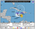
Tropical Storm Melissa Advisory Number 13
NWS National Hurricane Center Miami FL AL132025
1100 AM EDT Fri Oct 24 2025

...AIRCRAFT DATA SUGGEST THAT MELISSA COULD BE REFORMING TO THE
EAST...
...LIFE-THREATENING AND CATASTROPHIC FLASH FLOODING AND LANDSLIDES
EXPECTED IN PORTIONS OF SOUTHERN HISPANIOLA AND JAMAICA THROUGH THE
WEEKEND...


SUMMARY OF 1100 AM EDT...1500 UTC...INFORMATION
-----------------------------------------------
LOCATION...15.7N 74.6W
ABOUT 215 MI...345 KM SE OF KINGSTON JAMAICA
ABOUT 250 MI...405 KM SW OF PORT AU PRINCE HAITI
MAXIMUM SUSTAINED WINDS...45 MPH...75 KM/H
PRESENT MOVEMENT...ESE OR 105 DEGREES AT 2 MPH...4 KM/H
MINIMUM CENTRAL PRESSURE...1001 MB...29.56 INCHES


WATCHES AND WARNINGS
--------------------
CHANGES WITH THIS ADVISORY:

None.

SUMMARY OF WATCHES AND WARNINGS IN EFFECT:

A Hurricane Watch is in effect for...
* Southwestern peninsula of Haiti from the border with the
Dominican Republic to Port-Au-Prince
* Jamaica

A Tropical Storm Warning in effect for...
* Southwestern peninsula of Haiti from the border with the
Dominican Republic to Port-Au-Prince
* Jamaica


Tropical Storm Melissa Discussion Number 13
NWS National Hurricane Center Miami FL AL132025
1100 AM EDT Fri Oct 24 2025

The Air Force Reserve reconnaissance that has been flying through
Melissa this morning found the center significantly further to
the east-southeast than what was observed last night. How much of
this position is related to a real motion, or a center reformation
is unclear at this time. The storm remains about the same on
satellite imagery this morning, with a large burst of
deep convection, primarily along its southeastern flank, with
evidence of northwesterly shear still undercutting the outflow. A
WSFM microwave pass shows very deep hot towers, but not with that
much structure beyond that. In addition, there hasn't been a
significant change to Melissa's intensity, with peak 850 mb flight
level winds of 49 kt, and these winds support maintaining 40 kt
intensity this advisory.

As has been stated for the last few days, the lack of persistent
steering currents, due to competing mid-level ridges to the
southeast and northwest of Melissa, is responsible for the storm's
very slow motion. This is likely to continue for the next day or so,
and much of the system's motion could be just as influenced by
center reformations during this time period. After 24 hours, the
mid-level ridge located to the northwest is expected to strengthen
to the north of Melissa, and the guidance is coming into better
agreement on a very slow westward motion through 72 hours. Beyond
that time frame, a strengthening mid-latitude trough expected to
move into the Southeastern U.S., should provide an avenue for
Melissa to escape the Caribbean Sea to the northeast by the end of
the forecast period. The track guidance overall has shifted south
over the first few days, but there is still substantial spread in
solutions at the end of the forecast period, related to when and
how fast Melissa turns to the northeast. The latest NHC track
forecast is a little south of the prior one early on, but is
shifted a little eastward in 4-5 days, roughly a blend of the latest
HCCA and GDMI model aid solutions. On the forecast track, Melissa
could potentially be near western Jamaica by day 4 and near or
over southeastern Cuba by day 5, though timing still remains more
uncertain than usual.

The GFS and ECMWF-based SHIPS shear guidance indicates the
deep-layer shear is lower than yesterday, between 14-17 kt, but
there still appears to be mid-level shear undercutting the outflow
layer. Until Melissa also become better aligned vertically, any
intensification is likely to be slow to occur over the next 12 h or
so. After that, once Melissa's structure improves, environmental
conditions still appear favorable for a period of rapid
intensification (RI). Every single Google DeepMind member shows the
system become a Category 4 hurricane or higher, and the uncertainty
is more related on the timing of when RI occurs. After 96 hours,
Melissa could weaken some due to the combined effects of land
interaction, and an increase in southwesterly vertical wind shear by
the end of the forecast period. The latest NHC intensity forecast is
on the higher end of the model solutions, but more or less in line
with the latest GDMI guidance.

Key Messages:

1. Jamaica: Due to Melissa’s slow motion, the risk of a prolonged
multi-day period of potentially damaging winds, heavy rainfall
resulting in life-threatening flash flooding and numerous
landslides, and storm surge continues to increase for Jamaica.
Preparations to protect life and property should be rushed to
completion, since strong winds and flooding rains could begin in
Jamaica on Saturday or Sunday.

2. Haiti: Heavy rainfall will result in catastrophic flash flooding
and landslides across southwestern Haiti into early next week.
Extensive damage to roads and buildings is expected, potentially
isolating communities for an extended period of time. This is a
life-threatening situation and immediate preparations to protect
life and property should be taken. Strong winds could also
potentially last for a day or more over the Tiburon peninsula of
Haiti.

3. Remainder of Hispaniola and Eastern Cuba: Heavy rainfall could
also produce significant, life-threatening flash flooding and
numerous landslides in southern Dominican Republic. Interests in
Cuba should monitor the progress of Melissa since the risk of heavy
rainfall, damaging winds, and storm surge appears to be increasing.


FORECAST POSITIONS AND MAX WINDS

INIT 24/1500Z 15.7N 74.6W 40 KT 45 MPH
12H 25/0000Z 15.9N 74.5W 45 KT 50 MPH
24H 25/1200Z 16.3N 74.6W 60 KT 70 MPH
36H 26/0000Z 16.5N 75.3W 70 KT 80 MPH
48H 26/1200Z 16.6N 76.0W 85 KT 100 MPH
60H 27/0000Z 16.6N 76.8W 105 KT 120 MPH
72H 27/1200Z 16.6N 77.5W 125 KT 145 MPH
96H 28/1200Z 17.5N 78.3W 130 KT 150 MPH
120H 29/1200Z 20.4N 76.7W 105 KT 120 MPH...INLAND

$$
Forecaster Papin
 
This is sadly going to be a disaster. Surprised there’s not more chatter. Not everyday you have a Cat 4/5 taking aim at an island of 2 million

FORECAST POSITIONS AND MAX WINDS

INIT 24/2100Z 16.0N 74.3W 55 KT 65 MPH
12H 25/0600Z 16.2N 74.4W 65 KT 75 MPH
24H 25/1800Z 16.4N 74.8W 85 KT 100 MPH
36H 26/0600Z 16.5N 75.5W 105 KT 120 MPH
48H 26/1800Z 16.5N 76.0W 120 KT 140 MPH
60H 27/0600Z 16.5N 76.6W 135 KT 155 MPH
72H 27/1800Z 16.8N 77.4W 135 KT 155 MPH
96H 28/1800Z 17.9N 77.4W 120 KT 140 MPH...INLAND IN JAMAICA
120H 29/1800Z 21.5N 74.8W 95 KT 110 MPH...OVER WATER

IMG_6920.png
 
My wife and I have been super lucky so far on this trip to the USVI. It's been mostly cloudy most of the week but only isolated showers (like 5 minute showers once or twice per day), but just 100 miles west of here in Puerto Rico it's been almost constant rain all week. Feel awful for Jamaica, Haiti, and the Dominican Republic as they are looking at almost certain catastrophic flooding and mud slides over the next few days.
 
Interesting video scenes coming outta Jamacia (already), TS "squalls" wind & rain squalls, forecasting 3 feet of precip!
 
This is sadly going to be a disaster. Surprised there’s not more chatter. Not everyday you have a Cat 4/5 taking aim at an island of 2 million

FORECAST POSITIONS AND MAX WINDS

INIT 24/2100Z 16.0N 74.3W 55 KT 65 MPH
12H 25/0600Z 16.2N 74.4W 65 KT 75 MPH
24H 25/1800Z 16.4N 74.8W 85 KT 100 MPH
36H 26/0600Z 16.5N 75.5W 105 KT 120 MPH
48H 26/1800Z 16.5N 76.0W 120 KT 140 MPH
60H 27/0600Z 16.5N 76.6W 135 KT 155 MPH
72H 27/1800Z 16.8N 77.4W 135 KT 155 MPH
96H 28/1800Z 17.9N 77.4W 120 KT 140 MPH...INLAND IN JAMAICA
120H 29/1800Z 21.5N 74.8W 95 KT 110 MPH...OVER WATER

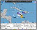
View attachment 175665
I talked about it extensively in my video today and tweeted (or whatever you call it now) yesterday. It's going to be awful. Flash flooding, landslides, and extreme wind.
 
BULLETIN
Tropical Storm Melissa Intermediate Advisory Number 15A
NWS National Hurricane Center Miami FL AL132025
200 AM EDT Sat Oct 25 2025

...AIR FORCE HURRICANE HUNTER DATA SUGGEST MELISSA IS ALMOST A
HURRICANE...
...LIFE-THREATENING AND CATASTROPHIC FLASH FLOODING AND LANDSLIDES
EXPECTED IN PORTIONS OF SOUTHERN HISPANIOLA AND JAMAICA THROUGH THE
WEEKEND...


SUMMARY OF 200 AM EDT...0600 UTC...INFORMATION
----------------------------------------------
LOCATION...16.3N 74.9W
ABOUT 170 MI...275 KM SE OF KINGSTON JAMAICA
ABOUT 235 MI...375 KM SW OF PORT AU PRINCE HAITI
MAXIMUM SUSTAINED WINDS...70 MPH...110 KM/H
PRESENT MOVEMENT...NW OR 315 DEGREES AT 3 MPH...6 KM/H
MINIMUM CENTRAL PRESSURE...986 MB...29.12 INCHES
 
Back
Top