• Hello, please take a minute to check out our awesome content, contributed by the wonderful members of our community. We hope you'll add your own thoughts and opinions by making a free account!

Tropical 91L

Well this is not very helpful. 🤣🤣🤣

View attachment 174767

I’m an ensembles guy and I like to look at them to see how wide a range of realistic possibilities there are, especially past day 7. I feel what you showed is helpful not in pinpointing where Invest 91L or anything else will likely go, but instead by showing the wide range of possibilities that far out. I like to look at the member spaghettios to determine the most likely scenarios and their chances such as Caribbean hit/cruiser, E coast hit, Bahamas threat, Gulf hit, Bermuda threat, Canada hit, recurve with no close pass to land, etc.

We all like to look at fantasyland of ops. I do for the record/entertainment.
Yeah honestly most of the time if people didn't post the operational 300 hour GFS I wouldnt even look at it

It's a waste of time
 
ZCZC MIATWOAT ALL
TTAA00 KNHC DDHHMM

Tropical Weather Outlook
NWS National Hurricane Center Miami FL
800 PM EDT Thu Sep 4 2025

For the North Atlantic...Caribbean Sea and the Gulf of America:

1. Tropical Atlantic (AL91):
A broad area of low pressure, associated with a tropical wave, is
producing a concentrated but still disorganized area of showers and
thunderstorms over the eastern tropical Atlantic. Environmental
conditions are favorable for development of this system, and a
tropical depression is likely to form by this weekend as it moves
slowly westward at 5 to 10 mph across the central tropical Atlantic.
This system is likely to be near the Lesser Antilles by the middle
to latter part of next week, and interests there should continue to
monitor its progress.
* Formation chance through 48 hours...medium...60 percent.
* Formation chance through 7 days...high...90 percent.
 
Yeah honestly most of the time if people didn't post the operational 300 hour GFS I wouldnt even look at it

It's a waste of time
There's no way this is true. There is nobody that posts on this board who doesn't like some good lingerie range model porn. I don't buy it! 😁
 
We probably aren't going to have a good idea of where things stand overall on potential mainland US impacts for at least a week. This seems extra complex to me this time, the main thing I noticed was that the ridging that might pose an issue was weaker for this run.

But a straight OTS for everyone doesn't seem like it's on the tables like Erin, the islands/PR potentially being threatened is within about a week.

Disagree, I think by day five we will know from sure if this is a threat or not.
 
But then this was released, showing WSW movement!?

AL, 91, 2025090500, , BEST, 0, 117N, 346W, 20, 1011, DB

🤷🏻‍♂️
 
From elsewhere:
18z best track was 12.1N but this looks more like 13.5N. Probably another round of model changes overnight.

Your or others’ thoughts about this?
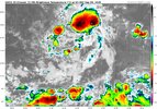
Watching it on satellite, seems to be moving straight down 14N

Updated 00z looks like it's initializing south of current location.

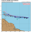
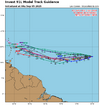
Don't get distracted by all the lines. Focus on TVCX and the 2 grey lines south of rest. NHC will follow those. How the average is south of all the rest is beyond me.


91L_tracks_latest (1).png

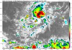
db10fe64-8460-4c5f-9b72-549e4ceb2166.jpeg

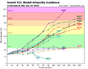
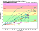
91L_intensity_latest.png
 
For the record, today’s 12Z JMA moves much more quickly as it gets near Bermuda at 192! What’s up with that? This is actually consistent with yesterday’s 12Z JMA.

IMG_4518.png
 
0z GFS is wayyy south. Looks like we’re about to get the northern turn though
1757045958277.png
 
There's almost zero run to run consistency in the GFS and it's Fantasyland anyway so I wouldn't put any money on any solution the only thing it's consistent in is that it does show some level of development
 
00z Euro.....weak low into Charleston. Hope it stays weak. GFS has posted this look a couple of times.

View attachment 174783

1. Henry,
That weak low into CHS on the 0Z Euro looks home-grown to me because 91L had much earlier dissipated.

2. 6Z GFS is way OTS, even E of Bermuda.

3. 6Z Icon is much weaker at the Lesser Antilles at 120.
 
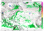
6Z GEFS: has a few TCs down in the Lesser Antilles followed by a pretty sharp recurve, sort of similar to the op. There are also a couple that lag behind that recurve from further E in the MDR. I don’t see any strong members through hour 222. All are 1000 mb+.
 
6Z GEFS: has a few TCs down in the Lesser Antilles followed by a pretty sharp recurve, sort of similar to the op. There are also a couple that lag behind that recurve from further E in the MDR. I don’t see any strong members through hour 222. All are 1000 mb+.
On this, looks like the majority is at cat1 by 120 hours.

91L_intensity_latest (1).png
 
I think the greatest odds are it swims with the fishes. If it really ramps up, it is even more likely it goes OTS but if it stays weak long enough, somebody will get hit IMO. When and if it intensifies will be key, if it does it early then it likely misses us, if it blows up late as a close in storm, would be trouble for somebody
 
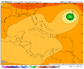
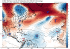
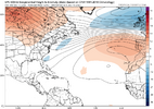
This is a pretty welcoming weakness. With this much influence to get NE and OTS it starts to get where it need quirky things for this to get well west. In this systems case with dry air, fast flow, land interaction its a little less straight forward than say Erin waseps_z500a_atl_37.png
 
Last edited:
I think the greatest odds are it swims with the fishes. If it really ramps up, it is even more likely it goes OTS but if it stays weak long enough, somebody will get hit IMO. When and if it intensifies will be key, if it does it early then it likely misses us, if it blows up late as a close in storm, would be trouble for somebody
Well said...
 
So here is my question.....
If these models have it at a cat1 in 120 hours, how can the Euro and AI even be a possible option with a disappearing act and zero anything?

Inquiring minds want to know....

91L_intensity_latest (1).png
 
So here is my question.....
If these models have it at a cat1 in 120 hours, how can the Euro and AI even be a possible option with a disappearing act and zero anything?

Inquiring minds want to know....

View attachment 174791
They're (the models) are all throwing darts from 150 feet away. Darts end up in different places with every throw. Must get closer to the target for real consistency. Even at closer range, a bullseye is a difficult throw. Hmmm, I guess I need to go to a Pub....I've got darts on the brain.
 
So here is my question.....
If these models have it at a cat1 in 120 hours, how can the Euro and AI even be a possible option with a disappearing act and zero anything?

Inquiring minds want to know....

View attachment 174791
These models are routinely all over the place. The system is a mess right now. The Euro keeps the system losing the battle with dry air. My guess is that it will probably develop to a low end hurricane over the next 5 days. I'm concerned for the northern islands, but beyond that, given the recent trends, it's probably going OTS, and I doubt very much we see a major cane out of this one.
 
Back
Top