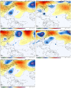
Islands/US threat?
-
Hello, please take a minute to check out our awesome content, contributed by the wonderful members of our community. We hope you'll add your own thoughts and opinions by making a free account!
You are using an out of date browser. It may not display this or other websites correctly.
You should upgrade or use an alternative browser.
You should upgrade or use an alternative browser.
Tropical 91L
- Thread starter SD
- Start date
Stormsfury
Member
Brent
Member
It's still reminding me of Erin but Gabrielle is next
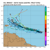
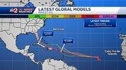
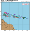
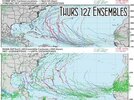
The 0Z EPS and other ensemble runs still strongly favor either a safe recurve from Conus or it staying weak or dissipating for those that stay further south and go into or near the Caribbean. So, there’s still a long ways to go before this would possibly be considered a significant threat to the Conus. Also, the threat is currently still higher for the NE Caribbean than the Conus due to being closer and considering those members that stay further S.
But Erin did come in 200 miles/3 degrees of longitude further W than forecasted by the NHC and models 4 days earlier. So, that’s something to keep in mind.
But Erin did come in 200 miles/3 degrees of longitude further W than forecasted by the NHC and models 4 days earlier. So, that’s something to keep in mind.
Gonna be a long 2 weeks of model waffling. I honestly prefer homegrown stuff cause it takes the waiting piece out of it. Can’t remember the last cruiser we had that threatened the US. Maybe Beryl? Before that who knows
lexxnchloe
Member
GeorgiaGirl
Member
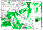
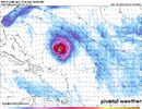
GFS looks as if it's completely caved to the Euro so far in the 12z run, definitely puts the islands at risk as that range is not in fantasy land.
Barely misses PR by the skin of its teeth. then starts strengthIng again.
Trapped and no choice but to head west/NW at best. Shear would help keep in check at this 10 day point of time. But this is A) GFS B) Hour 240
Trapped and no choice but to head west/NW at best. Shear would help keep in check at this 10 day point of time. But this is A) GFS B) Hour 240
Last edited:
GeorgiaGirl
Member
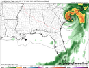
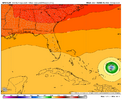
Well, we'll see how the rest of the run ends up, but the 500 map for now tells me this probably rakes the Bahamas and then cruises right into Florida...
GeorgiaGirl
Member
Well, that was a crazy run. It looks as if it almost might get in the Gulf.
12z GEFS seems as if it's caved to the southerly solution if it develops anything as well btw.
12z GEFS seems as if it's caved to the southerly solution if it develops anything as well btw.
lexxnchloe
Member
Donna track but weaker
The jury is still out on 91L and there is plenty of time to watch it to see where it goes. I hope the GFS is onto something with the rainfall totals after making a landfall on the southeast coast. It will be three weeks at the end of this week since the RDU area has seen any significant rainfall and the potential looks bleak for that to happen unless a tropical system changes the equation.
NoSnowATL
Member
Shear
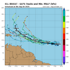
The 12Z EPS has one member from 91L hit FL, another headed toward the Gulf, and a couple of others not far from hitting the NE US as they recurve. But overall, that’s still pretty quiet for CONUS. Interestingly, there’s more Conus hits from other systems, mainly homegrown stuff.
Henry2326
Member
Henry2326
Member
Henry2326
Member
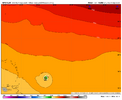
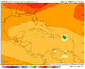
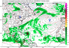
Looks like this one is destined to be plagued by dry air and shear. The forecasted environment does not look what I would expect it to look like for a big hurricane of growing intensity as it approaches the EC. It's way out there, so it can change. But it doesn't look great. The upper air pattern has a somewhat concerning look, which, coupled with the seemingly increasingly favored southern track, would be worrisome. But again, that's offset somewhat by the lack of a healthy forecasted environment. Lots to watch over the coming days.PR landfall as a mini-cane this time on the GFS dart throwView attachment 174763
lexxnchloe
Member
A little further west with a follow-up stormPR landfall as a mini-cane this time on the GFS dart throwView attachment 174763
lexxnchloe
Member
Heading north after thisWe will see if it makes it to the coast, but this run might be a weenie run intensity wise
View attachment 174765
Honestly, unless you really move the Bermuda ridge westward, this is easily OTS by day 4 or 5 per the 18z GFS.
Shaggy
Member
Which is no more or less believable than the 06z that crushed the east coast.Honestly, unless you really move the Bermuda ridge westward, this is easily OTS by day 4 or 5 per the 18z GFS.
Ensembles people
Henry2326
Member
Henry2326
Member
Which is no more or less believable than the 06z that crushed the east coast.
Ensembles people
Not quite. The 6z GFS actually did the perfect setup to impact the US. It kept this extremely weak which missed the trough and regressed the SE cut off perfectly to provide ventilation and pull it westward and a perfect anticylone over head to allow it rapidly deepen and help pump the ridge and get it even further westward. All in the near 300 hr range. Possible? Sure, but a deeper system is gone well before then with this look.
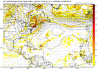
It’s for entertainment! Everyone on this weather board should know not to trust anything until we get inside of a week.Your the one showing it
I’d say check back on Monday unless you’re in the islands
Brent
Member
Yeah I'm not even giving this time of day right now to believe it's a legit threat. It's too early
I still think it could easily be like Erin and miss too
I still think it could easily be like Erin and miss too

