• Hello, please take a minute to check out our awesome content, contributed by the wonderful members of our community. We hope you'll add your own thoughts and opinions by making a free account!

Tropical 2025 Tropical Thread

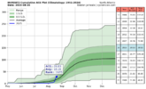
Today’s Euro Weeklies have Sept week 3 (9/15-21) for the first time. It’s near the very active 2005-24 avg. Regarding progged ACE in Sept: after a well BN 1st week and a moderately BN week 2, week 3 is significantly more active and actually has the most ACE of any of the 4 weeks by a good margin starting with the final week of August.

This is giving me flashbacks to 2024 as this is at least hinting at a Sept resembling last Sept, which had a much more active 2nd half than first half. I’m guessing that this prog of relative quiet in week 1 transitioning to normal active in week 3 is MJO related.

Here are today’s EW ACE forecasts:
8/25-31: 9-10
9/1-7: 5-6
9/8-14: 8-10
9/15-21: 13-15
 

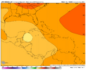
The Atlantic SST configuration has turned quite favorable-looking (for TC development) over the last couple weeks, in large part driven by reduced trades over the Caribbean.In fact, 2025 now ranks #7 in terms of MDR SST anomaly (with the tropics mean anomaly removed to bias correct for climate trends).2010 0.996250992023 0.749654292024 0.64659561995 0.621191562005 0.594340621998 0.518180192025 0.49122003 0.4752881999 0.410415562017 0.35969672All the other years in the Top 10 on this date reached "hyperactive" activity levels in terms of ACE (Accumulated Cyclone Energy). The Atlantic definitely has done some catching up after a slow start (thanks to #Erin), but TBD what the back half of the season holds after a potentially quiet couple weeks ahead.

Feels like it’s only a matter of time before something is going to take advantage of the Caribbean
 
Feels like it’s only a matter of time before something is going to take advantage of the Caribbean

I'm really feeling like that's our best chance to get a legit threat

It's gonna be very hard from the east with all these big troughs which are only gonna get more likely as the weeks go on
 
Today’s Euro Weeklies have Sept week 3 (9/15-21) for the first time. It’s near the very active 2005-24 avg. Regarding progged ACE in Sept: after a well BN 1st week and a moderately BN week 2, week 3 is significantly more active and actually has the most ACE of any of the 4 weeks by a good margin starting with the final week of August.

This is giving me flashbacks to 2024 as this is at least hinting at a Sept resembling last Sept, which had a much more active 2nd half than first half. I’m guessing that this prog of relative quiet in week 1 transitioning to normal active in week 3 is MJO related.

Here are today’s EW ACE forecasts:
8/25-31: 9-10
9/1-7: 5-6
9/8-14: 8-10
9/15-21: 13-15
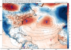
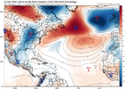
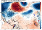
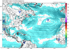
Yep....18z Euro AI and GFS, as well as 12z Euro show a prime position storm dropping off Africa Aug 29, Sept 1, and Sept 2, that would align with week 3.

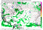
gfs_mslpa_atl_37.png

ec-aifs_mslpa_atl_46.png

ecmwf_mslpa_atl_79.png
 
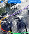
The kinda funny thing is that 99L might actually need to be watched (it's probably a TC to boot as well, though it's likely to be torn apart by shear) to see if the remnants can survive into the Caribbean and regenerate.

That's a 10+ day thing though.
 
Never say never......

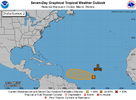
2. Central Tropical Atlantic (AL99):
Showers and thunderstorms associated with a tropical wave located
about midway between Africa and the Windward Islands have become
less organized overnight. While there is still some chance that a
short-lived tropical depression could form during the next day or
so, the system is expected to move through a less conducive
environment into Saturday.

The wave could reach a slightly more
favorable environment again late this weekend into early next week
as it moves westward at 10 to 15 mph over the central tropical
Atlantic and approaches the Lesser Antilles.


* Formation chance through 48 hours...medium...40 percent.
* Formation chance through 7 days...medium...50 percent.


two_atl_7d2 (1).png
 
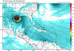
ICON 12z says "yeah, it might make the journey and odds are a labor day storm in the gulf".
Dang, I hope not. That water is hot.

icon_mslp_wind_atl_61.png
 
ICON 12z says "yeah, it might make the journey and odds are a labor day storm in the gulf".
Dang, I hope not. That water is hot.

View attachment 174494

Gonna be hard to hit the gulf coast besides SE TX or the Florida peninsula with that NW flow aloft and not be shreaded.
 
12z GFS quiet as a mouse.

12z Euro keeps an eastern trough the whole time, but develops a low off the SE coast late and runs it NE.

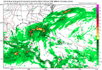
12z ICON has something and shoots the gap late. But we know this solution is likely erroneous.

icon_mslp_pcpn_atl_60.png

EPS has a generally threatening pattern late.

If anything could sneak into the Gulf and have favorable shear, boy look out.
 
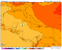
Fwiw, the 12Z JMA very similarly to the Icon has a TD that forms on 8/29 in the NW Caribbean and moves NW toward the N. Yucatan:

IMG_4409.png
 
No need to go into detail on the GFS or EURO but in general the only thing on them is a deep trof along the coast with numerous weak lows forming and zooming NE unable to do anything as there is nothing to hold them in place.
 
Back
Top