Triplephase93
Member
MRX Discussion:
Cold air will remain entrenched across the area this week, generally
running 5 to 10 degrees below normal. Zonal flow will keep the
midweek period fairly quiet.
However, the next southern Rockies system will begin ejecting into the central and southern Plains states Thursday-Friday, drawing up a large slug of Gulf moisture into the southeastern U.S. and Tennessee
Valley on Friday, persisting Friday night and departing Saturday.
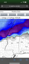
This event continues to show model potential for being another wintry weather system. The latest 12Z GFS run is bringing with it 6 to 8 inches of snow to our Valley, although the previous 06Z run kept those impacts away from us and in the Ohio Valley. The previous 00Z GFS run before that covered our Valley with 4 to 6 inches. The ECMWF has been less aggressive with the 00Z and 06Z runs, and am
still awaiting the 12Z run. So, besides the inconsistent (but not unexpected) flip-flops in the GFS runs, there remains disagreement between the GFS and ECMWF overall.
This situation will continue to bear monitoring, as surface temperature forecasts beneath a good southwesterly flow aloft (which this will have) tend to warm - and impacts wane - as such events
draw nigh in time.
&&
Sent from my iPhone using Tapatalk
Always one of the most conservative weather offices.


")
.png")


 ️
️