NBAcentel
Member
Here we go 


The entire country is in the freezer and we’re stuck inside some sort of gd heat bubble, Wedge wont be cold enough for sleet but you can bet your ass it will be cool enough to fk up a decent severe threat. So delete this thread bc rain is all we will get but keep the King Kong thread open just rename it the fkng “Mississippi snow map forum”

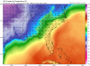
Looks like a good setup for coastal Georgia and southern SC. Elsewhere... cold rainEuro has a decent amount of shear but temps/dps are yawn, at least for CAE points northView attachment 73801


Anyone have some euro soundings for my area by chance with those parameters showing up.


Anyone have some euro soundings for my area by chance with those parameters showing up.

Can that weak confluence in SE Canada umm.... can it just --- off ??Looks like the Euro is showing the potential for elevated supercells down there. Gonna need the CAD to back off some to get sfc based storms and a tornado threat.
View attachment 73862


Not really a -NAO either during this, no wonder this is popping upWoah nelly


We talked about the 2nd half of Feb having severe. Crazy how we've gotten hereUmmm.... could this be the first legit severe weather setup of the season View attachment 73915View attachment 73916View attachment 73917
If I’m not mistaken phase 7 MJO is a favorable phase for severe weather for our areas so it’s not surprising anymoreWe talked about the 2nd half of Feb having severe. Crazy how we've gotten here
Wrong threadfor huntsville late mon afternoon/early evening, gfs has .34 freezing rain in two hours with a temp of 26!
This is the severe thread. Granted it has the same King Kong nameNO it's not, it the same thread we are talking about for early next week
Pretty sure this is the severe threadNO it's not, it the same thread we are talking about for early next week


Why do we need a server thread when it all falls under the winter storm thread.
Sent from my iPhone using Tapatalk

35 and rain with a rumble of thunder overhead, better then 33 and rain ?Oh so this is where the ones go when winter chances fail . Got it . I’ll be here later
Sent from my iPhone using Tapatalk
See you soonOh so this is where the ones go when winter chances fail . Got it . I’ll be here later
Sent from my iPhone using Tapatalk