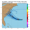
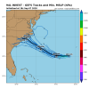
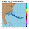
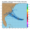
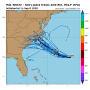
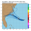
This one is tough. Major models like the GFS/UKMET/Euro and even the genesis happy CMC continue to do very little with this (just keeping it a low level trough) while the ICON and a few EPS members go up to a TS. Currently, the satellite loops show very little with no more than a sheared naked low level swirl moving W. The local NWS offices are going with little development. We'll see.
-
Hello, please take a minute to check out our awesome content, contributed by the wonderful members of our community. We hope you'll add your own thoughts and opinions by making a free account!
You are using an out of date browser. It may not display this or other websites correctly.
You should upgrade or use an alternative browser.
You should upgrade or use an alternative browser.
Tropical Invest 94L
- Thread starter SD
- Start date
RI would be good in this case because it would send it north-east off the outerbanks with little impact inland. A tropical storm would flood western NC on that track so let’s hope for RI.
Everything floods Wilkes County in your mind. I’m surprised you haven’t screamed about morning dew creating a mudslide in Wilkesboro.
Invest 94L now
AL, 94, 2020090718, , BEST, 0, 299N, 672W, 20, 1012, LO, 34, NEQ, 0, 0, 0, 0, 1014, 160, 90, 0, 0, L, 0, , 0, 0, INVEST, S, 0, , 0, 0, 0, 0, genesis-num, 041, SPAWNINVEST, al762020 to al942020
Convection has been building mainly on the southern and E ends of this the last few hours fwiw.
AL, 94, 2020090718, , BEST, 0, 299N, 672W, 20, 1012, LO, 34, NEQ, 0, 0, 0, 0, 1014, 160, 90, 0, 0, L, 0, , 0, 0, INVEST, S, 0, , 0, 0, 0, 0, genesis-num, 041, SPAWNINVEST, al762020 to al942020
Convection has been building mainly on the southern and E ends of this the last few hours fwiw.
Last edited:
Henry2326
Member
Henry2326
Member
12z GFS yesterday did the same thing....Again, the Euro has very little. What is does have, a very weak sfc low, goes to just offshore SC but it then stalls just offshore.
View attachment 48156
Everything except Laura flooded Wilkes. When you have multiple record setting years of rainfall like hickory and nearby it’s prone to flooding with each systemEverything floods Wilkes County in your mind. I’m surprised you haven’t screamed about morning dew creating a mudslide in Wilkesboro.
lexxnchloe
Member
This reminds me of hurricane Alex in 2004. It was not much to look at and no one expected it to do anything even when the NHC put out its first advisory.
ZCZC MIATCDAT1 ALL
TTAA00 KNHC DDHHMM
TROPICAL DEPRESSION ONE DISCUSSION NUMBER 1
NWS TPC/NATIONAL HURRICANE CENTER MIAMI FL
5 PM EDT SAT JUL 31 2004
THE LOW PRESSURE AREA OFF THE NORTHEAST FLORIDA COAST HAS SHOWN
INCREASING CONVECTIVE ORGANIZATION THIS AFTERNOON...WITH SATELLITE
INTENSITY ESTIMATES OF 30 KT FROM TAFB AND 25 KT FROM SAB. THUS...
ADVISORIES ARE BEING INITIATED ON THE SYSTEM AS TROPICAL DEPRESSION
ONE WITH 25 KT WINDS. WHILE THE DEPRESSION HAS A LARGE CYCLONIC
ENVELOPE...THE CENTER WAS VERY POORLY DEFINED ON THE RECONNAISSANCE
FLIGHT THIS MORNING...AND IT WOULD NOT BE A SURPRISE IF THE FLIGHT
SCHEDULED FOR 0000Z FINDS THE SAME.
THE INITIAL MOTION IS A SOMEWHAT UNCERTAIN 315/8. THE DEPRESSION IS
CURRENTLY BEING STEERED BY THE WESTERN END OF THE SUBTROPICAL
RIDGE...WHILE WATER VAPOR IMAGERY AND LARGE-SCALE MODELS SHOW
DEEP-LAYER TROUGHING OVER THE CENTRAL UNITED STATES MOVING EASTWARD.
ALL GUIDANCE SHOWS THE CYCLONE RECURVING NORTHEASTWARD AHEAD OF THE
TROUGH...WITH THE BIGGEST DIFFERENCES IN THE GUIDANCE BEING HOW
FAST IT MOVES AFTER RECURVATURE. THE OFFICIAL FORECAST TRACK WILL
CALL FOR THE SYSTEM TO TURN NORTHWARD AT ABOUT 24 HR AND
NORTHEASTWARD AFTER 36 HR...BRUSHING THE SOUTHEASTERN U.S. COAST.
WHILE THE OFFICIAL TRACK CALLS FOR LANDFALL IN NORTH CAROLINA...
SEVERAL MODELS RECURVE THE CYCLONE SHARPLY ENOUGH TO KEEP THE
CENTER OFFSHORE.
THIS LARGE AND POORLY DEFINED SYSTEM WILL LIKELY TAKE TIME TO
CONSOLIDATE EVEN THOUGH CONDITIONS GENERALLY APPEAR FAVORABLE FOR
INTENSIFICATION. THE INTENSITY FORECAST THUS CALLS FOR SLOW
STRENGTHENING UNTIL THE SYSTEM REACHES THE COAST. WHAT
INTENSIFICATION MAY OCCUR AFTER THE CYCLONE CLEARS THE U.S. EAST
COAST IS QUESTIONABLE...AS THE LARGE SCALE MODELS DISAGREE ON
WHETHER IT WILL DISSIPATE OR STRENGTHEN DURING INTERACTION WITH THE
WESTERLIES. FOR NOW...THE INTENSITY FORECAST WILL COMPROMISE
BETWEEN THE TWO EXTREMES AND KEEP A STEADY 40 KT UNTIL
EXTRATROPICAL TRANSITION.
THE PROXIMITY TO THE COAST REQUIRES A TROPICAL STORM WATCH TO BE
ISSUED FOR PORTIONS OF THE COASTS OF NORTH AND SOUTH CAROLINA AT
THIS TIME. A TROPICAL STORM WARNING MAY BE REQUIRED IN A LATER
ADVISORY.
FORECASTER BEVEN
They forecast it to maybe make it to 40 mph before moving quickly NEand dissapating. Turned out to be a 120 mph cat3
Globals, including the Euro or especially the Euro, have struggled with genesis this year. It may turn out to be basically nothing but we shall see
Henry2326
Member
accu35
Member
94L way south on the Nam


accu35
Member
Yeah the 18z eps has been showing this a while now and now the Nam is showing the same FWIW lol.Yeah, I noticed the same thing on the 18z EPS.
View attachment 48168
0Z UKMET says nada:
TROPICAL DEPRESSION 94L ANALYSED POSITION : 29.4N 67.5W
ATCF IDENTIFIER : AL942020
LEAD CENTRAL MAXIMUM WIND
VERIFYING TIME TIME POSITION PRESSURE (MB) SPEED (KNOTS)
-------------- ---- -------- ------------- -------------
0000UTC 08.09.2020 0 29.4N 67.5W 1010 20
1200UTC 08.09.2020 12 CEASED TRACKING
Henry2326
Member
Henry2326
Member
40% now
1. An area of low pressure is located about 300 miles west-southwest of
Bermuda. Showers and thunderstorm activity associated with the low
has increased since last night, but remains somewhat disorganized.
Gradual additional development of this system is possible during the
next two or three days and it could become a tropical depression
while it moves slowly westward to west-northwestward. Interests
along the southeast coast of the U.S. should monitor the progress of
this disturbance.
* Formation chance through 48 hours...low...30 percent.
* Formation chance through 5 days...medium...40 percent.
Henry2326
Member
This feels like Hanna, except in this case NHC has decided to watch...40% now
1. An area of low pressure is located about 300 miles west-southwest of
Bermuda. Showers and thunderstorm activity associated with the low
has increased since last night, but remains somewhat disorganized.
Gradual additional development of this system is possible during the
next two or three days and it could become a tropical depression
while it moves slowly westward to west-northwestward. Interests
along the southeast coast of the U.S. should monitor the progress of
this disturbance.
* Formation chance through 48 hours...low...30 percent.
* Formation chance through 5 days...medium...40 percent.

Time for obs thread? up to nearly a 100% chance based on the models for 1-3” rain bands to start moving in late tonight from the eastern OBX all the way to the blue ridge mtns. The system is bringing tropical moisture for all as seen on NAM and nearly all short term guidance for this week and I believe any stronger cells could produce flash flooding with 1-2” rates.
No obs thread.... just discuss anything with this system in here for now. We have enough threads atm.Time for obs thread? up to nearly a 100% chance based on the models for 1-3” rain bands to start moving in late tonight from the eastern OBX all the way to the blue ridge mtns. The system is bringing tropical moisture for all as seen on NAM and nearly all short term guidance for this week and I believe any stronger cells could produce flash flooding with 1-2” rates.
Henry2326
Member
Downeastnc
Member
Henry2326
Member
Henry2326
Member
Shaggy
Member
I'd say the LLC looks a little better today but it just cant fire any storms
I have a feeling models gonna bust on those rain totals..I mean tropical pwats 1-2” being shoved west against the mtns...plus some storms on the NAM...I could see some 3-6” totals by Sunday maybe more.
Henry2326
Member
Bannerdude
Member
Shear environment has improved and consequently there's a nice blowup of convection around the COC this morning
As I expected, over performing for some currently down East with flash flood warnings along the NC/VA border area. More to come
As I expected, over performing for some currently down East with flash flood warnings along the NC/VA border area. More to come
So, do you like, make up your own warning criteria or am I missing something?
Downeastnc
Member
As I expected, over performing for some currently down East with flash flood warnings along the NC/VA border area. More to come
The rain right now really isnt associated directly with 94L...."94L" is still well south of NC and struggling to maintain even small storm flare ups around its llc....
Henry2326
Member
NHC AT 0% chance of development....
Tornadocane
Member
Moderators should just change the thread to "That New Mess in the Bahamas", because it'd be a Cinderella Story if it manages to develop.
lexxnchloe
Member
It needs to be watched.
Tornadocane
Member
So on Satellite I saw this big swirl to the SW of Haiti that looked like an upper level low that's producing some shear over the Bahamas.
So I says to myself, "Let's see if the 200Mb vorticity map has it", and there it was on the map. Looks like it's trying to scoot away to the WNW.
So I says to myself, "Let's see if the 200Mb vorticity map has it", and there it was on the map. Looks like it's trying to scoot away to the WNW.
North Atlantic - 200mb Vorticity - Latest Available - Large Scale
tropic.ssec.wisc.edu
lexxnchloe
Member
94 is gone but this is something different.
94L, itself, turned out to be nothing, which means the non-ICON global models not having genesis did well and the ICON’s having had genesis on numerous runs along with a landfall in the Carolinas until not that long ago make it a big fail.Globals, including the Euro or especially the Euro, have struggled with genesis this year. It may turn out to be basically nothing but we shall see
Tornadocane
Member
I don't know why NWS Miami updated their forecast with only a 50% and 30% chance of rain today and tonight. We already got an inch and Ft. Lauderdale received over a half inch. Miami is closing in on 2 inches. We should be under some sort of flood watch at this point. Even the low resolution models are picking up on the heavy rain over the next 72 hours.

