Shaggy
Member
Broke my streak with a rainless day so far.
Ok, now I quit. It's not raining...
View attachment 46466
Broke my streak with a rainless day so far.
I’m pretty busy right now, but I will explain tomorrow.I care, what’s up B?

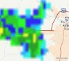
When a thunderstorm merely 8 miles away leaves you with stratiform gunk.... ?
This is a good start to knock down the humidity. Bring it!!Came in a couple of degrees cooler than 18z.. I think upper 60s are a lock, but mid 60s will be pushing it at the CHA airport, where temps always seem to run a few degrees warmer than everywhere else in the city: View attachment 46473
Didn't you just say that?I don’t see 3-4” happening today per flash flood watch. Too much activity just east of the OBX is robbing plus too foggy and clouds with drizzle no storms

") )
)2.31" last night. Should have bought the snorkel.
View attachment 46478
But I won't, bc I'm sure this is the last rain I'll see till Thanksgiving.. (
Looks at current setup, yep, that's a mess.
There's just a bunch of crap out there this morning. Sfc convergence along the nc/va border, mcv north of CLT moving north, maybe a weak mcv in Eastern nc, numerous outflows, extensive stratus deck, trough axis still to the west, CU bubbling to the south where they have gotten into some sun, almost a closed 850mb feature to the west, potential weak sfc low/loose mcs developing later. It all points to some corridor of the state getting a lot of rain today but where?Whatch you talkin bout Willis.
Sent from my iPhone using Tapatalk
There's just a bunch of crap out there this morning. Sfc convergence along the nc/va border, mcv north of CLT moving north, maybe a weak mcv in Eastern nc, numerous outflows, extensive stratus deck, trough axis still to the west, CU bubbling to the south where they have gotten into some sun, almost a closed 850mb feature to the west, potential weak sfc low/loose mcs developing later. It all points to some corridor of the state getting a lot of rain today but where?
Yeah it's not clear cut at all. I could see RAH maybe extending the FFW south a layer of counties. My guess is initiation along the sfc convergence between 40 and the Va border that sends an OFB south, as the mountain storms and upper trough move east it interacts with the ofb and the axis of big totals is along and south of 40.Yeah the HRRR is struggling keeps changing every run.
Sent from my iPhone using Tapatalk
Getting lucky here, getting some breaks in the clouds and some sunThere's just a bunch of crap out there this morning. Sfc convergence along the nc/va border, mcv north of CLT moving north, maybe a weak mcv in Eastern nc, numerous outflows, extensive stratus deck, trough axis still to the west, CU bubbling to the south where they have gotten into some sun, almost a closed 850mb feature to the west, potential weak sfc low/loose mcs developing later. It all points to some corridor of the state getting a lot of rain today but where?
Stratus is really taking a beating everywhere now on visible. Still locked in hereGetting lucky here, getting some breaks in the clouds and some sun
Yeah nothing but clouds. 77F but the humidity.. 88%Stratus is really taking a beating everywhere now on visible. Still locked in here
Even with the clouds you've got some decent new cells popping up to your south and west.Yeah nothing but clouds. 77F but the humidity.. 88%

600+dm no big deal. So happy this didn't go up over the SEView attachment 46479