YesDo you guys think north ga could see some storms tomorrow?
-
Hello, please take a minute to check out our awesome content, contributed by the wonderful members of our community. We hope you'll add your own thoughts and opinions by making a free account!
You are using an out of date browser. It may not display this or other websites correctly.
You should upgrade or use an alternative browser.
You should upgrade or use an alternative browser.
Severe Severe Threat 3/24-3/27
- Thread starter SD
- Start date
ForsythSnow
Moderator
Actually, by looking at the models, I would argue not at all. Only some heavy isolated showers and isolated thunderstorms from what I can tell.
Storm5
Member
Holy hail !!!! Look at these bad boys from Texas


Sent from my iPhone using Tapatalk


Sent from my iPhone using Tapatalk
Storm5
Member

Sent from my iPhone using Tapatalk
skywatcher
Member
This was what destroyed my car (and my roof) in 2009. I was in the house, and it was an insane sound hearing tennis ball size hail hitting the roof, breaking the security lights, etc. The cats totally freaked out.

6z NAMs were pretty impressive for parts of west tn, north ms for later today the GFS isn't quite as impressive will be interesting to see who wins today
NWMSGuy
Member
Certainly ready to see how this plays out today!6z NAMs were pretty impressive for parts of west tn, north ms for later today the GFS isn't quite as impressive will be interesting to see who wins today
Bama Ravens
Member
Enhanced risk is now in the NW corner of Alabama.

NWMSGuy
Member
Lots of breaks in the cloud cover being observed in Northwest MS. Looks to be warming up outside.
Lots of breaks in the cloud cover being observed in Northwest MS. Looks to be warming up outside.
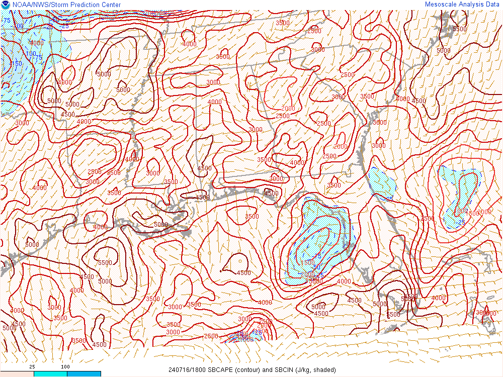
SBCapes over 2000 according to the RAP at this point over most of MS and AL.
Bama Ravens
Member
SBCapes over 2000 according to the RAP at this point over most of MS and AL.
Last edited:
olhausen
Member
Woke up to some serious thunder boomers this morning! I see my area is under an enhanced risk for severe storms. Looking at the tornado threat it seems low correct?
Woke up to some serious thunder boomers this morning! I see my area is under an enhanced risk for severe storms. Looking at the tornado threat it seems low correct?
Yes overall, but as it is with anytime you will have strong supercells, don't sleep on it.
Bama Ravens
Member
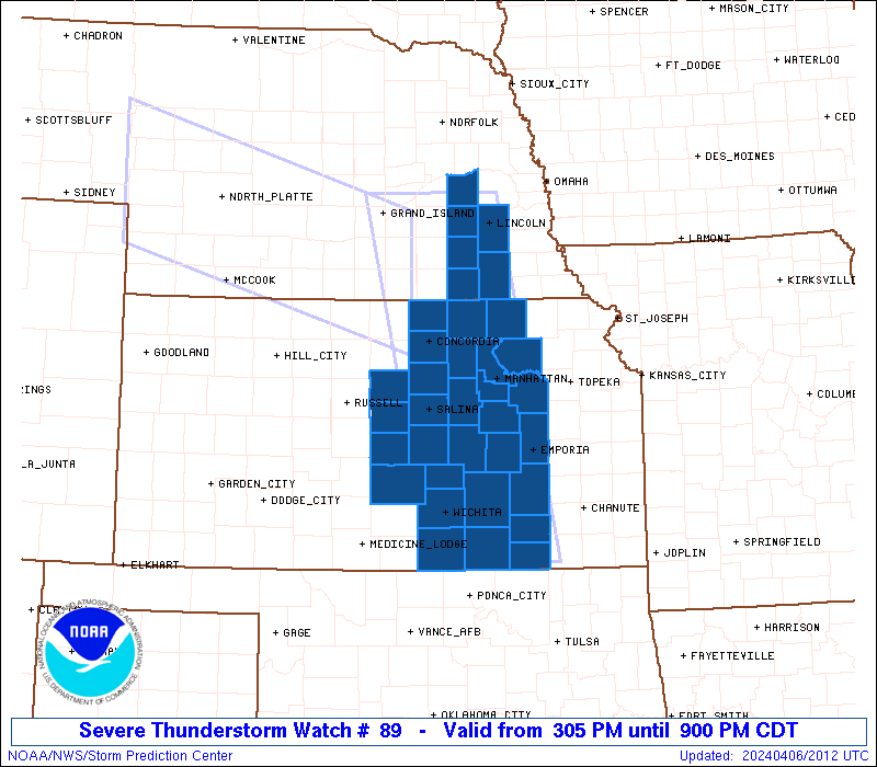
Severe T'storm Watch for western TN possible by 1pm CDT:

Bama Ravens
Member
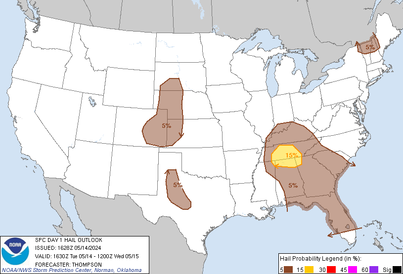
30% hatched area for hail
NWMSGuy
Member
Thunderstorms starting to fire quickly over North MS! Severe Thunderstorm warnings going up.
Bama Ravens
Member
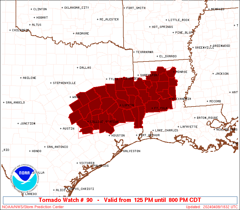
Effective this Monday afternoon and evening from 1205 PM until
800 PM CDT.
* Primary threats include...
Scattered large hail and isolated very large hail events to 2.5
inches in diameter possible
Scattered damaging wind gusts to 70 mph possible
A tornado or two possible
SUMMARY...Severe thunderstorms will continue to develop within an
increase moist and unstable air mass across the region. Mostly
linear bands of severe thunderstorms will spread east-northeastward
across northwest Tennessee into west-central Kentucky, while more
isolated storms are expected across northern Mississippi into
west-central Tennessee. Large hail and damaging winds can be
expected, and at least some tornado risk could gradually increase
through the afternoon.
Bama Ravens
Member
New severe thunderstorm watch:
Storm5
Member

Sent from my iPhone using Tapatalk
Early hours would advise any West Georgia folks to be mindful as atmosphere is supportive these storms early on before they die off moving NE to make it a lil bumpy perhaps in areas of extreme West- Central and North West Ga
Pretty good amount of -10-30c CAPE across Tn/MS/Al should get quite a few really large hail reports
NWMSGuy
Member
I wonder if more storms are expected to fire over watch 89 in the next few hours? Especially over western sections.Pretty good amount of -10-30c CAPE across Tn/MS/Al should get quite a few really large hail reports
Storm5
Member
Storms really starting pop across Mississippi

Sent from my iPhone using Tapatalk

Sent from my iPhone using Tapatalk
I would guess there would be another west to east moving line developing soon. Perhaps those storms in Ark are the beginningI wonder if more storms are expected to fire over watch 89 in the next few hours? Especially over western sections.
Storm5
Member
Guntersville Alabama hail

Sent from my iPhone using Tapatalk

Sent from my iPhone using Tapatalk
Storm5
Member
Big hail north of Philadelphia MS

Sent from my iPhone using Tapatalk

Sent from my iPhone using Tapatalk
Storm5
Member

Sent from my iPhone using Tapatalk
Storm5
Member
Hail reports are flying in now
Sent from my iPhone using Tapatalk
Sent from my iPhone using Tapatalk
thanksgivingbrown
Member
Tornado Warning for Franklin County, Alabama. Tracking northeast towards Russellville
Storm5
Member
Tornado Warning for Franklin County, Alabama. Tracking northeast towards Russellville

Sent from my iPhone using Tapatalk
According to the report a funnel cloud was spotted in that one...An off duty NWS employee reported a funnel cloud with this same storm in the last few minutes
Sent from my iPhone using Tapatalk
gawxnative
Member
Cell behind the first showing a tightening couplet....
And just got Tornado Warned as I typed
And just got Tornado Warned as I typed
gawxnative
Member

pcbjr
Member
T'nado Warning showing up on NWS radar for NW Alabama

pcbjr
Member
and ... 

Good grief.
Storm5
Member
Damn huge hail in walker county

Sent from my iPhone using Tapatalk

Sent from my iPhone using Tapatalk