-
Hello, please take a minute to check out our awesome content, contributed by the wonderful members of our community. We hope you'll add your own thoughts and opinions by making a free account!
You are using an out of date browser. It may not display this or other websites correctly.
You should upgrade or use an alternative browser.
You should upgrade or use an alternative browser.
Pattern April Chasing ???⛈⛈⛈
- Thread starter TheBatman
- Start date
It looks like the high today will be 84*F, I think making this the warmest day of the year.
Make that 85*F
B
Brick Tamland
Guest
Didn't want to clutter up the storm threads with this, but I am really worried about the severe threats this weekend and the middle of next week. Especially for the middle of next week, since it could possibly happen in my backyard. I just have a feeling these will be bad because of the timing being about the same time of the April 2011 outbreak, and for some reason a lot of bad things seem to happen in April, especially between the 15th and 30th.
Webberweather53
Meteorologist
For those interested, I just updated my NCEP-NCAR MEI index for February-March. This is the 2nd month in a row that the bi-monthly Empirical Orthogonal Function (EOF) rankings were in moderate El Nino territory. Outgoing Longwave Radiation was most supportive of an El Nino in Feb-Mar w/ the EOF reaching nearly +1.5 sigma. Interested to see how long this El Nino persists into the spring & summer.

https://www.webberweather.com/multivariate-enso-index.html
https://www.webberweather.com/multivariate-enso-index.html
I don't see it for us yet.Didn't want to clutter up the storm threads with this, but I am really worried about the severe threats this weekend and the middle of next week. Especially for the middle of next week, since it could possibly happen in my backyard. I just have a feeling these will be bad because of the timing being about the same time of the April 2011 outbreak, and for some reason a lot of bad things seem to happen in April, especially between the 15th and 30th.
Sent from my SM-G955U using Tapatalk
NBAcentel
Member
Didn't want to clutter up the storm threads with this, but I am really worried about the severe threats this weekend and the middle of next week. Especially for the middle of next week, since it could possibly happen in my backyard. I just have a feeling these will be bad because of the timing being about the same time of the April 2011 outbreak, and for some reason a lot of bad things seem to happen in April, especially between the 15th and 30th.
I’d be worried about isolated pulse storms at this time, needa hope and pray for areas with a tornado threat to our west these upcoming days that things don’t get bad
The high today is 85*F again (at least).
NoSnowATL
Member
The high today is 85*F again (at least).
A few more weeks of this and pollen will be done.
Sent from my iPhone using Tapatalk
Fountainguy97
Member
18z hrrr is very aggressive with discreet cells across NC tmrw with a sounding that could support some weak super-cellular structure and a spin up or two..
Of course its the hrrr.

Of course its the hrrr.
Brent
Member
90 yesterday and today struggling to stay around 60
April madness
April madness
Fountainguy97
Member
3km sounding out in front of cells moving into Central NC tmrw afternoon is also supportive of some weak super-cellular activity.
Will come down to initiation and if any cells can get established. Will be a small window late afternoon tomorrow in Central NC.

Will come down to initiation and if any cells can get established. Will be a small window late afternoon tomorrow in Central NC.
pcbjr
Member
When CPC issues these two models the same day and they generally agree, one should pay attention ...


Lol CLOWN MAP FROM FV3 ... these next few weeks are going to wild in terms of extreme weather I believe
they really should just scrap that FV3. i made the mistake of showing my daughter how to pull it up and i've had to answer since December why we aren't getting all that snow it forecasted, and now i'm going to have to explain away April 21. I may have to call my congressman.
they really should just scrap that FV3. i made the mistake of showing my daughter how to pull it up and i've had to answer since December why we aren't getting all that snow it forecasted, and now i'm going to have to explain away April 21. I may have to call my congressman.
Trump could do it, himself. Rumor has it he hates the FV3 because of the cold bias and loves the old GFS. Had he not allowed the govt shutdown, the FV3 might already be operational. I think he wants to make the old GFS great again.
NBAcentel
Member
3km sounding out in front of cells moving into Central NC tmrw afternoon is also supportive of some weak super-cellular activity.
Will come down to initiation and if any cells can get established. Will be a small window late afternoon tomorrow in Central NC.
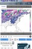
View attachment 18761
Yep, I’m assuming a little boundary will develop supporting elevated amounts of storm relative helicity, decent CAPE, low LCLs, gonna be some nice structures tommorow if these things can stay separated
NBAcentel
Member
I’m not making a thread on this because many people will probably find it as clutter, which I understand, but hrrr (trrrash) but still helpful I guess spits out supercells in NC tommorow, ones in eastern/central NC have higher helicity than the ones around CLT (90-120) here’s a sounding from my area (Salisbury) tommorow, soundings aren’t that supportive of tornadoes but more of a wind/hail threat but could support a spin up, especially areas to the east 

The Big Wet just keeps rolling on around here. Ive never seen it as wet as it is in April right now. After 2 full days of sun, mower still spins in low areas. Looks like another 3 inches is in route for the weekend with more to follow middle next week.
I’ve had about .7 of rain in the past month. Drought creeping up in S Ga and S SC! Heading this way!
Fountainguy97
Member
Latest hrrr continues to bring a line of supercells into Central NC

This is a sounding in Wake county right in front of one of the supercells. This sounding is actually a decent sounding for a tornado today.

This is a sounding in Wake county right in front of one of the supercells. This sounding is actually a decent sounding for a tornado today.
NBAcentel
Member
gonna be nasty storms today in NC, weakly rotating supercells/multicellular clusters, if storms stay separated today, could be some nice structure/shelfies, unfortunately we might deal with damaging winds and large hail and maybe a spin up 


B
Brick Tamland
Guest
Latest hrrr continues to bring a line of supercells into Central NC
View attachment 18786
This is a sounding in Wake county right in front of one of the supercells. This sounding is actually a decent sounding for a tornado today.
View attachment 18787
And we're not even under a marginal threat today, and it seems WRAL doesn't think there is much of a threat today. They were hyping up Sunday's threat more. But if it's like the past few years, we've actually had worse storms when we're not under any kind of watch, and hardly anything when we are.
Some solid training going on here

HEAVY, gully washer,frog strangler rain again.
The high today was *ONLY* 80*F, under a thick cirrostratus deck much of the day.
BTW, I also noticed the 12z GFS, EURO and GGEM significantly backed off on the extent of the "cold blast" in the long range. 
Last edited:
Thankfully. I was really concerned about that causing some frost/freeze problems.BTW, I also noticed the 12z GFS, EURO and GGEM significantly backed off on the extent of the "cold blast" in the long range.
Sent from my SM-G955U using Tapatalk
Under Flash Flood Warning. I sound like a broken record. But 2018 set the all time record for wettest year ever
At Greensboro. We are way ahead in 2019 compared to this time last year.
At Greensboro. We are way ahead in 2019 compared to this time last year.
Something tells me we are setting up for a dry summerUnder Flash Flood Warning. I sound like a broken record. But 2018 set the all time record for wettest year ever
At Greensboro. We are way ahead in 2019 compared to this time last year.
Sent from my SM-G955U using Tapatalk
80/71 hello summer
Sent from my SM-G955U using Tapatalk
Sent from my SM-G955U using Tapatalk
Looks like 85*F will be the high yet again today.
Picked up another 1.10" of rain with this mornings storms... brings my MTD total up to 4.83". Definitely a wet start to Spring in my neck of the woods for sure. At least the pollen has been washed away for now I suppose lol.
Seeing some broad low amp waves in the long range on both GFS and Euro. May be a change from the more amped up waves we have been seeing.
Have recorded to 79*F so far.
Getting some strong wind gusts too.
Getting some strong wind gusts too.
Have recorded to 79*F so far.
Getting some strong wind gusts too.
We tagged 80*F as of the last observation.
pcbjr
Member
My turn ...

GeorgiaGirl
Member
Immaculate forecast:
Sunny, with a high near 71. West wind 14 to 16 mph.
Only thing that would make it better is if you halved the winds.
Sunny, with a high near 71. West wind 14 to 16 mph.
Only thing that would make it better is if you halved the winds.
Snowing in Boone this morning currently. Nice little shower just passed through
pcbjr
Member
Just for Monday lunch hour kicks ...

Watch the 22-24th. This is the type of system to cause big problems.