NBAcentel
Member
Fv3 also has the deform band of doom
Why is this 192 hours out

Why is this 192 hours out


Lol -20% chance. Fun to look at, though!
Gfs/fv has minimal support by its ensembles (gefs), altho they did take a better turn for the storm the gfs/FV is showing atm

Third year in a row where we had a snow threat in March, it would be funny if this run verified.Big snow NC on 12Z GFS on 3/26! And there's even 1-2" of snow way on down at the @GeorgiaGirl abode!
Big snow NC on 12Z GFS on 3/26! And there's even 1-2" of snow way on down at the @GeorgiaGirl abode!


I think maybe if it was the Fv3 showing this 240+ hours out then yeah I would agree ... but we have similar agreement on the same style of a system on both gfs twins the euro and CMC along with slow ensemble support should give a 168 hour threat a little more legitimacyExtremely hard for me to believe that a system coming from the trajectory shown, in late March, at 168 hours out is going to produce a southeast snowstorm.
Extremely hard for me to believe that a system coming from the trajectory shown, in late March, at 168 hours out is going to produce a southeast snowstorm.
I think maybe if it was the Fv3 showing this 240+ hours out then yeah I would agree ... but we have similar agreement on the same style of a system on both gfs twins the euro and CMC along with slow ensemble support should give a 168 hour threat a little more legitimacy
Euro showed something and When the dv3 shows nothing it’s right but when it shows snow it’s wrong? It has the storm signal that’s the key rn ... I would like to see how the gefs are tho for confidence sakeThe 12z Fv3 was well north, the ICON was as well. The 12z CMC is stuck at 108 for me on TT but so far all we really have is a storm signal with one model showing something wintry and the rest to our north/warm and rainy. It will be awhile before specifics can be nailed down but overall we need a PERFECT setup and timing to occur given the time of year... I just don't see it happening right now.
Lol very true but we got it to (at least in NC) work out before winter started so hopefully we will get it to work our after it’s over lmaoWe can't even get things to work out in the heart of winter so no reason to expect this to be any different, especially this time of year. It's good for entertainment purposes at least but chances of this working out for us are pretty low. If anything I'd bet on this verifying as a nice, boring, cold rain.
High ratio snow in late March almost early April???? What sun angle or ground temperature problems?? HahaLMAO, RDU on the 12Z GFS is a frigid near 23 at 2 PM on 3/26, which is only some 35 degrees colder than normal for 3/26 and 25 colder than normal for a mid Jan day!
Euro showed something and When the dv3 shows nothing it’s right but when it shows snow it’s wrong? It has the storm signal that’s the key rn ... I would like to see how the gefs are tho for confidence sake
There is like zero chance that this thing holds all the way in from here. Even in the dead of winter, as you said earlier, we usually whiff. Models almost always press the cold too far south. This one looks exactly like a case of that to me. Not to poo poo @Nick_boynton_ because it's definitely fun to watch and track. And you're right, Nick, we need to look for ensemble support and other model support. But prior to 18z yesterday, I don't think we have had much shown in the way of wintry weather. We need the aforementioned support through many cycles to consider this a legitimate threat at this range. If we were 72 hours out and had this same scenario before us, I would argue that we indeed had a legit threat. But at this point, it's little more than a mirage, IMO. If all models were consistently showing a big block, I might feel differently. Anyway, it will be interesting and fun to watch over the next few days. Hopefully, we get a growing support and this event bucks the seasonal trends and historical norms for storms at this range.After all the major issues of the Fv3 I don’t trust it no matter what it shows. The biggest thing is we need more than GFS/GEFS support, we need the Euro consistently on board and the UK especially under 144 hours. Tomorrow we will know a lot more but right now it doesn’t look like a good chance.
Halloween ‘14, says HolaExtremely hard for me to believe that a system coming from the trajectory shown, in late March, at 168 hours out is going to produce a southeast snowstorm.
Is it fair to assume that if its 23 in Raleigh then temps are in the teens or single digits in the Mid Atlantic ?LMAO, RDU on the 12Z GFS is a frigid near 23 at 2 PM on 3/26, which is only some 35 degrees colder than normal for 3/26 and 25 colder than normal for a mid Jan day!


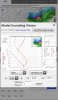
GEFS support doesn't really mean anything over one or two or three cycles at 168. We've seen this over and over and over. All kinds of groovy looking ensemble members that morph to 0 as we move in. What we need is broad model good agreement on a credible synoptic scenario that makes for an anomalously far south cold press a legitimate possibility. What we have is this:Speaking of GEFS support, I guess it has some..... still I'm not buying it (and hope I'm wrong)
View attachment 17888

I agree, in fact if you want to get technical imo none of the models output mean anything over one or two or three cycles at 168, 140, 120, 84, heck 72 (coastal this week). I was just throwing it out there. Trust me I'm out on this and will be shocked beyond belief if anything remotely to what the GFS is showing occurs.GEFS support doesn't really mean anything over one or two or three cycles at 168. We've seen this over and over and over. All kinds of groovy looking ensemble members that morph to 0 as we move in. What we need is broad model good agreement on a credible synoptic scenario that makes for an anomalously far south cold press a legitimate possibility. What we have is this:
View attachment 17890
What is there to press the PV that far south just prior to and during the storm, thus allowing cold air to be tapped and the storm to stay south? I don't know, but I do know that we've seen this same look show up a lot, only to verify farther north. I wish we had a big block up north of it. That would help. I do like the high pressure though. Maybe we can rely on that? But we've seen those verify weaker also. But maybe we get lucky this time.