Pattern Jammin January 2024
- Thread starter SD
- Start date
-
Hello, please take a minute to check out our awesome content, contributed by the wonderful members of our community. We hope you'll add your own thoughts and opinions by making a free account!
You are using an out of date browser. It may not display this or other websites correctly.
You should upgrade or use an alternative browser.
You should upgrade or use an alternative browser.
Yes, welcome to April! It looks like these temps will be here for three days and then, after a short "normal" period, returning next weekend. It will probably erase all of the negative departures so far and most locations will end up at or above normal for the overall monthly average. My average temp for the month is already up to 39 degrees just from today alone. It was at 36 prior to this. I think the daily average is about 45 for my area. I have 7.5" of rain since 1/1/2024!REALLY?
Well "officially" January Thaw as the Spring Peepers are having a loud sustained "chorus" here this evening after my high here of 74.7 !!!
It’s straight up lightening and thundering.
It's not even over yet and this is what I have for the month so far. Too bad this wasn't the snow total but the drought's almost gone.


I just got back home and emptied 4.1" out of my gauge and I'm right there with you at 10.7" for the month.It's not even over yet and this is what I have for the month so far. Too bad this wasn't the snow total but the drought's almost gone.
View attachment 143388
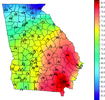
Crazy we have these precip totals and we’re running around 5 degrees below normal for the month of January and no snow 
It will be at or above before January ends, though.Crazy we have these precip totals and we’re running around 5 degrees below normal for the month of January and no snow
Mountain Brethren will see flakes flying Sunday night into Monday a.m.; Then have another better round coming up Wed into Thursday. This one could surprise a few east of the apps/ minor. But it beats this sultry air we are experiencing this morning, Thankfully it will be gone within 48 hours. Temps and DP's in the mid 60's currently.

I’m not sure where you’re getting 5 degrees below normal but Atlanta is at 2 below normal for the month.Crazy we have these precip totals and we’re running around 5 degrees below normal for the month of January and no snow

You’re normally better than this. It’s been documented well enough on here that Atlanta is skewed well above stations nearby and in all directions.I’m not sure where you’re getting 5 degrees below normal but Atlanta is at 2 below normal for the month.
Take him to school @J.C.
You’re normally better than this. It’s been documented well enough on here that Atlanta is skewed well above stations nearby and in all directions.
Take him to school @J.C.
KPDK is -3
KFTY is -3.4
Carrollton is -3.8
Dallas is -4.8
KATL is -2.4
All of these are after factoring in yesterday.

Today and tomorrow will erase all deficits, everywhere in GA.KPDK is -3
KFTY is -3.4
Carrollton is -3.8
Dallas is -4.8
KATL is -2.4
All of these are after factoring in yesterday.
Unfortunately.Today and tomorrow will erase all deficits, everywhere in GA.
I'm at 48.1F/29.6F and rapidly going up.
Makes sense, you are around 38.85 for a daily average and I'm at 40.5. Average is around 45 I think, though it's rising daily now that we are approaching February. I doubt she holds below average. Got a good bit of rain, which is expected. I think this winter season has played out as expected for my area. Hopefully we can keep the "cool" season going to suppress the severe season in April.Unfortunately.
I'm at 48.1F/29.6F and rapidly going up.
Ending January with a bang...more rain. Jimmy jackpots down in GSP 
Interesting situation in regards to severe weather tomorrow. Threat is conditional. Depending on how atmosphere recovers. SPC mentioning the possibility of some low topped super cells. If instability can be realized. I love a good low topper!
Extensive convection will likely be ongoing Saturday morning from
near the LA Gulf Coast into parts of MS/AL, within the warm conveyor
region of the developing cyclone. Rich low-level moisture and
favorable low-level and deep-layer shear will support organized
convection, with some morning threat for locally damaging wind and
possibly a tornado or two from southeast LA into southern MS/AL and
eventually the FL Panhandle. This initial band of convection may
reach southwest GA by early afternoon with an isolated severe
threat, before weakening as large-scale ascent becomes displaced to
the north.
In the wake of morning convection, some low-level moistening is
expected across much of AL into far southern TN, in advance of a
cold front that will be moving eastward in conjunction with the
surface low. Relatively steep midlevel lapse rates will also
overspread the region, resulting in the potential for MLCAPE to
increase to at least 500 J/kg range, though the magnitude of
destabilization will depend on the extent of heating/moistening in
the wake of morning convection, which remains uncertain at this
time. If robust convection can evolve and be sustained, a few
relatively low-topped supercells may evolve with time along/ahead of
the cold front and spread eastward with a threat of a couple
tornadoes, isolated damaging wind, and small to perhaps marginally
severe hail.

Wes Wyatt just posted these for tomorrow. Looks interesting.