No change in text discussion from NWS earlier today:
.SHORT TERM...
(This afternoon through Thursday)
Issued at 232 PM EDT Wed Apr 10 2024
Primary forecast issue for the day will be the potential for
thunderstorms and severe weather, including
flash flooding, across
southern portions of the
CWA this evening and into the overnight
hours.
Strong/severe line of thunderstorms moving east along the Gulf Coast
this afternoon. The models have struggled with this system from run
to run, especially the track of the system. This initial system may
bypass much of the
CWA to the south, but the SW corner of the
outlook
area would have the best chances from seeing any convective impacts
from the line.
The
hi-res models continue to fire
shra/
tsra on the backside of any
initial line that moves through during the evening in association
with strong mid level energy/
trough. This secondary system may end up
evolving into another broken line of strong/potentially severe
thunderstorms overnight and into early Thursday morning. The primary
convective severe hazards will be damaging wind gusts and brief
tornadoes.
The secondary area of
convection likely to develop with the
trough/strong
shortwave energy will
likely impact areas well north
of the Columbus to Macon line overnight. The convective mode may be
a bit more messy than down south, with widespread showers with
embedded
thunder.
Another potential hazard will be heavy
rainfall across portions of
the southern
CWA. With repeated convective systems moving across,
each one producing locally heavy
rainfall, have gone ahead and
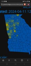
issued a
Flood Watch for the potential for
flash flooding. For areas
mostly along and south of a line from Columbus to Macon and along
and west of I-75. Widespread 2 to 4 inches of
rainfall is
likely
with some locally higher amounts up to 5 inches possible.
Winds are expected to become gusty behind the
front later Thursday
into Thursday night. The pressure
gradient will tighten as a
deepening low pressure system moves from the Lower Mississippi River
Valley into the Ohio Valley tonight and early Thursday. Will hold
off issuing a Wind Advisory for now, but it may need to be
considered on later shifts.
NListemaa