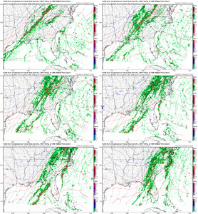
Severe threat for Dec 9-11 2023
-
Hello, please take a minute to check out our awesome content, contributed by the wonderful members of our community. We hope you'll add your own thoughts and opinions by making a free account!
You are using an out of date browser. It may not display this or other websites correctly.
You should upgrade or use an alternative browser.
You should upgrade or use an alternative browser.
Severe 12/9-11 Severe
- Thread starter SD
- Start date
tennessee storm
Member
Bout. 3 days ago. This system looked pretty legit…. With a good tornado setup across south …. Looking more likely a squall Line threat mainly
W
WSW
Guest
Yeah looks like a squall line more than anything. Could be some pretty high gusts.Bout. 3 days ago. This system looked pretty legit…. With a good tornado setup across south …. Looking more likely a squall Line threat mainly
Yep LLJ is rocking once it gets into the apps and east with winds at and above 900mb over 50kt. Doesn't take a ton to translate that downYeah looks like a squall line more than anything. Could be some pretty high gusts.
Shaggy
Member
Will be interesting to see how the gradient winds can mix that down even before the storms. Wilmington says gusts to 40 seem possibleYep LLJ is rocking once it gets into the apps and east with winds at and above 900mb over 50kt. Doesn't take a ton to translate that down
JHS
Member
By Sat night, the atmos become quite dynamic to the west as an acute
h5 trof develops across the MS Valley and initiates a stg wavy sfc
front over middle TN. This front will be the main weather-maker Sun
as it will be supported with high shear thru a deep layer and
increasing upper divergence due to coupled jets crossing the area. A
pre-frontal trof pushes into the NC mtns arnd 18z (good model
consensus on timing) and the overall synoptic forcing will be high
enuf to likely produce QLCS even with relatively low instability to
work with.
The models continue to indicate arnd 100-250 J/kg of sbCAPE by mid-
afternoon ahead of the sfc convg zone, thus a high-shear low-CAPE
setup looks to be in store. Expect semi-organized lines of convect
capable of producing bowing segments and possible broken-S tors in
addition to stg/svr mixed-down straight line winds. The SPC has yet
to include an outlook as the event is still Day 4, but the new Day 3
outlook shud have the fcst area in some sort of severe risk. Another
issue will be high rainfall amts as the the alignment of strong and
deeper cells may linger or train over the same areas while producing
high rainfall rates. All in all, this is looking like an event to
keep an eye on. Some storm variables will change as we near the
event, but right now confidence is abv normal for a sigfnt event to
take place.
GSP beginning to sound a little more bullish with this.
Shaggy
Member
Wilmington
Late afternoon/early evening is also when the area
finds itself in the ageostrophic divergence associated with the
right entrance of a 145kt jet streak. In fact BUFKIT soundings imply
vertical motion through just about the entire depth of the
troposphere around 00Z. Rain will almost certainly be heavy at times
but a rapid progression overall will minimize flooding potential if
not preclude it altogether. Instability appears to be the main
factor that will modulate our severe weather threat, and it tends to
be hard to come by during these shortest days of the year. That
said, forecast soundings are showing more than yesterday and imply
that SBCAPE could get as high at 1000J/Kg. Even if this doesn`t pan
out there is good agreement that 925mb winds crank up to 50kt, which
could very well be the gusts in heavier areas of rain even in the
absence of lightning.
tractor girl
Member
Peachtree City GA
.LONG TERM...
(Saturday morning through next Wednesday)
Issued at 350 PM EST Thu Dec 7 2023
The main story for the long term period will be the frontal passage
on Sunday, so this portion of the AFD is going to focus mainly on
this portion. Looking at Sunday the risk for severe weather remains
very conditional. A strong deep trough with 500 mb winds close to
100kts is expected to move eastward across the southeast Saturday
into Sunday and arriving into GA as early as Sunday morning before
moving through during the day Sunday. This is looking like a high
shear low CAPE setup at the moment with shear values ranging from
90-100kts, but CAPE values struggling at max ~200 J/kg. With the
front coming through earlier in the day, instead of afternoon during
peak heating ultimately means that the instability will likely at
this time not get a chance to reach ranges to warrant much of a
severe threat. Definitely stay tuned though because any change in
timing with the front could change things, thus the conditional
severe wording. Regardless with those shear values, and 850 mb winds
up to 45 kts, gusty winds are likely for much of north and central
GA. Current values up to 30 kts are expected, but could see higher
values up to 35kt at higher elevations of course. With how strong
this trough and subsequent cold front is, temps are expected to drop
quickly into the low to mid 30s across the area by Monday morning.
Leftover precip is possible in far northeast GA which in addition to
temps dropping below freezing could lead to a rain/snow mixture for
that far northeast GA area especially in higher elevations. No
accumulations are expected at this time.
Following this frontal passage high pressure is expected to build
back in which will ultimately keep the precip out of the area for
the remainder of the forecast period into Thursday. Only a marginal
warm up is expected following the frontal passage with highs in the
mid 50s and lows in the low to mid 30s.
Hernandez
NWS BMX
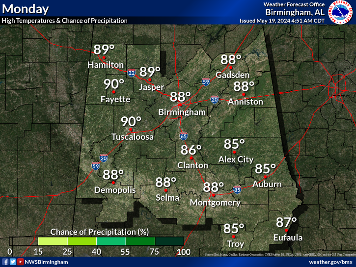
.LONG TERM...
(Saturday through next Wednesday)
Issued at 245 PM CST THU DEC 7 2023
*Marginal risk (level 1 of 5) for severe storms across west
Alabama starting late Saturday.
A trough and associated surface front will swing across the Gulf
Coast region over the weekend as a weak surface low moves toward
the Great Lakes. Saturday morning and afternoon should include a
few clusters of showers due to low- to mid-level lift across the
area. Upstream, a band of rain and storms is expected to develop
from the Ohio Valley southwestward to the Lower Mississippi River
Valley Saturday afternoon. As this activity moves across central
Alabama late Saturday into early Sunday, the storm environment
will be characterized by high shear/low instability, which has
been a consistent theme for many model cycles. MUCAPE around 500
J/kg is modeled to occur in a narrow ribbon against the line of
convection, mainly across west Alabama before becoming more
stunted through the night farther east.
It appears that we`ll experience a band of heavy rain with the
potential for embedded storm elements. The ability for any cell to
produce a damaging wind gust or brief tornado will be especially
dependent on storm evolution and organization given the low-
instability environment. A marginal risk (level 1 of 5) best fits
the situation. The risk area looks good (generally along and west
of the 65). The 4 pm start time is something I was eyeing; if
trends hold, it may be okay to push it back a couple hours, but I
will let the night shift take a look at new cycles of/additional
CAMs that`ll then be within range.
It`ll also be breezy on Saturday from the south/out ahead of the
front and then out of the northwest/behind the front on Sunday
(plus colder temperatures). Several communities stand to pick up
between one to two inches of rain Saturday into early Sunday.
High pressure then advances across the region during the upcoming
work week, bring days`s worth of quiet weather conditions.
89^GSatterwhite
View attachment 120823.mp4
solid line on the 3k
solid line on the 3k
tractor girl
Member
Brick Tamland
Member
Supposed to be traveling Sunday to and from VA. Not sure if I want to now.
W
WSW
Guest
Yeah very stormy and strong winds Sunday/Sunday night. Maybe a changeover to snow after 4am north and west.Supposed to be traveling Sunday to and from VA. Not sure if I want to now.
Bama Ravens
Member
LukeBarrette
im north of 90% of people on here so yeah
Meteorology Student
Member
2024 Supporter
2017-2023 Supporter
Darklordsuperstorm
Member
Definitely looks like parameters have shifted a little to be a little more favorable.
olhausen
Member
Mason Dixon
Member
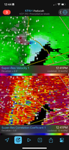
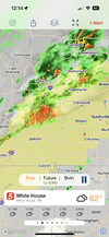
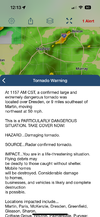
PDS Clarksville?
Poor KY! They have been hit a lot the last few years in December! That fire station damage was devastating from earlier this afternoon in TN also! Thoughts with those people!
NCSNOW
Member
- Joined
- Dec 2, 2016
- Messages
- 9,186
- Reaction score
- 18,036
Storm chasers live. Nashville metro up next

 www.youtube.com

The December 9, 2023 Tornado Outbreak, As It Happened...
Support the channel here: http://www.shopryanhall.comSupport the Y'all Squad here: http://www.theyallsquad.orgWANT TO BECOME A MEMBER? CLICK HERE:https://www...

