SCweather
Member
Not a lot. Important thing is for now is that we have a similar look.What are the final amounts for CAE?
Not a lot. Important thing is for now is that we have a similar look.What are the final amounts for CAE?
Nice! Glad to hear that. Good feeling with them showing the same things.Ignore. Would have been 6-8" like the GFS depicted.
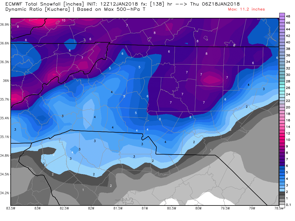
Euro is further West than the GFS with the axis of heaviest snow. You talk as though it should be further East which would benefit central NC more. Which one looks more likely in this type of scenario?Ignore. Would have been 6-8" like the GFS depicted.

Yeah, I was going to say the GFS just seemed to have a wider area covered with the higher totals.Should be a widespread area of moderate to heavy snow with that H5 solution, like the GFS depicted. We'll see if the EPS doesn't tick up again for much of the state.
The current Euro map is already correct. It has me at under an inch in the armpit of the county.If the EPS goes up across the board, it's a good sign the more widespread solution is correct.

If the EPS goes up across the board, it's a good sign the more widespread solution is correct.


No . We need you off the train it's bringing good luck . Keep taking about dry air until Monday please40 of those frames have snow here, and it's the correct time frame as well! I'm going to jump aboard this train, but I have a fear that those models with a sharp cutoff around here is a possibility. Those warm noses are pains.
LOL but I don't want to be in a snow hole. If you want bad talk, then it's going to be too dry and it's going to disintegrate. There will be no storm.No . We need you off the train it's bringing good luck . Keep taking about dry air until Monday please
Sent from my SM-J320VPP using Tapatalk