• Hello, please take a minute to check out our awesome content, contributed by the wonderful members of our community. We hope you'll add your own thoughts and opinions by making a free account!

Tropical TS Gamma

ForsythSnow

Moderator
Joined
Jan 5, 2017
Messages
9,663
Reaction score
17,498
Location
North Forsyth County, Georgia
1. A tropical wave located over the west-central Caribbean Sea is
producing a large area of disorganized showers and thunderstorms.
Conditions are expected to be conducive for development of this
system, and a tropical depression is likely to form over the
northwestern Caribbean Sea or the south-central Gulf of Mexico,
possibly before the system reaches the east coast of the Yucatan
Peninsula on Saturday. Interests in Belize, the Yucatan Peninsula
of Mexico, and western Cuba should monitor the progress of this
disturbance.
* Formation chance through 48 hours...medium...40 percent.
* Formation chance through 5 days...high...70 percent.
 
Gamma?

1. A broad area of low pressure has developed over the west-central
Caribbean Sea just north of the northeastern coast of Honduras.
Satellite images indicate that showers and thunderstorms are slowly
becoming better organized, and a NOAA buoy northeast of the center
has reported winds to near tropical storm force during the past few
hours. Environmental conditions are expected to be conducive for a
tropical depression or a tropical storm to form on Friday or
Saturday
, but only if the system moves and remains over the waters
of the northwestern Caribbean Sea or southern Gulf of Mexico.
Development will become less likely if the system moves over the
Yucatan Peninsula or northern Central America. Regardless of
development, this system is expected to produce locally heavy rains,
with possible flash flooding, over portions of southeastern Mexico,
Central America, and western Cuba during the next several days, and
interests in those areas should monitor the progress of this
disturbance. An Air Force Reserve reconnaissance aircraft is
scheduled to investigate the system tomorrow afternoon, if
necessary.
* Formation chance through 48 hours...high...70 percent.
* Formation chance through 5 days...high...80 percent.
 
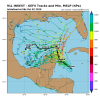
GFS hangs around the Gulf for over a week and is South Texas bound at day 11 lol

Should note an October hit would be almost unheard of in Texas

gfs_z500_mslp_watl_46 (1).png
 
GFS hangs around the Gulf for over a week and is South Texas bound at day 11 lol

Should note an October hit would be almost unheard of in Texas

View attachment 49649
The latest Texas hurricane landfall I could find was Hurricane 6 of the 1912 season which made landfall near Corpus Christi as a category 2 hurricane on October 16th. Looking at the path the GFS shows for 91L I see it is somewhat similar to that storm, but of course it will change many times. Just something I found interesting.A9C86A26-08DB-44A6-969A-7CF1F4FEDD69.png
 
This is escalating rapidly. Water Vapor imagery looks fantastic, and convection is clearly trying to wrap around a broad, but dominant, area of spin. Previous runs of the GFS have been moving this system more towards the NE end of the Yucatan, and the latest 6z run has the COC just barely onshore for a few hours. I’m thinking HH will find a 55-65 MPH storm when they enter soon-to-be ‘Gamma’ later today, and models will likely take a stronger storm further NE through the channel.

e3TdvIO.gif
 
Last edited:
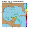
00z Euro.....from nothing to something....but still undecided sitting in the middle of the gulf.

ScreenshotCapture_2020_10_02_08_11_22_400.jpg
 
Back
Top