-
Hello, please take a minute to check out our awesome content, contributed by the wonderful members of our community. We hope you'll add your own thoughts and opinions by making a free account!
You are using an out of date browser. It may not display this or other websites correctly.
You should upgrade or use an alternative browser.
You should upgrade or use an alternative browser.
Tropical TS Bret
- Thread starter SD
- Start date
EURO falls apart near the islands, or at least last run did right?
lexxnchloe
Member
Totally gone and never gets lower than 1005mb. I doubt now its going to do anythingEURO falls apart near the islands, or at least last run did right?

accu35
Member
Gfs 6z has it again
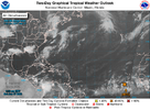
50/70Eastern Tropical Atlantic (AL92):
A tropical wave located several hundred miles south-southwest of the
Cabo Verde Islands continues to produce a broad area of disorganized
showers and thunderstorms. Environmental conditions appear conducive
for additional development, and a tropical depression is likely to
form by the early to middle portion of next week while the system
moves westward at 15 to 20 mph across the eastern and central
tropical Atlantic.
* Formation chance through 48 hours...medium...50 percent.
* Formation chance through 7 days...high...70 percent.
$$
Forecaster Bucci
60/80000
ABNT20 KNHC 172310
TWOAT
Tropical Weather Outlook
NWS National Hurricane Center Miami FL
800 PM EDT Sat Jun 17 2023
For the North Atlantic...Caribbean Sea and the Gulf of Mexico:
Eastern Tropical Atlantic (AL92):
A tropical wave located several hundred miles southwest of the
Cabo Verde Islands is producing a broad area of showers and
thunderstorms. This activity is starting to show some signs of
organization and environmental conditions appear conducive for
additional development. A tropical depression is likely to form by
the early to middle portion of next week while the system moves
westward at 15 to 20 mph across the eastern and central tropical
Atlantic.
* Formation chance through 48 hours...medium...60 percent.
* Formation chance through 7 days...high...80 percent.
$$
Forecaster Papin
Brent
Member
I definitely see Bret coming from this but still doubt it'll be anything major or threatening. Very uncharacteristic for June either way
Shaggy
Member
Looking better tonight and starting to get that look for sure. Outflow seems to be improving a bit as wellI definitely see Bret coming from this but still doubt it'll be anything major or threatening. Very uncharacteristic for June either way
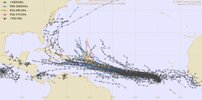
Looks like a ton of uncertainty with this one as the models take it anywhere from the middle of the Atlantic to the western Caribbean. The one definite is that there is a lot unusually warm water that it will be moving over.
I’m going to social media for the real results. I love hearing what’s gonna happen stamped in stone!
Brent
Member
iGRXY
Member
Water temps decline the further west this goes, combine that with El Niño tropical forcing over the Atlantic basin, and it being June this likely falls apart over the eastern Caribbean or curves north. Could definitely change but that seems like the most logical path right now
80/90Eastern Tropical Atlantic (AL92):
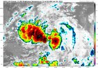
Showers and thunderstorms continue to show signs of organization in
association with a tropical wave located several hundred miles
southwest of the Cabo Verde Islands. Environmental conditions appear
conducive for additional development, and a tropical depression is
likely to form over the next day or two. This system is expected to
move westward at 15 to 20 mph across the eastern and central
tropical Atlantic through the middle part of the week.
* Formation chance through 48 hours...high...80 percent.
* Formation chance through 7 days...high...90 percent.
$$
Forecaster Blake
90/90Eastern Tropical Atlantic (AL92):
Showers and thunderstorms have become better organized in
association with a broad area of low pressure located several
hundred miles southwest of the Cabo Verde Islands. Environmental
conditions appear conducive for additional development, and a
tropical depression or tropical storm is expected to form over the
next day or so. This system is forecast to move westward at 15 to
20 mph across the central tropical Atlantic with further
development through the middle part of the week. Additional
information on this system, including gale warnings, can be found in
High Seas Forecasts issued by the National Weather Service.
* Formation chance through 48 hours...high...90 percent.
* Formation chance through 7 days...high...90 percent.
&&
Shaggy
Member
definitely has the look of a developing system. Clearly this early that far east is unusual but not sure we can deduce anything from that to project out the season90/90
Shaggy
Member
Should be named any time now. Made lots of progress on development overnight.
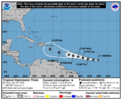
TD 3
BULLETIN
Tropical Depression Three Advisory Number 1
NWS National Hurricane Center Miami FL AL032023
1100 AM AST Mon Jun 19 2023
...TROPICAL DEPRESSION THREE FORMS OVER THE CENTRAL ATLANTIC...
...INTERESTS IN THE LESSER ANTILLES SHOULD MONITOR THIS SYSTEM...
SUMMARY OF 1100 AM AST...1500 UTC...INFORMATION
-----------------------------------------------
LOCATION...11.0N 40.3W
ABOUT 1425 MI...2295 KM E OF THE SOUTHERN WINDWARD ISLANDS
MAXIMUM SUSTAINED WINDS...35 MPH...55 KM/H
PRESENT MOVEMENT...W OR 275 DEGREES AT 21 MPH...33 KM/H
MINIMUM CENTRAL PRESSURE...1009 MB...29.80 INCHES
WATCHES AND WARNINGS
--------------------
There are no coastal watches or warnings in effect.
Interests in the Lesser Antilles should monitor the progress of
this system.
Moved kido down to Brunswick County. Caught a Forest Fire Day1/week 1. Surely not a Hurricane/ TS week 2.
NoSnowATL
Member
Heading to the shredder.
BHS1975
Member
Gonna be hard for it to make it this far west with all the troughs swinging through.
Sent from my iPhone using Tapatalk
Sent from my iPhone using Tapatalk
If stays on the southern side of the cone, it could miss the troughs and go south of the shredder. If that happens it will be in position for a trough to pull it into the eastern GOM.Gonna be hard for it to make it this far west with all the troughs swinging through.
Sent from my iPhone using Tapatalk
Bret.
AL, 03, 2023061918, , BEST, 0, 112N, 414W, 35, 1008, TS
AL, 03, 2023061918, , BEST, 0, 112N, 414W, 35, 1008, TS
should have 2 named storms out in the atlantic this week:

SUMMARY OF 500 PM AST...2100 UTC...INFORMATION
----------------------------------------------
LOCATION...11.3N 42.2W
ABOUT 1295 MI...2085 KM E OF THE SOUTHERN WINDWARD ISLANDS
MAXIMUM SUSTAINED WINDS...40 MPH...65 KM/H
PRESENT MOVEMENT...W OR 280 DEGREES AT 21 MPH...33 KM/H
MINIMUM CENTRAL PRESSURE...1008 MB...29.77 INCHES

...TROPICAL STORM BRET EXPECTED TO STRENGTHEN...
...INTERESTS IN THE LESSER ANTILLES SHOULD MONITOR THIS SYSTEM...
SUMMARY OF 1100 PM AST...0300 UTC...INFORMATION
-----------------------------------------------
LOCATION...11.4N 43.5W
ABOUT 1210 MI...1945 KM E OF THE SOUTHERN WINDWARD ISLANDS
MAXIMUM SUSTAINED WINDS...40 MPH...65 KM/H
PRESENT MOVEMENT...W OR 275 DEGREES AT 18 MPH...30 KM/H
MINIMUM CENTRAL PRESSURE...1008 MB...29.77 INCHES

Shaggy
Member
We have a naked swirl ejecting to the west of the storms
lexxnchloe
Member
I dont think its going to ever get that far. Looks like it will fall apart.If stays on the southern side of the cone, it could miss the troughs and go south of the shredder. If that happens it will be in position for a trough to pull it into the eastern GOM.
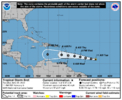
SUMMARY OF 1100 AM AST...1500 UTC...INFORMATION
-----------------------------------------------
LOCATION...11.9N 47.0W
ABOUT 945 MI...1525 KM E OF THE WINDWARD ISLANDS
MAXIMUM SUSTAINED WINDS...40 MPH...65 KM/H
PRESENT MOVEMENT...W OR 275 DEGREES AT 21 MPH...33 KM/H
MINIMUM CENTRAL PRESSURE...1008 MB...29.77 INCHES
WATCHES AND WARNINGS
--------------------
There are no coastal watches or warnings in effect.
Interests in the Lesser Antilles should monitor the progress of
this system. Tropical storm watches may be required for some
islands later today or tonight.
NoSnowATL
Member
DOA
lexxnchloe
Member
Highly unlikely its a storm or even identifiable at 70W
BULLETIN
Tropical Storm Bret Advisory Number 6
NWS National Hurricane Center Miami FL AL032023
500 PM AST Tue Jun 20 2023
...BRET A LITTLE STRONGER...
...TROPICAL STORM WATCH ISSUED FOR BARBADOS...
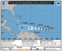
SUMMARY OF 500 PM AST...2100 UTC...INFORMATION
----------------------------------------------
LOCATION...12.2N 48.6W
ABOUT 835 MI...1350 KM E OF THE WINDWARD ISLANDS
MAXIMUM SUSTAINED WINDS...45 MPH...75 KM/H
PRESENT MOVEMENT...W OR 280 DEGREES AT 18 MPH...30 KM/H
MINIMUM CENTRAL PRESSURE...1006 MB...29.71 INCHES
WATCHES AND WARNINGS
--------------------
CHANGES WITH THIS ADVISORY:
The government of Barbados has issued a Tropical Storm Watch for
Barbados.
SUMMARY OF WATCHES AND WARNINGS IN EFFECT:
A Tropical Storm Watch is in effect for...
* Barbados
A Tropical Storm Watch means that tropical storm conditions are
possible within the watch area, generally within 48 hours.
Interests elsewhere in the Lesser Antilles should monitor the
progress of Bret. Tropical storm watches will likely be required
for other islands later tonight.
For storm information specific to your area, please monitor
products issued by your national meteorological service.
SUMMARY OF 800 PM AST...0000 UTC...INFORMATION
----------------------------------------------
LOCATION...12.4N 49.5W
ABOUT 780 MI...1255 KM E OF THE WINDWARD ISLANDS
MAXIMUM SUSTAINED WINDS...45 MPH...75 KM/H
PRESENT MOVEMENT...W OR 280 DEGREES AT 18 MPH...30 KM/H
MINIMUM CENTRAL PRESSURE...1006 MB...29.71 INCHES
WATCHES AND WARNINGS
--------------------
CHANGES WITH THIS ADVISORY:
The government of St. Lucia has issued a Tropical Storm Watch for
St. Lucia.
SUMMARY OF WATCHES AND WARNINGS IN EFFECT:
A Tropical Storm Watch is in effect for...
* Barbados
* Dominica
* St. Lucia
A Tropical Storm Watch means that tropical storm conditions are
possible within the watch area, generally within 48 hours.
Interests elsewhere in the Lesser Antilles should monitor the
progress of Bret. Additional tropical storm watches will likely be
required for other islands later tonight.
For storm information specific to your area, please monitor
products issued by your national meteorological service.
BULLETIN
Tropical Storm Bret Intermediate Advisory Number 12A
NWS National Hurricane Center Miami FL AL032023
800 AM AST Thu Jun 22 2023
...BRET NEAR HURRICANE STRENGTH...
...EXPECTED TO BRING STRONG WINDS AND HEAVY RAIN TO PORTIONS OF THE
LEEWARD ISLANDS LATER TODAY AND TONIGHT...
SUMMARY OF 800 AM AST...1200 UTC...INFORMATION
----------------------------------------------
LOCATION...13.6N 57.0W
ABOUT 170 MI...265 KM E OF BARBADOS
MAXIMUM SUSTAINED WINDS...70 MPH...110 KM/H
PRESENT MOVEMENT...W OR 280 DEGREES AT 15 MPH...24 KM/H
MINIMUM CENTRAL PRESSURE...996 MB...29.42 INCHES


