• Hello, please take a minute to check out our awesome content, contributed by the wonderful members of our community. We hope you'll add your own thoughts and opinions by making a free account!

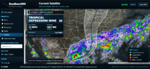
Tropical TD9

It’s not gone but it’s not as strong as it could be if the system slowed down because of the window of time it has a chance to strengthen before landfall on Saturday


Sent from my iPhone using Tapatalk
So, we want it to move faster?
 
If the 18Z GFS were to verify, Tuscaloosa would be in for a whipping but mainly during the afternoon. By gametime, the storm is already passed Tusc. Interesting.
With Gameday scheduled to be in town for the morning and the all-day tailgating, I wonder if a morning/afternoon only impact forecast would still cause the game to get postponed.
 
With Gameday scheduled to be in town for the morning and the all-day tailgating, I wonder if a morning/afternoon only impact forecast would still cause the game to get postponed.

Yeah I actually think it might clear out for the evening. That's the trend today
 
Yeah I actually think it might clear out for the evening. That's the trend today
Who cares what the weather is like in the evening during game time ? If the damage is done early in the day, then that's enough to move the game. Don't wanna have a game when there's trees down everywhere and widespread power outages.
 
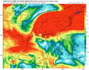
Seeing a bad trend for the gulf coast in the latest models. Upper level anticylone staying better established over the storm probably a result of the quicker movement. I definitely don't think a weakening storm is a given and it may be strengthening.

Latest HWRF landfall at 110knts.

hwrf-p_shear_09L_31.png
 
From James Spann concerning the Bama / Georgia game:

FOOTBALL WEATHER: Concerning the Bama/Georgia game Saturday night...

*Right off the bat, it is a challenging combination. A top 10 battle in prime time, ESPN College Game Day in down, a visit from the U.S. President, and an approaching hurricane.

*The day Saturday in Tuscaloosa will be windy and wet. Lots of rain, winds gusting to 30/40 mph.

*Greatest concern will be the possibility of a few isolated tornadoes. Tropical tornadoes are typically low topped, short lived, literally under the radar, and dangerous in that providing warnings isn't easy.

*Best possible case for the game... the rain ends around 6pm as the tropical low lifts northward, and the rest of the night will be dry as a slot of dry air works in from the southwest. This is a possibility.

*Worst case... a slower moving tropical low to the west brings soaking rain, wind gusts to 35/40 mph, and the risk of a tornado.

Understand the tropical depression is still disorganized tonight. We need a good low level center so models can initialize the system. That should happen tomorrow. We also have dropsonde data gathered being gathered tonight that will be used in future model runs.

Bottom line... there is a good bit of uncertainty in the forecast tonight, but in 24 hours or so confidence levels will be much higher.

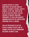
UA Athletics and the SEC are monitoring the weather situation closely.
 
Back
Top