E coast threat?
-
Hello, please take a minute to check out our awesome content, contributed by the wonderful members of our community. We hope you'll add your own thoughts and opinions by making a free account!
You are using an out of date browser. It may not display this or other websites correctly.
You should upgrade or use an alternative browser.
You should upgrade or use an alternative browser.
Tropical TD3 2025
- Thread starter SD
- Start date
lexxnchloe
Member
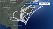
Lots of rain coming to wash out weekend beach plans and late weekend inland plans.
lexxnchloe
Member
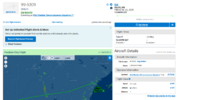
Recon will be in it shortly. They issued the 2PM TWO quite early:
Tropical Weather Outlook
NWS National Hurricane Center Miami FL
200 PM EDT Fri Jul 4 2025
For the North Atlantic...Caribbean Sea and the Gulf of America:
1. Near the Southeastern United States (AL92):
Satellite wind data indicate that the system located about 150 miles
off the northeast Florida coast has become better defined today with
an area of strong winds located on its east side. Showers and
thunderstorms are also persisting near and to the east of the
center. A short-lived subtropical or tropical depression could
form later today or on Saturday while the system drifts generally
north-northwestward. This low is expected to move inland over the
southeastern U.S. by early Sunday. An Air Force Reserve Hurricane
Hunter aircraft is currently en route, and the data they collect
should provide more details on the system's structure. Regardless of
development, heavy rainfall is possible across portions of
west-central and southwestern Florida through early Saturday, and
across coastal sections of the Carolinas beginning later on
Saturday.
* Formation chance through 48 hours...high...70 percent.
* Formation chance through 7 days...high...70 percent.
Forecaster Cangialosi/Beven
snowc
Member
And to follow up @GaWx
GLOBAL MODEL DATA TIME 1200UTC 04.07.2025
TROPICAL DEPRESSION 92L ANALYSED POSITION : 30.6N 79.2W
ATCF IDENTIFIER : AL922025
LEAD CENTRAL MAXIMUM WIND
VERIFYING TIME TIME POSITION PRESSURE (MB) SPEED (KNOTS)
-------------- ---- -------- ------------- -------------
1200UTC 04.07.2025 0 30.6N 79.2W 1014 23
0000UTC 05.07.2025 12 CEASED TRACKING
snowc
Member
Carolina Fever
Member
lexxnchloe
Member
Belle Lechat
Member
- Joined
- Aug 29, 2021
- Messages
- 1,529
- Reaction score
- 1,215
Belle Lechat
Member
- Joined
- Aug 29, 2021
- Messages
- 1,529
- Reaction score
- 1,215
Belle Lechat
Member
- Joined
- Aug 29, 2021
- Messages
- 1,529
- Reaction score
- 1,215
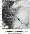
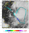
The winds are high enough but is the circulation tight enough to be classified as a TD+? Based on your image, it seems kind of broad.
Looking at visible id agree. Seems like its still stretched W to EThe winds are high enough but is the circulation tight enough to be classified as a TD+? Based on your image, it seems kind of broad.
I just saw this, which suggests the NHC may be going with a 30 knot subtropical depression perhaps due to the center being too broad for TD status:
AL, 92, 2025070418, , BEST, 0, 309N, 790W, 30, 1012, SD
Also, note the 79.0W longitude, which suggests it’s a little E of the 79.5W longitude that the LLC was earlier supposedly near.
AL, 92, 2025070418, , BEST, 0, 309N, 790W, 30, 1012, SD
Also, note the 79.0W longitude, which suggests it’s a little E of the 79.5W longitude that the LLC was earlier supposedly near.
Tropical*I just saw this, which suggests the NHC may be going with a 30 knot subtropical depression perhaps due to the center being too broad for TD status:
AL, 92, 2025070418, , BEST, 0, 309N, 790W, 30, 1012, SD
Also, note the 79.0W longitude, which suggests it’s a little E of the 79.5W longitude that the LLC was earlier supposedly near.
Visible sat looks pretty good. Looking forward to some rain and breezy weather tomorrow and Sunday.
Honestly some of the best summertime porch sitting weather when you have a weak TS come inland.
Belle Lechat
Member
- Joined
- Aug 29, 2021
- Messages
- 1,529
- Reaction score
- 1,215
snowc
Member
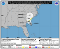
A Tropical Storm Watch has been issued from Edisto Beach, South
Carolina to Little River Inlet, South Carolina.
Tropical Depression Three Discussion Number 1
NWS National Hurricane Center Miami FL AL032025
500 PM EDT Fri Jul 04 2025
The wind circulation associated with the low pressure area east of
the coast of north Florida has become stronger, with aircraft and
scatterometer data indicating a well-defined circulation with
maximum winds near 30 kt and a radius of maximum wind of about
80-90 n mi. The system has also developed persistent convection east
and southeast of the center. Based on these developments,
advisories are being started on Tropical Depression Three. The
cyclone is currently being affected by 20-25 kt of southwesterly
shear caused by a mid- to upper-level trough not far to the west.
The initial motion is uncertain due to some reformation of the
center, with the best estimate of 360/2 kt. During the next 24 h,
the cyclone should move slowly north-northwestward on the northeast
side of a developing mid- to upper-level low over the northeastern
Gulf. After that time, the system should be steered northward with
a gradual increase in forward speed. This motion should bring the
center near or over the coast of South Carolina Sunday morning. A
generally northward motion should then continue until the system
dissipates over land. While the guidance generally agrees with this
scenario, there is considerable spread in both the forecast
direction and speed, with the HWRF being a notable right outlier.
The forecast track is in best agreement with the GFS and the HCCA
corrected consensus model.
The current shear is expected to diminish on Saturday as the
upper-level trough moves westward away from the cyclone and the
upper-level winds become southerly. However, the upper-level winds
are forecast to become convergent, which may limit the amount of
convection the system produces. Most of the guidance shows some
development as the system approaches the coast, so the intensity
forecast calls for modest strengthening to a tropical storm before
the cyclone makes landfall. This forecast is a little below the
intensity consensus.
BULLETIN
Tropical Depression Three Advisory Number 2
NWS National Hurricane Center Miami FL AL032025
1100 PM EDT Fri Jul 04 2025
...TROPICAL DEPRESSION FORECAST TO STRENGTHEN ON SATURDAY...
SUMMARY OF 1100 PM EDT...0300 UTC...INFORMATION
-----------------------------------------------
LOCATION...30.6N 78.9W
ABOUT 165 MI...260 KM SSE OF CHARLESTON SOUTH CAROLINA
ABOUT 255 MI...415 KM SSW OF WILMINGTON NORTH CAROLINA
MAXIMUM SUSTAINED WINDS...35 MPH...55 KM/H
PRESENT MOVEMENT...STATIONARY
MINIMUM CENTRAL PRESSURE...1012 MB...29.89 INCHES
Tropical Depression Three Discussion Number 2
NWS National Hurricane Center Miami FL AL032025
1100 PM EDT Fri Jul 04 2025
The depression is less organized on satellite imagery this evening,
with a seemingly elongated low-level center near or just west of the
deep convection. This structure is due to persistent southwesterly
shear, with a mid-level circulation apparent east of the low-level
center. The current intensity will remain 30 kt, consistent with
data from the last Air Force reconnaissance mission and satellite
trends.
The system has been moving erratically recently, but a longer term
motion is basically stationary. A slow north-northwestward motion
is anticipated to begin on Saturday as the depression is steered on
the northeast side of a developing mid- to upper-level low over the
northeastern Gulf. After that time, the system should be steered
to the north and northeast with a gradual increase in forward speed
along the western periphery of the subtropical ridge. This motion
should bring the center near or over the coast of South Carolina
Sunday morning. The new NHC track forecast was nudged to the east,
consistent with the latest guidance.
The global models generally indicate that the current shear should
lessen on Saturday, which could allow for some strengthening in
combination with the warm waters of the Gulf Stream. There is
plenty of dry air aloft, however, which will probably limit
significant development, as well as the current disheveled
structure. The bulk of the guidance indicates modest strengthening
as the system approaches the coast, and the new forecast follows
suit, near the latest model consensus.
FORECAST POSITIONS AND MAX WINDS
INIT 05/0300Z 30.6N 78.9W 30 KT 35 MPH
12H 05/1200Z 30.9N 79.1W 35 KT 40 MPH
24H 06/0000Z 31.7N 79.5W 40 KT 45 MPH
36H 06/1200Z 32.9N 79.8W 35 KT 40 MPH...INLAND
48H 07/0000Z 34.2N 79.6W 30 KT 35 MPH...POST-TROP/REMNT LOW
60H 07/1200Z 35.5N 78.5W 25 KT 30 MPH...POST-TROP/REMNT LOW
72H 08/0000Z...DISSIPATED
$$
Forecaster Blake
That was a noticeable left shift in most modeling once inland

