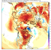
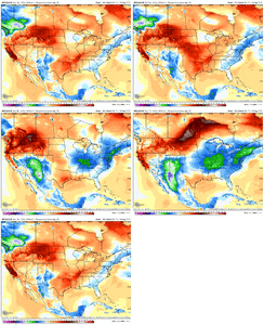
This coming Saturday might give today a run for its money. Got full sun today with these mid 70's, probably be cloud induced Sat
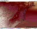
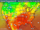



Summer. To summer, Mitch. You know how this goes!Euro just doesn't know what it wants to do. Flopping around like a fish. What an idiot. It's going to be warm til Christmas day, then get cold for 9 days then change to Spring.
View attachment 198085


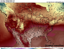
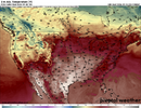
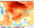
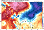
Scrolled all the models 18z Temps from 0z last night. Every one of them does just what this image shows below. Could have used any of my choice, but here's the Euro AI for next Tuesday. Notice how the heat is centered over TN valley back out toward Brent. Actually pays to be east of the APPs for once. This is next week, but you can go out to the end of September on all of them and it will show the same pic as you see below. Never seen a more stubborn ridge that refuses to die off, as the one centered back over lower central plains/ TN Valley.
Our biggest fan of the heat and summer on this board resides out in TN. So I'm glad he can keep enjoying his favorite flavor of wx.
View attachment 198096
Fast forward to Sept 30th off the Euro Op: Ridiculous how this just want let go
View attachment 198097

Ask and ye shall receive! GFS gets these going in 8-9days. Wide right for the fish on one. But the other has a bead set dead square on the ole stubborn ridge parking lot.Still nothing over 90 here showing up after Sunday. That's still a big improvement over the last month either way but yeah I'm not convinced it's over at all. We need a big storm somewhere to flip the pattern probably
It should be noted I guess that a couple years ago we even had some 90s a week before Halloween... After we had already had a freeze outside the city... It's just random days not the entire month though
Another warm low... 80 degrees... This is the latest it's ever not gotten in the 70s at night
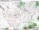
Ridge won’t let the storm come on shore. We need a major deep trough Midwest push east . That would shake up this stubborn patternAsk and ye shall receive! GFS gets these going in 8-9days. Wide right for the fish on one. But the other has a bead set dead square on the ole stubborn ridge parking lot.
View attachment 198098
Ask and ye shall receive!


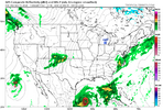
All jokes aside, a hurricane in October will probably be what does it. Hurricane Michael did the same thing in Mid October 2018.

BTW forgot to respond but you are right about this. the Iowa State site lied to me, which is odd. The current streak ties for just 27th at KGSP as far as no sub 60 lows.Per NWS, the last sub 60 was June 24th with a 59, that would make today day 84. Nevertheless, that's an incredible stretch that needs to end!

Well it looks like we're going to give a run anyway; nothing close to that showing up over the next week at least. At least GSP only hit 80 yesterday. BTW; CAE has not been sub 66 since June 6th; so today makes that a stretch of 102 days. Heck, it's only been sub 70 8 times since then.BTW forgot to respond but you are right about this. the Iowa State site lied to me, which is odd. The current streak ties for just 27th at KGSP as far as no sub 60 lows.

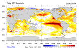
Better get good negative nao. get that . Be hardNot a bad time for a Beach Trip. Lower rates and warmer than normal water temps. Need that red blob North pac to take a hike. Also interetsed to see how the AN Atlantic continues and actually enhances blocking like they say it does for DJF
View attachment 198103

It’s been a great summer for the beach. No storms, hot and clear waters.Not a bad time for a Beach Trip. Lower rates and warmer than normal water temps. Need that red blob North pac to take a hike. Also interetsed to see how the AN Atlantic continues and actually enhances blocking like they say it does for DJF
View attachment 198103
 Temperature Alterations
 Precipitation & Snowfall Shifts
It will do a 180 at the 12z tomorrow!
Yeah. We have seen this few times before already . Do not hold your breath lolIt will do a 180 at the 12z tomorrow!


Yeah where it’s at right now is not in a bad location. What you don’t want to see is it move back west towards AsiaActually we dont need the warm blob in north pac to take a hike: AI says I stand corrected
Higher sea surface temperatures (SSTs) in the North Pacific usually trigger a positive Pacific-North American (PNA) teleconnection pattern, which acts as a major steering mechanism for North American winter weather. [1, 2]
When the North Pacific is abnormally warm, it alters the atmospheric pressure field—typically building a massive high-pressure ridge over the West Coast and a deep low-pressure trough over the East Coast. This configuration drastically shifts the jet stream, creating a stark "warm-West, cold-East" split across the continent. [1, 2]
The generalized impacts across different regions include:
- Western North America & Alaska: Experience above-normal temperatures. The high-pressure ridge acts as a heat dome, keeping winter remarkably mild and suppressing typical Arctic blasts. [1]
- Eastern & Southern US: Experience below-normal temperatures. The jet stream dives sharply southward out of Canada, serving as a continuous conveyor belt for cold, polar air masses to spill into the Midwest, Northeast, and Southeast. [1, 2]
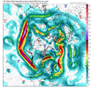
Getting ready to rockPac jet maxing View attachment 198106

@ Tenn storm. You winning biggly. Wish i had the passion for heat you do. Enjoy
View attachment 198102
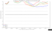
This is gonna be a major issue heading deeper into fall. This is gonna nuke the source regions. Which per usual is a problem for ninos. This constant flooding of momentum deposition into the pacific jet is gonna consistently encourage warmth into Canada and west Canada, and encourage lower heights to get dug in around Alaska. Unless we get something to temporarily shorten wavelengths in late fall/early winter, this is not exactly ideal. Worst case scenario is a TPV getting stuck in AK in late Nov/decGWO and AAM off the chart pac jet rages for the time being until this can hopefully get redistributed poleward. Have to think it's partially why the cfs keeps dabbling with cold particularly the 2nd half of winter. Really could use a EAMT event or recurving typhoon to try to shake up what's av relatively stable patternView attachment 198107View attachment 198108
Yep. 96 here yesterday. If I wanted this in mid September I'd live in Texas.If you live anywhere from Brent to Mack to the guy in IL to the guy in Maine to the VA boys to the TN/MS/AL/Carolina/GA guys and gals and if you don’t like it warmer than normal, then the latest Bleaklies are bleak as far as the eye can see.
The only active members not in endless bleakness are the guy in Montana and Eric Webb.
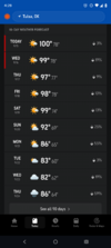
I can confirm. I’m 30 minutes south of Nashville. Never see anything like it. Hell on earth right now@ Tenn storm. You winning biggly. Wish i had the passion for heat you do. Enjoy
View attachment 198102