Deep south severe threat
-
Hello, please take a minute to check out our awesome content, contributed by the wonderful members of our community. We hope you'll add your own thoughts and opinions by making a free account!
You are using an out of date browser. It may not display this or other websites correctly.
You should upgrade or use an alternative browser.
You should upgrade or use an alternative browser.
Severe Severe Threat Jan 11-13 2023
- Thread starter SD
- Start date
Hazardous Weather Outlook
National Weather Service Birmingham AL
329 AM CST Tue Jan 10 2023
ALZ011>015-017>050-111230-
Marion-Lamar-Fayette-Winston-Walker-Blount-Etowah-Calhoun-Cherokee-
Cleburne-Pickens-Tuscaloosa-Jefferson-Shelby-St. Clair-Talladega-
Clay-Randolph-Sumter-Greene-Hale-Perry-Bibb-Chilton-Coosa-Tallapoosa-
Chambers-Marengo-Dallas-Autauga-Lowndes-Elmore-Montgomery-Macon-
Bullock-Lee-Russell-Pike-Barbour-
329 AM CST Tue Jan 10 2023
This Hazardous Weather Outlook is for the counties served by the
National Weather Service office in Birmingham.
.DAY ONE...Outlook through Tonight.
Areas of fog are expected to develop overnight and persist through
early Thursday morning with the best potential across the southwest
counties of Central Alabama. Visibilities may fall below one mile at
times.
.DAYS TWO THROUGH SEVEN...Wednesday through Monday.
Strong to severe storms are possible on Thursday generally from 11
am through 9 pm as a cold front moves through the area. The main
concern will be damaging winds, though a tornado to two cannot be
ruled out.

- Joined
- Jan 5, 2017
- Messages
- 3,580
- Reaction score
- 5,560
12Z 1/11/2023 Euro Hi-res indicates to me that the severe threat in GA is going to be higher than "slight". It may be the most robust with the storm dynamics, but it has me concerned. Bulk shear is high and surface cape is over 1,300. Along with other ingredients it would mean any discrete super cells will need to be closely watched and there will be spin-ups once the line forms and moves east.
This evening through Thursday)
Issued at 155 PM CST WED JAN 11 2023
Strong to severe storms remain possible Thursday.
Central Alabama is quickly transitioning into a more moist and
unstable atmosphere this afternoon. Southerly to southwesterly
flow at the surface has advected moisture from west to east, where
dewpoints in the 60s are now being observed across western and
southwestern Alabama. That moisture will only increase as we go
through the rest of the day and overnight hours tonight. Low
stratus clouds continue to persist across the northern half of
Central Alabama this afternoon thanks to continued isentropic
lift. Visible satellite is showing some mixing ongoing across the
U.S.80/I-85 corridors, and we`re still expecting the warmest
temperatures into the low and mid 70s for those locations. Across
the north, highs will be trickier based on where the clouds happen
to mix out. Current observations are getting close to 70 degrees
in Mississippi while Haleyville is reporting 58. Warm air
advection will continue despite the amount of cloud cover and we
should warm into at least the low to mid 60s in the north and
northeastern counties.
All eyes will then turn to the rapidly approaching storm system
Thursday morning that will move across Central Alabama through
Thursday evening. The previous forecast remains pretty much in
tact in terms of the overall severe threat as the cold front moves
across the area. Strong southwesterly gradient winds remain in the
forecast as the surface low deepens over the Ohio River Valley
Thursday Morning. A Wind Advisory will be needed across most of
Central Alabama as guidance continues to indicate that we`ll see
wind gusts up to 40mph through much of the day.
Timing remains fairly similar in terms of when the front first
arrives across northwest counties, but have adjusted a tad earlier
for storms to move into Marion County as early as 7am and as
early as 10am for the Birmingham Metro. We decided to add in the
threat for large hail into the forecast along with damaging winds
and isolated tornadoes due to the fact that 500mb temperatures are
very cold aloft on the order of -15 to -18C. If we`re able to get
enough forcing along and just out ahead of the front, we may be
able to overcome the limited amount of instability at least early
on in the event. With steep lapse rates aloft, hail will
definitely be in the cards if stronger updrafts develop. We`ll
have to watch these storms closely across the north and northwest
as they develop Thursday morning, as the available dynamics
suggest there`s a chance they could overachieve in terms of
strength.
We`ll likely be dealing with a QLCS as the front continues moving
to the southeast later into the afternoon. All types of severe
weather will remain possible as the line moves into the east and
southeast counties between 1pm and 6pm. As the parent low quickly
ejects off to the northeast over Ohio, low-level winds will become
parallel to the upper flow, which should limit the overall
tornado threat with time. However, we`ll have to watch for those
isolated spin-ups very closely throughout the entire event. The
good news in terms of rainfall for this event is that due to the
progressive nature of the front we shouldn`t have a flood threat
to deal with. Heavier amounts up to one inch are possible with a
few higher amounts, but generally under one inch of rain can be
expected with this event.
56/GDG
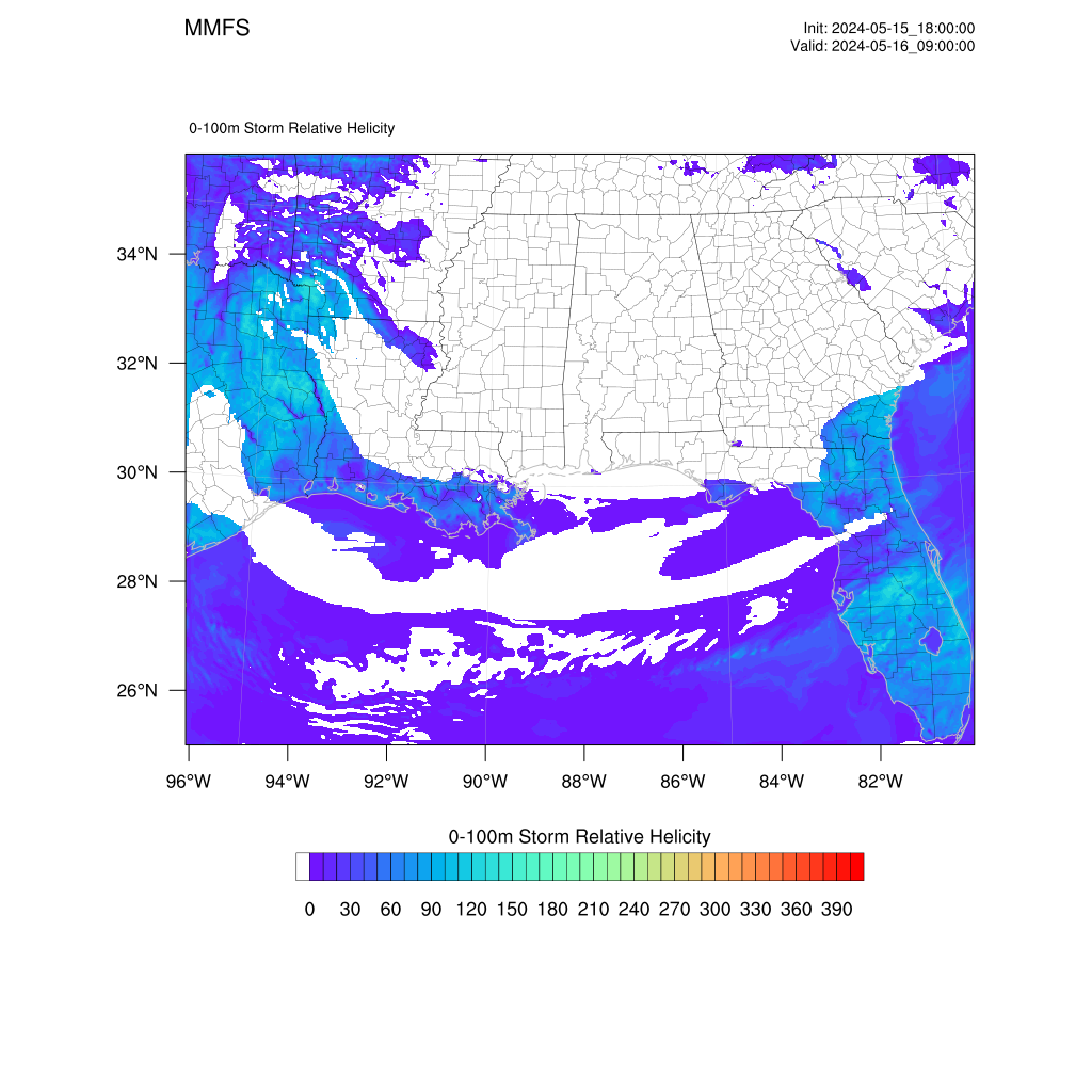
Outputs from the 12z MMFS-r at a 1km horizontal grid resolution.


Darklordsuperstorm
Member
Gotta admit this one snuck up on me. The talk I had heard all week was this risk area was there out of a course of least regret. Did not expect to wake up to an enhanced risk but here we are.Pretty quiet for a severe weather threat were the models have been creeping higher and highers portions of GA/AL now in enhanced risk.


..Synopsis...
A positively tilted mid-level trough and associated surface low will
traverse the OH/TN Valley areas today as a surface cold front sweeps
across the Southeast. Low-level moisture will stream north from the
Gulf of Mexico ahead of the advancing front. The moisture will be
overspread by a seasonably strong low-level jet and cold
temperatures aloft, providing enough buoyancy, shear, and deep-layer
ascent to support a threat for several strong to potentially severe
thunderstorms, especially from the TN Valley into the Southeast this
afternoon into the evening hours.
...TN Valley into the Southeast...
Scattered strong to potentially severe thunderstorms should be
ongoing at the beginning of the period across the TN Valley ahead of
the surface low. These storms should be fueled by at least some
elevated instability, with strong deep-layer shear and 7-8 C/km
mid-level lapse rates promoting an isolated large hail threat in
association with transient supercell structures. With diurnal
heating, strong thunderstorms should continue to develop along the
cold front in MS by morning and progress eastward through the
afternoon.
The 00Z LIX observed sounding shows mid 60s F surface dewpoints and
near 8 C/km mid-level lapse rates. These steeper lapse rates should
continue to overspread the Gulf Coast states given strong westerly
700-500 mb flow. Low-level moisture should remain modest (i.e. low
60s F surface dewpoints), but the steeper lapse rates should
compensate to support 500-1000 J/kg of skinny MLCAPE. A 40-50 kt
low-level jet overspread by even stronger westerlies aloft should
result in elongated hodographs, with some curvature in the surface-3
km layer. As such, a mix of line-embedded transient supercells and
bowing segments are expected along the front. Modestly dry 850-500
mb air may promote efficient downward momentum transport through the
strong low-level jet to promote a damaging/severe wind gust threat,
hence the Category 3/Enhanced risk across central AL/GA. Large hail
may initially accompany the stronger, sustained updrafts given the
steep mid-level lapse rates. Given the modest low-level moisture,
the tornado threat appears a bit more conditional, though at least a
few brief tornadoes may still develop in either embedded QLCS
circulations, or any discrete, sustained storms ahead of the line.
khughey
Member
FFC is all over it this AM
Issued at 419 AM EST Thu Jan 12 2023
Thursday Afternoon/Evening: Enhanced Risk for Severe Thunderstorms
A quasi-linear convective system is forecast to enter the far northwestern Georgia around noon Thursday, and will swiftly push through the forecast area, exiting to the southeast just before midnight. This QLCS is expected to form along or just ahead of a strong cold front, supported by a deep shortwave trough digging through the southeast and a deepening surface low-pressure system pushing from the Midwest into the eastern Great Lakes region through the day. Ahead of the line of storms, dewpoints will rise into the low 60s, which will boost SBCAPE values between 500-1250 J/kg through most of the areas with decent lapse rates. A 50 kt jet streak will also be in place at the 850 hPa level, with steady speed shear through the low- and mid-levels and clockwise curvature in forecast hodographs which will set 0-1 km SRH values between 150-300 m2/s2. Additionally, a layer of dry air in the mid-levels will make for effective downdrafts within the line of storms, which should be very efficient at transferring severe wind gusts down to the surface. The combination of severe weather parameters will also support Significant Tornado Parameter values over 2 ahead of the line with CAM ensembles like the HREF showing the line will have embedded supercells/circulations evident by a dense Updraft Helicity field.
The result will be a QLCS with a significant damaging wind gust threat within the strongest storms and where bowing line segments occur. Additionally, with strong parallel flow ahead of the storms, vorticity along the frontal zone will be enhanced, making it easier for brief, spin-up tornadoes to form within and propagate northeastward through the line of storms. Models have also indicated some discrete storms may form ahead of the line and become supercellular with a wind/tornado threat, but confidence is lower for this storms mode. Ultimately this setup, which is extremely potent for this time of year, has resulted in an Enhanced Risk (a 3 on a scale of 0-5) for Severe Thunderstorms, with the primary threat being damaging wind gusts up to 60 mph, and several brief tornadoes being the secondary threat. Please be advised of any Watches, Warnings, or Severe Weather Statements issued for your area today.
Sent from my iPhone using Tapatalk

Area Forecast Discussion
National Weather Service Birmingham AL
254 AM CST Thu Jan 12 2023
...New SHORT TERM, LONG TERM...
.SHORT TERM...
(Today through Tonight)
Issued at 251 AM CST THU JAN 12 2023
Severe storms are likely today.
A strong cold front will be moving into Central AL this morning and
will continue southeastward through the area during the day.
Key messages:
1. Gradient winds (not associated with thunderstorms) will likely
cause impacts today. Sustained winds of 20-30mph with gusts around
40 mph will be possible beginning as early as 8-9am and persisting
through 6 PM.
2. As the front moves through the area, thunderstorms that develop
along the boundary will be capable of producing damaging winds up to
70 mph. Tornadoes and hail up to 1" are also possible with the
thunderstorm activity, but the highest confidence remains with the
damaging wind threat.
Forecast:
Thunderstorms are expected to develop along the cold front as it
moves through Central AL during the day today. Latest guidance
suggests that we`ll see enough destabilization to support strong to
severe storms. High resolution models overnight have trended with a
a more southerly component to the surface winds than previous
guidance had shown. This results in more directional shear and
large/curved hodograph profiles, which could indicate a slight
increase in the tornado potential than previously forecast, though
the winds are still expected to veer to the southwest with time,
decreasing the tornado threat. However, the main concern continues
to be the potential for damaging straight line winds as any
thunderstorms activity could help mix some strong winds aloft down
to the surface. The potential for hail up to 1" is also present due
to the instability and higher lapse rates. It`s worth noting that
the forward speed of the front itself is rather quick, which could
lead to the higher than normal wind gusts that we`d typically see
with cool season QLCS events.
The front is expected to exit to our southeast by 6 PM this evening,
ending the severe chances for Central AL. The gusty winds may
continue through the night, but should gradually diminish after the
front passes.
Much colder air builds in this evening and tonight with temperatures
dropping to near freezing across the north overnight. There could be
enough wrap-around moisture from the departing upper low to generate
a few snow flurries across the northern half of Central AL after
midnight tonight. We`re not expecting any accumulation or impacts
with any snow flurries.
25/Owen
That’s pretty impressive for January. Should mostly keep a linear mode with a higher then usual damaging wind threat, but those kinematics are favorable for a few tornadoes if any supercells can develop, along with elevated hail risk. 


Newest HRRR sending a lil supe up 85 from CLT to GSO pre-QLCS
These kinematics today are no slouch. Impressive Hodographs today with decent-good mid-upper level venting, and weak backing at the sfc. mostly linear mode today but any supercell that gets going with this environment could pose all hazardsNewest HRRR sending a lil supe up 85 from CLT to GSO pre-QLCS


Darklordsuperstorm
Member
1st tornado warning of the day already in Mississippi
DadOfJax
Member
Maybe a brief touchdown around 6:40am per CC. Looks like it has lifted for the moment.1st tornado warning of the day already in Mississippi
Bama Ravens
Member
That wedge boundary ?
- Joined
- Jan 5, 2017
- Messages
- 3,580
- Reaction score
- 5,560
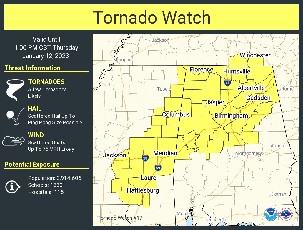
Tornado warnings in Franklin and Lawrence Counties in northern AL. Lots of spin in those storms.
- Joined
- Jan 5, 2017
- Messages
- 3,580
- Reaction score
- 5,560
The cell south of Franklin County looks more potent, honestly. Radar indicated only.Tornado warnings in Franklin and Lawrence Counties in northern AL. Lots of spin in those storms.
LukeBarrette
im north of 90% of people on here so yeah
Meteorology Student
Member
2024 Supporter
2017-2023 Supporter

Tor warning where I’m staying currently
JHS
Member
This is an awful time not to have the GSP radar. I am close enough to CAE, but most of the GSP metro will not be covered like it needs to be today. Hopefully WYFF's radar will be working today.
On to the threat itself, the farther west you are in the Carolinas the greater the threat is unless the weak CAD we have somehow holds on longer than forecast.
On to the threat itself, the farther west you are in the Carolinas the greater the threat is unless the weak CAD we have somehow holds on longer than forecast.
- Joined
- Jan 5, 2017
- Messages
- 3,580
- Reaction score
- 5,560
How was it? Any field reports?View attachment 129934
Tor warning where I’m staying currently
LukeBarrette
im north of 90% of people on here so yeah
Meteorology Student
Member
2024 Supporter
2017-2023 Supporter
Over top of us now, lightning in the field next to usHow was it? Any field reports?
vsublazer
Member
The latest from the NWS.
DadOfJax
Member
Extremely unimpressive so far
You do know there has been damage reported in Winston County AL per NWS.Extremely unimpressive so far
It’s literally 9:47 in the morning. Stop trollingExtremely unimpressive so far
DadOfJax
Member
Legit storm SW of Dekalb, MS
Darklordsuperstorm
Member
As James Spann would say "the first storms of the day tell you something" this may be long day...
Channel 48 is reporting multiple 18 wheelers overturned near Decatur
Darklordsuperstorm
Member
Damage with entrapments and injuries in Winston County
Darklordsuperstorm
Member
Clearly the NWS is seeing something with the current meso scale environment. You don't see long polygons like this often.
DadOfJax
Member
Quickly shifting to an I20 south threat for AL. That cell coming out is MS will be trouble if it ever drops anything. CC says it hasn’t yet.
- Joined
- Jan 5, 2017
- Messages
- 3,580
- Reaction score
- 5,560
That one is the strongest couplet I've seen this morning.Legit storm SW of Dekalb, MS
- Joined
- Jan 5, 2017
- Messages
- 3,580
- Reaction score
- 5,560
That storm is still somewhat discrete and entering a more favorable environment. Watch it.Quickly shifting to an I20 south threat for AL. That cell coming out is MS will be trouble if it ever drops anything. CC says it hasn’t yet.
