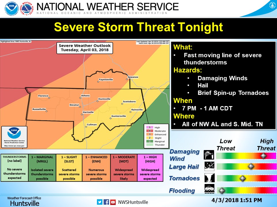
• Hello, please take a minute to check out our awesome content, contributed by the wonderful members of our community. We hope you'll add your own thoughts and opinions by making a free account!

Severe Severe Threat April 3rd/4th

Conditions look favorable for severe storms in a squall line along the front with damaging winds and large hail. But there are concern for increasing TOR threat
 
New day 2 outlook
0d8899ed402db8de7bdfe44f174c36ba.jpg


Sent from my SM-J327VPP using Tapatalk
 
Day 3 for those in FL/GA/Carolinas: (ie, squall line)

day3prob_0730.gif
 
WRF ARWs at first glance look generally a bit better than the NAM as the precip is entering NC, if the front slows up even a little more this could put more of central NC at play
 
Newest SPC update has placed a moderate risk area over western Tennessee and northern Mississippi also a hatched area for tornado, wind, and hail. Looking to be a very serious system at this point.
 
Isnt today the anniversary of a major tornado outbreak in the 70s ? This will be much weaker im assuming ?
 
Yes this is an interesting change indeed. Looks like a significant hail risk, according to the HUN NWS.

DZ4V36XUQAAbW_w.jpg
 
Supercells are going up in the central MS Valley, we’ll have to see how quickly they grow upscale, the environment isn’t the best for most of the storms remaining discretes but I’ve seen worse
 
Back
Top