Henry2326
Member
Hurricane models say it will break stronger early on in the gulf.

Break stronger or get stronger in the gulf ?
That path would seem to be a big rain maker for NW Georgia. Local Mets are saying best chance of heavy rain is east and south of 85
This early, it probably depends on which model they are looking at. For a Sunday landfall, way to early to tell. Better handle on it about Thursday.That path would seem to be a big rain maker for NW Georgia. Local Mets are saying best chance of heavy rain is east and south of 85
Stronger initially. How long it stays that way is questionable.Break stronger or get stronger in the gulf ?

.png")
Of course it goes to New Orleans who’s still reeling from Katrina.
Huh????? That was 19 years ago.Of course it goes to New Orleans who’s still reeling from Katrina.
.png")
I frequent thereHuh????? That was 19 years ago.
 .
.

Almost like Zeta track


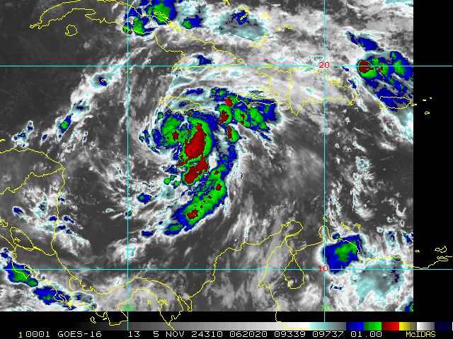
| ...RAFAEL CONTINUES TO STRENGTHEN... ...EXPECTED TO BE NEAR MAJOR HURRICANE INTENSITY AT LANDFALL IN WESTERN CUBA... |
| 7:00 AM EST Wed Nov 6 Location: 21.0°N 81.6°W Moving: NW at 14 mph Min pressure: 964 mb Max sustained: 100 mph |