• Hello, please take a minute to check out our awesome content, contributed by the wonderful members of our community. We hope you'll add your own thoughts and opinions by making a free account!

Tropical Potential Tropical Cyclone Ten

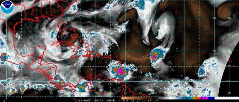
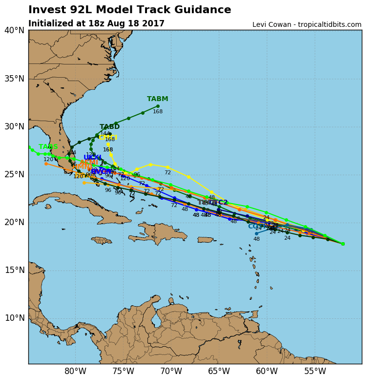
Oh, and what about all the "we are almost at speed of 2005" and it's an "I" storm? Lots of hype and skewed info from hypists may come. I also expect Irma or TD by tomorrow.

Katrina is still a week away in 2005... if we can get Irma and Jose from the CV wave which seems believable we're gonna be close...:p:weenie:

oh and Katia replaced Katrina :rolleyes:
 
It's looking good at the moment.

rb_lalo-animated92l.gif
 
GFS still has nada

CMC is going to recurve east of the US entirely this run lmao... er almost

It misses the coast til it's past Long Island then goes into Massachusetts and Maine. 969 mb over Boston lol

Not staying up for the Euro, I'm working early all weekend zzz
 
Last edited:
The 0Z GEFS is MUCH less bullish on the threat to the SE CONUS vs the last 4 runs and especially vs the last run. I don't even see one member even close to H strength. The 18Z had 5 members at H strength per my count.

The King is running now and is still doing almost nothing with it.
 
GFS still has nada

CMC is going to recurve east of the US entirely this run lmao... er almost

It misses the coast til it's past Long Island then goes into Massachusetts and Maine. 969 mb over Boston lol

Not staying up for the Euro, I'm working early all weekend zzz

LOL! I love the CMC...It's such a great model...It's been so accurate with the track and intensity of these tropical cyclones...GIVE ME A FREAKING BREAK! Wishcasting is so much fun...


Sent from my iPhone using Tapatalk
 
May I direct your attention to one of the most informative post I've ever read over on flhurricane.com http://flhurricane.com/cyclone/showflat.php?Number=97852&gonew=1#UNREAD

No matter what models are showing until it has completely dissipated or turned north (either of which is possible or may not happen) we need to keep a close eye on this one

Very true! I certainly have not given up on 92L. I just get fed up w/people saying these model or that model is more correct w/a storm that is so far out. But then again this is weather forum to discuss things like that.


Sent from my iPhone using Tapatalk
 
Very true! I certainly have not given up on 92L. I just get fed up w/people saying these model or that model is more correct w/a storm that is so far out. But then again this is weather forum to discuss things like that.


Sent from my iPhone using Tapatalk
Not to derail a thread but to your points, sharing and discussing model output, maps, etc is exactly why we have weather forums but when comments are made with finality one way or the other is when, to me, it becomes problematic.
 
Looking at the runs form overnight, it looks like they are all changing. 92L seems to be moving consistently with Harvey and the last system and I believe that third one tugs 92L away from land as it pulls the trough south. The GFS keeps squashing everything including Harvey which is a complete mystery, unless its just blind. The Euro as mentioned blows Harvey up and that is a solution that we don't want either because a stalled strengthening hurricane off of Texas, then headed directly toward Texas would absolutely destroy the Houston Galveston area. As for 92L, it seems to be too weak per the Euro to do anything, and the HWRF seems to have backed off some as well. Maybe we won't see this system form at all, but the one certain thing is that it's too early to tell anything other than it's a system and its headed west at the moment.
 
I don't know what the near future holds due to the generally not favorable conditions, but this sure looks suspiciously like a TC to me per this loop. Any other opinions? Note the cool outflow boundary, which I believe is usually not a sign of immediate further intensification fwiw:

http://rammb-slider.cira.colostate.edu/?sat=goes-16&sec=full_disk&x=17166.7998046875&y=6636&z=3&im=12&ts=1&st=0&et=0&speed=130&motion=loop&map=1&lat=0&p[0]=1&opacity[0]=1&hidden[0]=0&pause=0&slider=-1&hide_controls=0&mouse_draw=0&s=rammb-slider
Been scratching my head with the same notion today but frankly thought I might be dreaming -- Thanks Larry for confirming my sanity, or confessing our mutual lack thereof ... LOL :p
 
I don't know what the near future holds due to the generally not favorable conditions, but this sure looks suspiciously like a TC to me per this loop. Any other opinions? Note the cool outflow boundary, which I believe is usually not a sign of immediate further intensification fwiw:

http://rammb-slider.cira.colostate.edu/?sat=goes-16&sec=full_disk&x=17166.7998046875&y=6636&z=3&im=12&ts=1&st=0&et=0&speed=130&motion=loop&map=1&lat=0&p[0]=1&opacity[0]=1&hidden[0]=0&pause=0&slider=-1&hide_controls=0&mouse_draw=0&s=rammb-slider
I tend to concur on both points, it looks very close to TC status and the outflow boundary usually an inhibitor of additional development or at least as you point out not a sign of immediate intensification.
 
I tend to concur on both points, it looks very close to TC status and the outflow boundary usually an inhibitor of additional development or at least as you point out not a sign of immediate intensification.
To me, it now looks like an absolute mess. I can't see a rotation anymore and the NHC dropped the chance down to 60. The environment is too unfavorable for development get it away from the ULL and we will see what it can or can't do.
 
The forward speed of both Harvey and 92L are pretty fast imo.

To me the big wild card to be conscious of with 92L is its size isnt big like you see with some TDs/ storms. So this may cut against the grain of some ole rules of thumbs we use in development/steering forecast. Certainly gives it higher chance down road for RI if it ever got the opportunity at such an enviroment conducive (Bahamas area). Andrew is a good case study for that scenerio. Anyway its got a couple hard days coming up and so far is holding up. Well see if it goes poof or boom by early next week.

c4dc809fc2409101bfad894a95df6c4670c3bb9cd7e9e49839ad2c4e993264a0.png
 
Last edited:
If any of you were in Miami/Homestead any time for 2 to 3 years afterwards, it looked like a nuke went off ... :(
I have a cousin that lived there and his house was destroyed.... he never rebuilt, they moved back to NC. Anyway it's a reminder as to why these things are never written off until they have fully dissipated or turned ots you just never know.
 
Interesting similarities obviously doesn't mean a thing but interesting none the less...

Capture.jpg
Wow that looks eerily similar to what is happening right now. That wave in that picture in the front wasn't a storm, but still a large amount of moisture in a relative area, and was that a ULL to Andrew's north? The biggest difference though is that we have Harvey and 92L is a very weak storm and has a strengthening tropical storm in front of it. The chances of having another Andrew are 0.0000001% from this system.
 
Wow that looks eerily similar to what is happening right now. That wave in that picture in the front wasn't a storm, but still a large amount of moisture in a relative area, and was that a ULL to Andrew's north? The biggest difference though is that we have Harvey and 92L is a very weak storm and has a strengthening tropical storm in front of it. The chances of having another Andrew are 0.0000001% from this system.
Nobody is suggesting another Andrew that was certainly not my intent as I mentioned "doesn't mean a thing but interesting", however the area around the Bahama's is notorious for TC RI so while I have my doubts 92L survives, IF it does, it will need be watched closely
 
Back
Top