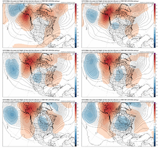
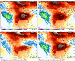
Definitely want more info on this. Fascinating stuff. How does one make a simulation like that, and when it missed the event completely, how far out was it? Wild that someone can put out something like that, sounds really interesting. Was their goal to look at how changes/updates have affected its precision and accuracy?I was speaking with Dr. Lackmann today, and he mentioned that one of his PhD students ran an updated GFS simulation of the January 2000 storm in modern times, and they still found that it missed the event completely.
So he said that based on this, there's some real merit to wishcasting snow in the future.
-
Hello, please take a minute to check out our awesome content, contributed by the wonderful members of our community. We hope you'll add your own thoughts and opinions by making a free account!
You are using an out of date browser. It may not display this or other websites correctly.
You should upgrade or use an alternative browser.
You should upgrade or use an alternative browser.
November 2025
- Thread starter packfan98
- Start date
They took the ERA-5 initial conditions and fed them into the GFS physics, and it still missed. I figure it went about 24 hours out, which is where the error occurred. The conclusion is that something went wrong with the data initialization. His former PhD student, Mike Brennan (now NHC director), found that there was some convective latent heat release that was entirely undermodelled, and all the readings that measured this were so far off from the model that they discarded this data. So nobody knows exactly why the initial readings were so flawed.Definitely want more info on this. Fascinating stuff. How does one make a simulation like that, and when it missed the event completely, how far out was it? Wild that someone can put out something like that, sounds really interesting. Was their goal to look at how changes/updates have affected its precision and accuracy?
They're trying to figure out what is going wrong with the data assimilation so that another January 2000 does not happen again.
Iceagewhereartthou
Member
olhausen
Member
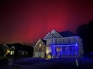
Impressive event on Monday for sure. To start the snow fell from around 11AM and pretty much was off and on all day until sunset. Didn’t get more than a dusting on the decks and fences but still extremely rare to get a full day of snow flurries in early November. The temps were most impressive with a high of 35 and a low of 22. And to top it off we got some northern lights action last night!

Drizzle Snizzle
Member
Some areas may not see another freeze until December !
- Joined
- Jan 5, 2017
- Messages
- 3,769
- Reaction score
- 5,966
Fine by me. Costs much less to heat my living space.Some areas may not see another freeze until December !
AJ1013
Member
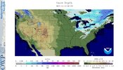
I was in Colorado over the weekend and there was virtually no snow even above the treeline aside from a couple isolated patches in permanently shaded areas. Going to be a rough start to the ski season for them.Wow, is this accurate?
NO snow anywhere in US, except what just fell. Nothing in CO, NV, MN, or the Sierra Nevadas? That would have to be unheard of for Mid Nov, no? And look at Canada!
View attachment 176554
Brent
Member
I was in Colorado over the weekend and there was virtually no snow even above the treeline aside from a couple isolated patches in permanently shaded areas. Going to be a rough start to the ski season for them.
I was in Breckenridge on December 7th last year and it was like peak winter on snow pack I remember. It wasn't even 100 percent open because it was typically so early
All these comparisons to last year... We better get moving fast...
It's definitely giving me pause on all the hype
AJ1013
Member
Not sure how much snow in the rockies translates to cool weather in south florida haha. Regardless I was shocked to be in Vail walking around in shorts in near mid-November.I was in Breckenridge on December 7th last year and it was like peak winter on snow pack I remember. It wasn't even 100 percent open because it was typically so early
All these comparisons to last year... We better get moving fast...
It's definitely giving me pause on all the hype
Brent
Member
Not sure how much snow in the rockies translates to cool weather in south florida haha. Regardless I was shocked to be in Vail walking around in shorts in near mid-November.
Well maybe that's true but more broadly it's just the lack of snow anywhere so far except mostly east
I mean it's still early and things can flip but like they need to flip before I get too excited
I mean it's pretty crazy y'all got that cold without it to be fair
MRKEVIN7575
Member
Sometimes ssw events will cause the pattern to flip on a dime in the models and ensembles. If it's legit, by Saturday we should start to see cold really show up imoWell maybe that's true but more broadly it's just the lack of snow anywhere so far except mostly east
I mean it's still early and things can flip but like they need to flip before I get too excited
I mean it's pretty crazy y'all got that cold without it to be fair
Brent
Member
Sometimes ssw events will cause the pattern to flip on a dime in the models and ensembles. If it's legit, by Saturday we should start to see cold really show up imo
Yeah true I mean it didn't matter so far and Atlanta and Myrtle Beach had snow flurries obviously
MRKEVIN7575
Member
That will mean missing alot of systems up north for a while to do that i supposeYeah true I mean it didn't matter so far and Atlanta and Myrtle Beach had snow flurries obviouslybut like yes hopefully we build up a lot more snow pack to get a truly better pattern in December
Sometimes ssw events will cause the pattern to flip on a dime in the models and ensembles. If it's legit, by Saturday we should start to see cold really show up imo
Do you mean on the Euro Weeklies? I’m asking because any prevailing E US cold pattern resulting from a major SSW typically doesn’t start until after a lag period that follows the event. So, even if it’s legit, it could easily take til after Dec 15th and it possibly be mild through then.
MRKEVIN7575
Member
Maybe that's what I meant lol. Ensembles are hinting at a ridge forming over Alaska and sometimes cold can come down quicker than expectedDo you mean on the Euro Weeklies? I’m asking because any prevailing E US cold pattern resulting from a major SSW typically doesn’t start until after a lag period that follows the event. So, even if it’s legit, it could easily take til after Dec 15th and it possibly be mild through then.
Stellar Weather looks to continue right on it's annual que/ through Thanksgiving. Dry, no bugs/No Humidity, 55-60 everyday. Enjoy it.
Watching to see how we set the table up for December over next couple of weeks. One thing is for certain, we will no doubt continue the much Below normal qpf streak the rest of Nov, per the eps. No surprise there. Hard to gauge anything pattern wise past day 7-8 on the models/ ensembles. They have been sending false flags for months now, since late July that Ive noticed. Reading folks post a lot more in the know, than I am noticed the same thing. And to beat the dead hoarse but GFS/Gefs has just been pure garbage since July
Watching to see how we set the table up for December over next couple of weeks. One thing is for certain, we will no doubt continue the much Below normal qpf streak the rest of Nov, per the eps. No surprise there. Hard to gauge anything pattern wise past day 7-8 on the models/ ensembles. They have been sending false flags for months now, since late July that Ive noticed. Reading folks post a lot more in the know, than I am noticed the same thing. And to beat the dead hoarse but GFS/Gefs has just been pure garbage since July
That's a heck of a jet retraction/epo build/cold dump look towards the end of the overnight means
Brent
Member
I have been hearing talk about Thanksgiving weather for weeks out here from some usually reliable local people but honestly at this point I wouldn't be surprised if it's 80 and sunny 
I'm thinking it's more in December
I'm thinking it's more in December
Bigedd09
Member
IT ALWAYS DOES! MJO will never spend quality time in phase 8. Ever. And if it does its always low amplitude. I'm definitely not getting my hopes up.EPS builds a nice EPO toward the end of the run, but we need that trough near/just west of HI to swing east.
View attachment 176578
The LR MJO isn't looking as good today. Hope that doesn't go down the drain.
View attachment 176579
Looking at a lot of the LR models and they signal a trough in the west and a (overall) ridge in the east. So this would point to a higher chance of a warm Thanksgiving. But a couple of the models do show some CAD potential. Still too far out, but right now don't get your hopes up for a white Thanksgiving. Maybe a cool overcast day from CAD.
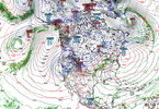
0z Euro Thanksgiving morning (other models are similar):
Edit: you guys are already talking about this. I should have read first....
0z Euro Thanksgiving morning (other models are similar):

Edit: you guys are already talking about this. I should have read first....
EPS builds a nice EPO toward the end of the run, but we need that trough near/just west of HI to swing east.
View attachment 176578
The LR MJO isn't looking as good today. Hope that doesn't go down the drain.
View attachment 176579
I was just looking at the MJO updates and thinking "man, this looks perfect". So, the MJO forecasts say that the MJO is going to take about 1 month to get thru all of 5 and 6 (Oct 27 to Nov 27) via slow downs in each of those phases.
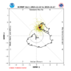
So let's say it continues to move along at a fairly slow pace, which I think it will - but not quite as slow since that's normal as it tends to run slower in the E Hemisphere (roughly 3-4-5-6) than W Hemisphere (roughly 7-8-1-2). Let's say by end of Dec (Nov 27 - Dec 27), it's thru 7-8 and half way thru 1. That would mean Dec would be 7-8- middle of 1. And Jan 1-15 would be MJO mid-1 thru phase 2. That's pretty good!
The alternative would be it moving on at a steady pace without the slow downs. From Oct 12 to Oct 31, it went thru 1-2-3-4-5! If that would have continued on, the MJO would have gone thru 6-7-8-1 in November, leaving the yuck phases for Dec and Jan.
Could it collapse in the circle or bypass 8-1-2? Yes, but nothing indicates that's going to be the case at the moment.
Nov 18-23 here, MJO is in Maritime Continent and Western Pacific
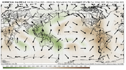
Dec 3-8 Convective signal has moved out of the MC & WPac
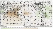
Dec 20-25 MC and WPac are still drier than normal. Convective signal in Atlantic and W Indian Ocean (colors are more faint with the ensemble at long range)
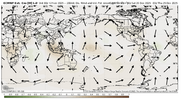
Plenty of things can go wrong, but to me, the MJO looks really good right now
I 100% agree with you on that being the ideal timing. What I was concerned about is in the Euro ext image I posted, it looks to hook back into the COD and not make it into P8 and beyond.I was just looking at the MJO updates and thinking "man, this looks perfect". So, the MJO forecasts say that the MJO is going to take about 1 month to get thru all of 5 and 6 (Oct 27 to Nov 27) via slow downs in each of those phases.
View attachment 176581
So let's say it continues to move along at a fairly slow pace, which I think it will - but not quite as slow since that's normal as it tends to run slower in the E Hemisphere (roughly 3-4-5-6) than W Hemisphere (roughly 7-8-1-2). Let's say by end of Dec (Nov 27 - Dec 27), it's thru 7-8 and half way thru 1. That would mean Dec would be 7-8- middle of 1. And Jan 1-15 would be MJO mid-1 thru phase 2. That's pretty good!
The alternative would be it moving on at a steady pace without the slow downs. From Oct 12 to Oct 31, it went thru 1-2-3-4-5! If that would have continued on, the MJO would have gone thru 6-7-8-1 in November, leaving the yuck phases for Dec and Jan.
Could it collapse in the circle or bypass 8-1-2? Yes, but nothing indicates that's going to be the case at the moment.
Nov 18-23 here, MJO is in Maritime Continent and Western Pacific
View attachment 176584
Dec 3-8 Convective signal has moved out of the MC & WPac
View attachment 176585
Dec 20-25 MC and WPac are still drier than normal. Convective signal in Atlantic and W Indian Ocean (colors are more faint with the ensemble at long range)
View attachment 176586
Plenty of things can go wrong, but to me, the MJO looks really good right now
I could be looking at it wrong or not interpreting it properly, though.
I hear ya. Yeah, wish we could get rid of the Pirate Hook on those plots giving us angst and suchI 100% agree with you on that being the ideal timing. What I was concerned about is in the Euro ext image I posted, it looks to hook back into the COD and not make it into P8 and beyond.
I could be looking at it wrong or not interpreting it properly, though.
SnowNiner
Member
I hear ya. Yeah, wish we could get rid of the Pirate Hook on those plots giving us angst and such
I thought your post showing the MJO trend the last 10 days or so was excellent...illustrating how the euro progs recently tend to show the hook, but so far it keeps correcting and progressing. Hopefully that theme continues through the winter (until it gets to 8-2, lol). That and Webbs technical rationale as to why it should keep going is what I'm hanging my hat on right now.
MJO to me seems the most telling sign of what type of weather we get, no matter the enso each year. If the tropical forcing isn't right, we deal with warmer than normal temps. Anecdotal observation.
Thank you! Don't have hard evidence for it on hand, but I feel like the MJO correlations work better during La Nina.....whereas El Nino just kind of does what it wants to do regardless of whether it is weak or strong (future research topic I guess - add it to the list lol)I thought your post showing the MJO trend the last 10 days or so was excellent...illustrating how the euro progs recently tend to show the hook, but so far it keeps correcting and progressing. Hopefully that theme continues through the winter (until it gets to 8-2, lol). That and Webbs technical rationale as to why it should keep going is what I'm hanging my hat on right now.
MJO to me seems the most telling sign of what type of weather we get, no matter the enso each year. If the tropical forcing isn't right, we deal with warmer than normal temps. Anecdotal observation.
What a great time that would be to slow ride the good phases in the most favorable climo time of the year.I was just looking at the MJO updates and thinking "man, this looks perfect". So, the MJO forecasts say that the MJO is going to take about 1 month to get thru all of 5 and 6 (Oct 27 to Nov 27) via slow downs in each of those phases.
View attachment 176581
So let's say it continues to move along at a fairly slow pace, which I think it will - but not quite as slow since that's normal as it tends to run slower in the E Hemisphere (roughly 3-4-5-6) than W Hemisphere (roughly 7-8-1-2). Let's say by end of Dec (Nov 27 - Dec 27), it's thru 7-8 and half way thru 1. That would mean Dec would be 7-8- middle of 1. And Jan 1-15 would be MJO mid-1 thru phase 2. That's pretty good!
The alternative would be it moving on at a steady pace without the slow downs. From Oct 12 to Oct 31, it went thru 1-2-3-4-5! If that would have continued on, the MJO would have gone thru 6-7-8-1 in November, leaving the yuck phases for Dec and Jan.
Could it collapse in the circle or bypass 8-1-2? Yes, but nothing indicates that's going to be the case at the moment.
Nov 18-23 here, MJO is in Maritime Continent and Western Pacific
View attachment 176584
Dec 3-8 Convective signal has moved out of the MC & WPac
View attachment 176585
Dec 20-25 MC and WPac are still drier than normal. Convective signal in Atlantic and W Indian Ocean (colors are more faint with the ensemble at long range)
View attachment 176586
Plenty of things can go wrong, but to me, the MJO looks really good right now
That late fall front will never be deniedInsane boundary at the end of the Euro. Way out there I know, but I bet we have something wild at the end of the month as things transition one way or the other. View attachment 176589
Webberweather53
Meteorologist
In all fairness, i haven’t regularly looked at these mjo diagrams in a long time. There are a lot of issues with them & just most MJO indices in general, which usually only explain a small fraction of the total subseasonal variability of a few select fields.
The RMM MJO for instance that we all love to reference only explains a mere 25% of the total subseasonal variability in upper and lower-level zonal winds and OLR. The other 75% isn’t explained by this index nor does this index include other fields (like streamfunction or velocity potential) that can be more important in diagnosing extratropical teleconnections. Also, the MJO is just one part of the recipe that yields certain wave patterns. Low frequency variability (enso for example), high-frequency tropical variability like Kelvin Waves and Equatorial Rossby Waves, and “internal” mid-latitude wave variability (like individual large-scale wave breaking events) are also important to consider.
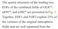
You’re much better off paying attention to hovmollers, and probably more importantly, spatial maps of multi-day averages upper level velocity potential (which is not included in the RMM (or Real-Time Multivariate MJO (RMM).
I like using this field because it is smoother, more coherent, and can trace mjo events more easily over the western hemisphere where convective heating and low-level winds associated with the MJO (that RMM uses) are weak. Upper-level variables like this are also more inherently linked to tropical - extratropical teleconnections. The upper-level winds and upward/downward motion anomalies from mid-latitudes Rossby Waves often project themselves onto this velocity potential field which is one way the extratropics can influence the tropics (e.g., https://journals.ametsoc.org/view/journals/atsc/60/3/1520-0469_2003_060_0526_efocck_2.0.co_2.pdf)
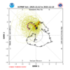
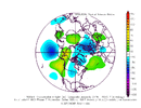
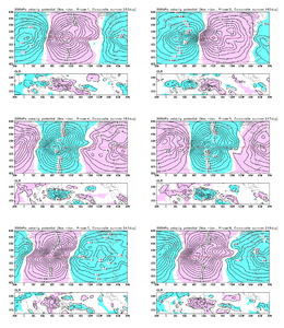
Here is the animation from the Japanese Meteorological Agency of upper level (200mb) velocity potential anomalies as a function of RMM MJO phase.
Green => upward motion & divergence, pink => downward motion & subsidence.
The RMM MJO for instance that we all love to reference only explains a mere 25% of the total subseasonal variability in upper and lower-level zonal winds and OLR. The other 75% isn’t explained by this index nor does this index include other fields (like streamfunction or velocity potential) that can be more important in diagnosing extratropical teleconnections. Also, the MJO is just one part of the recipe that yields certain wave patterns. Low frequency variability (enso for example), high-frequency tropical variability like Kelvin Waves and Equatorial Rossby Waves, and “internal” mid-latitude wave variability (like individual large-scale wave breaking events) are also important to consider.

You’re much better off paying attention to hovmollers, and probably more importantly, spatial maps of multi-day averages upper level velocity potential (which is not included in the RMM (or Real-Time Multivariate MJO (RMM).
I like using this field because it is smoother, more coherent, and can trace mjo events more easily over the western hemisphere where convective heating and low-level winds associated with the MJO (that RMM uses) are weak. Upper-level variables like this are also more inherently linked to tropical - extratropical teleconnections. The upper-level winds and upward/downward motion anomalies from mid-latitudes Rossby Waves often project themselves onto this velocity potential field which is one way the extratropics can influence the tropics (e.g., https://journals.ametsoc.org/view/journals/atsc/60/3/1520-0469_2003_060_0526_efocck_2.0.co_2.pdf)
Here is the animation from the Japanese Meteorological Agency of upper level (200mb) velocity potential anomalies as a function of RMM MJO phase.
Green => upward motion & divergence, pink => downward motion & subsidence.

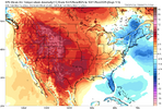
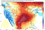
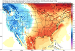
Yes, and I actually think this isn’t mentioned enough, there is definitely a difference between 2 and 12 degrees above normal, but a lot of times that gets lost in the panic.this isn't of any real major significance but i will take the minimum amount of AN i can get no matter what
View attachment 176604
Near mega frost this morning
Sneaking freeze, 28.6, coldest yetNear mega frost this morning
Yeah, I was surprised at how low we got. Ground level thermometers are below freezing with one getting down to 30.1 degrees. five foot above ground temps were right around freezing.Near mega frost this morning
RDU also got below freezing. As of ~7am they got to 30.9 degrees.

